MyTopo
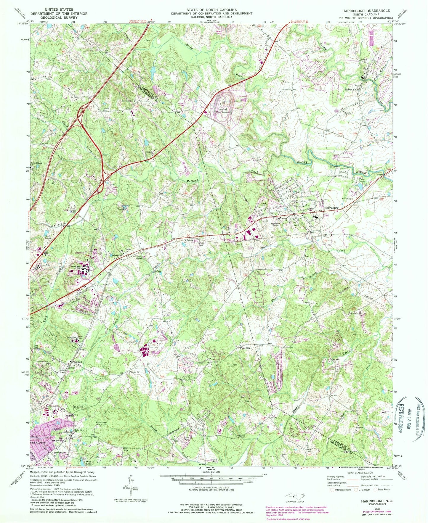
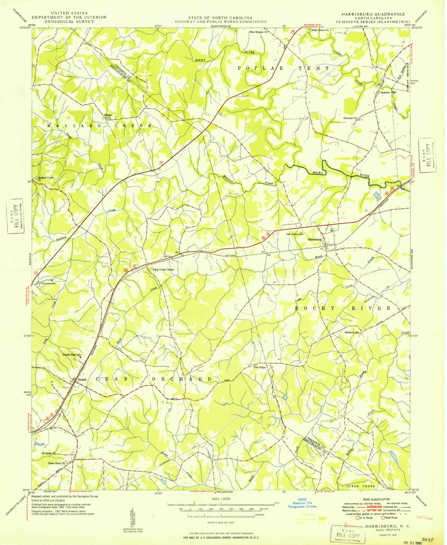
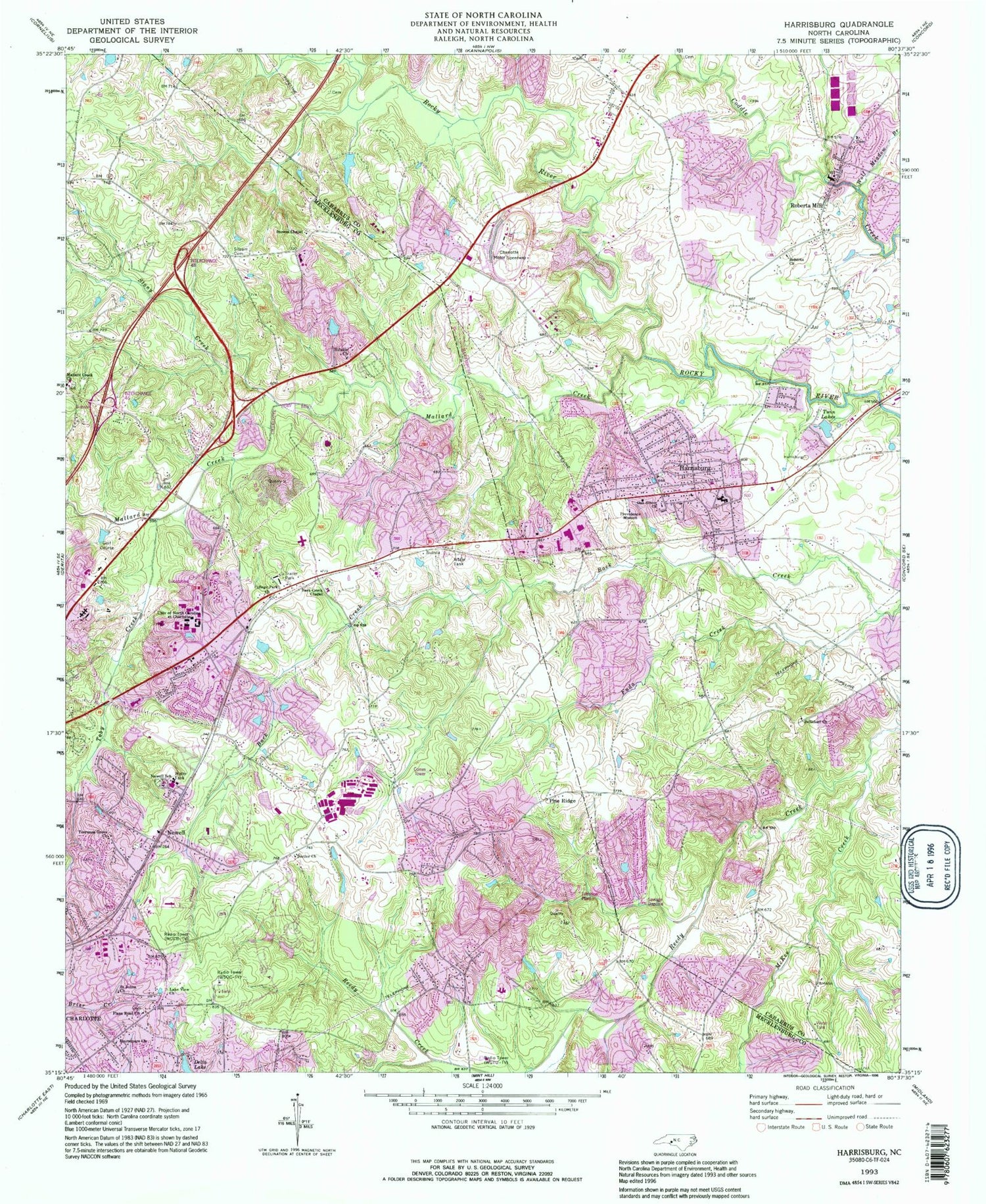
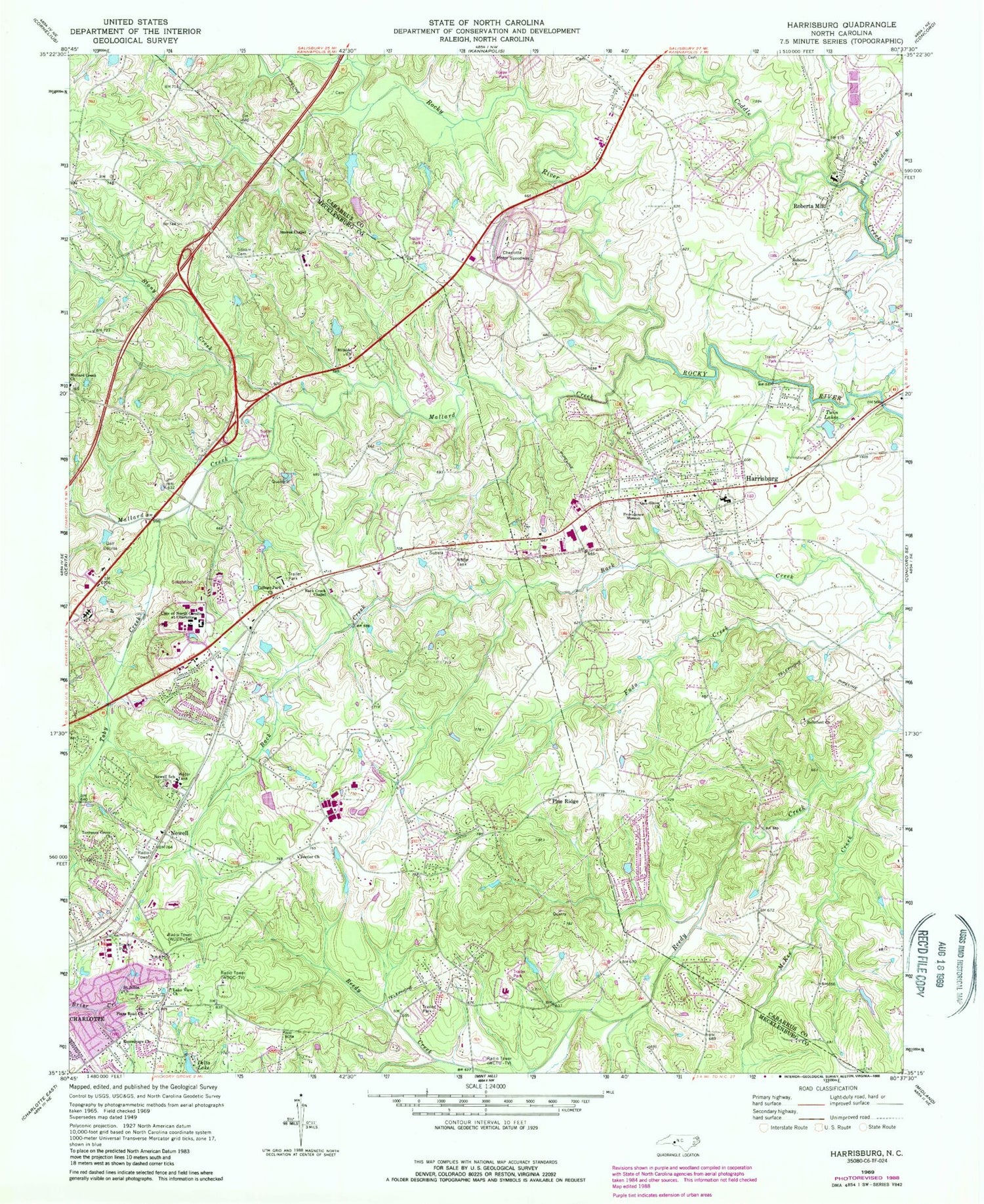
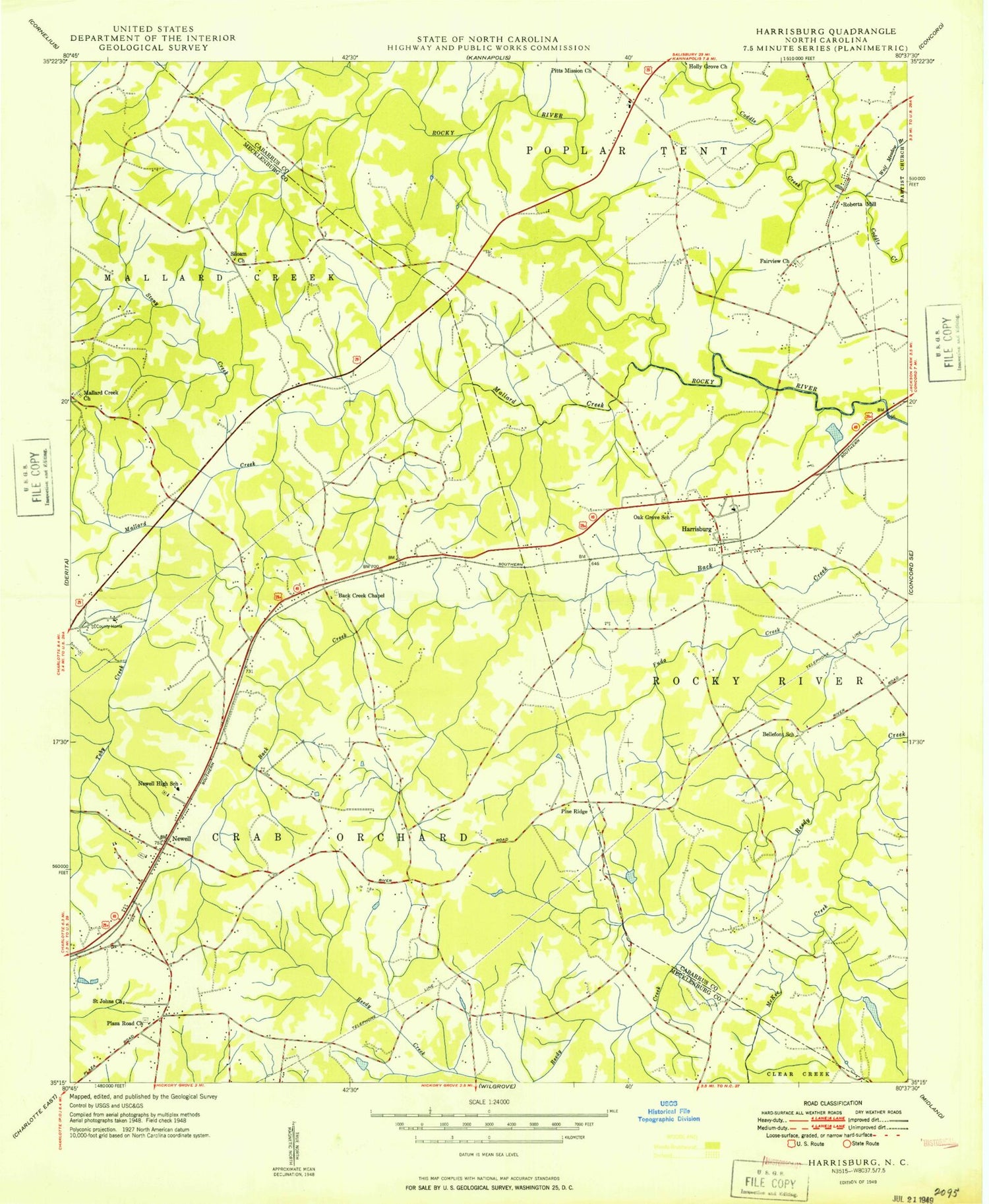
Classic USGS Harrisburg North Carolina 7.5'x7.5' Topo Map
Couldn't load pickup availability
Historical USGS topographic quad map of Harrisburg in the state of North Carolina. Map scale may vary for some years, but is generally around 1:24,000. Print size is approximately 24" x 27"
This quadrangle is in the following counties: Cabarrus, Mecklenburg.
The map contains contour lines, roads, rivers, towns, and lakes. Printed on high-quality waterproof paper with UV fade-resistant inks, and shipped rolled.
Contains the following named places: Alexander Slave Cemetery, Back Creek Chapel, Back Creek Presbyterian Church Cemetery, Barnard Building, Belk Tower, Bellefont Church, Bellefont School, Bonnie E Cone University Center, Brocker Health Center, Candlewood, Casa Linda Estates, Charlotte Fire Department Station 34, Charlotte Fire Department Station 35, Charlotte Motor Speedway, College Downs, College Park Church, Concord Mills, Dalton Library Tower, Deetler Church, Delta Lake, Denny Building, Eastfield, Foursquare Church, Fuda Creek, Grierview, Harrisburg, Harrisburg Community Park, Harrisburg Fire Department Station 1, Harrisburg Fire Department Station 3, Harrisburg Post Office, Hechenbleikner Lake, Hillside Church, Holshouser Residence Hall, J Murrey Atkins Library, Keasler Lake, Keasler Lake Dam, Kennedy Building, Lake View Church, Macy Building, Mallard Creek, Mallard Creek Church, Mallard Creek Church Cemetery, Mc Cachren Field, McKee Creek, Monteith, Moore Residence Hall, Newell, Newell Acres, Newell Elementary School, Newell Post Office, Newell Presbyterian Church Cemetery, Newell Volunteer Fire Department, Northeast Post Office, Northridge Middle School, Oak Grove Church, Oak Grove School, Paridise Valley Golf Course, Pine Ridge, Pitts Mission Church, Plaza Charlotte Post Office, Plaza Road Baptist Church Cemetery, Plaza Road Church, Providence Mission, Public Library of Charlotte and Mecklenburg County - University City Regional Branch, Querys Dixons, Reedy Creek Elementary School, Reedy Creek Park, Reese Building, Roberta Church, Roberta Mill, Rolling Acres, Rowe Creative Arts Building, Saint Johns Church, Sanford Residence Hall, Scott Residence Hall, Siloam Cemetery, Stony Creek, Stowes Chapel, Stowes Chapel Cemetery, Toby Creek, Torrence Grove AME Zion Church Cemetery, Torrence Grove Church, Town Center, Town of Harrisburg, Township 7-Crab Orchard, Twin Lakes, University Hospital, University Meadows Elementary School, University of North Carolina - Charlotte, W Hugh McEniry Earth/Life Sciences Building, WCCB-TV (Charlotte), WEZC-FM (Charlotte), WFAE-FM (Charlotte), Whispering Oaks, Wolf Meadow Branch, World 600 Airport, WPCQ-TV (Charlotte), WSOC-FM (Charlotte), WSOC-TV (Charlotte), ZIP Codes: 28075, 28213, 28262