MyTopo
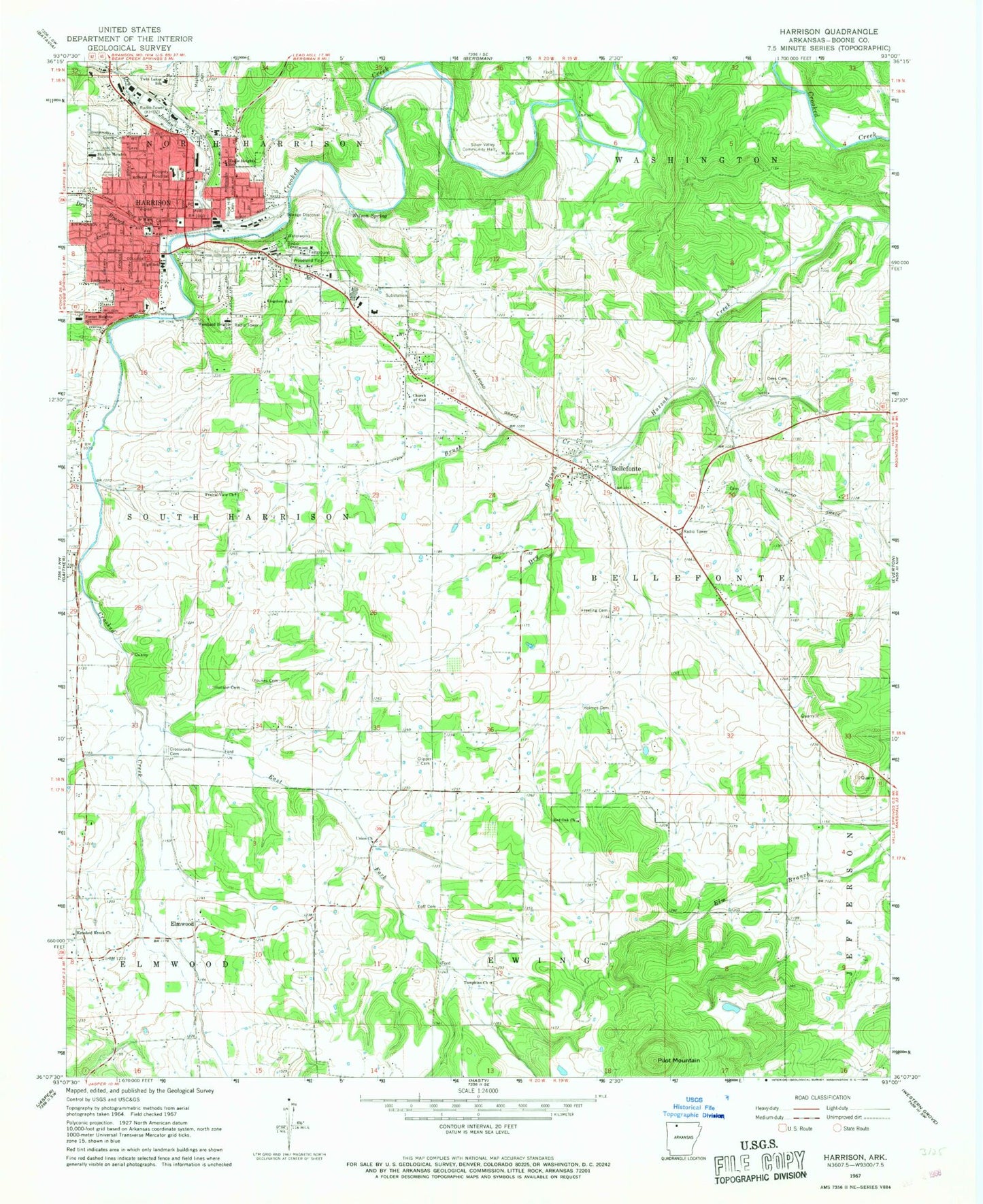
Classic USGS Harrison Arkansas 7.5'x7.5' Topo Map
Couldn't load pickup availability
Historical USGS topographic quad map of Harrison in the state of Arkansas. Typical map scale is 1:24,000, but may vary for certain years, if available. Print size: 24" x 27"
This quadrangle is in the following counties: Boone.
The map contains contour lines, roads, rivers, towns, and lakes. Printed on high-quality waterproof paper with UV fade-resistant inks, and shipped rolled.
Contains the following named places: Brush Creek, Clipper Cemetery, Crossroads Cemetery, Dees Cemetery, Dry Branch, Dry Branch, Dry Jordan Creek, Eoff Cemetery, Freeling Cemetery, Holmes Cemetery, Hudson Cemetery, Krooked Kreek Church, Maplewood Cemetery, Milum Cemetery, Prairie View Church, Rose Hill Cemetery, Silver Valley Community Hall, Speer Cemetery, Tompkins Church, West Fork Crooked Creek, Wilson Spring, Woodland Park, Younes Cemetery, Pilot Mountain, Agape Family Church, Bible Baptist Church, Bible Missionary Church, Boone County Courthouse, Boone County Heritage Museum, Boone County Jail, Calvary Baptist Church, Central Elementary School, Chapman, Church of God, Church of the Living God, Crossroads Landmark Missionary Baptist Mission, Elmwood Baptist Church, Township of Elmwood (historical), Emmanuel Baptist Church, First Baptist Church, First Church of God, First Church of the Nazarene, First Lutheran Church, First Presbyterian Church, Harrison Alliance Church, Harrison Junior High School, Township of Harrison (historical), Huzzah Prairie, Kingdom Hall, Lifegate Freewill Baptist Church, Mount Pleasant (historical), North Arkansas Community College, North Arkansas Regional Medical Center, North Pine Street Church of Christ, Northside Church of Christ, Pine Street Baptist Church, Saint Johns Episcopal Church, Saint Pauls United Methodist Church, Watkins (historical), Woodland Heights Baptist Church, Township of Bellefonte, Township of Ewing, Township of North Harrison, East Fork Crooked Creek, Bellefonte, Elmwood, Harrison, Red Oak Baptist Church, Twin Lakes School, Union Baptist Church, Eagle Heights Elementary School, Forest Heights Elementary School, Skyline Heights Elementary School, Woodland Heights Elementary School, North Arkansas Medical Center Heliport, KNWA-AM (Bellefonte), KHOZ-AM (Harrison), Harrison Fire Department Station 1, Krooked Kreek Fire Department, Krooked Kreek Volunteer Fire Department Southern Hills Substation, Valley Springs Rural Fire Department Station 3 Bellefonte, Harrison Police Department, Boone County Sheriff's Office, Northern Arkansas Regional Medical Center Emergency Medical Service Boone County, City of Harrison, Town of Bellefonte, Fick Cemetery