
MyTopo
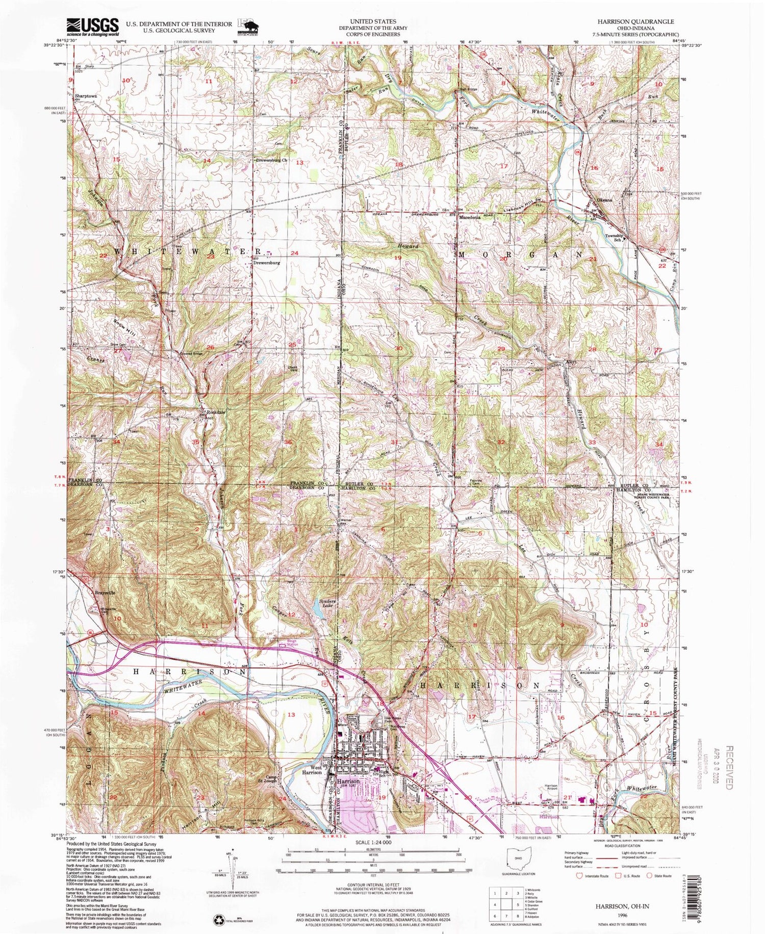
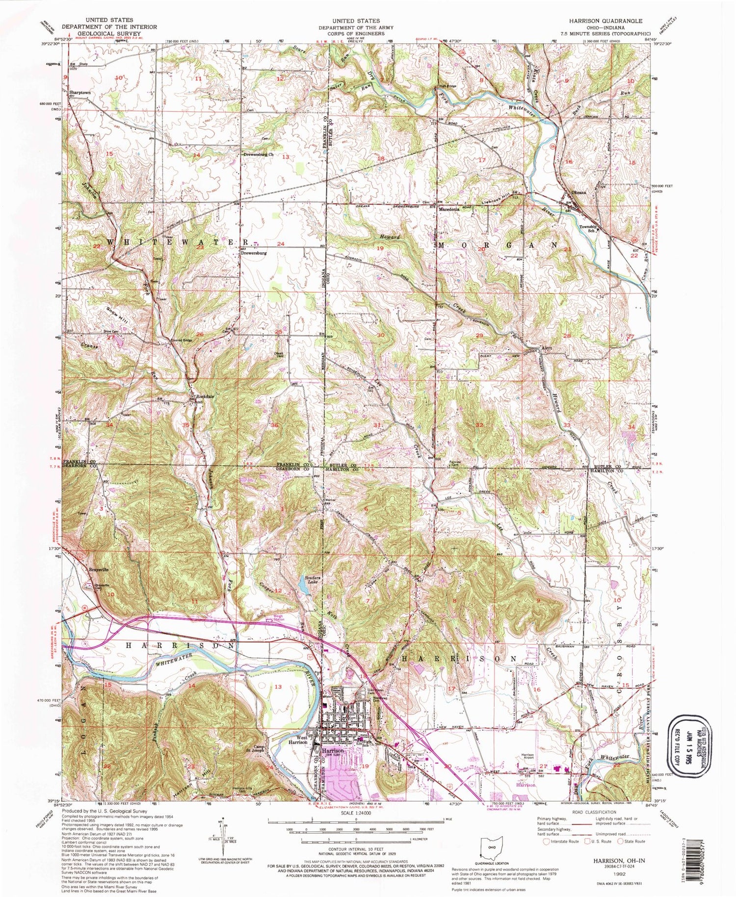
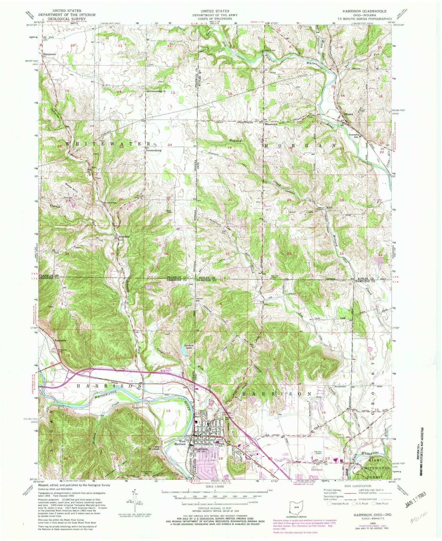
Classic USGS Harrison Ohio 7.5'x7.5' Topo Map
Couldn't load pickup availability
Historical USGS topographic quad map of Harrison in the states of Ohio, Indiana. Typical map scale is 1:24,000, but may vary for certain years, if available. Print size: 24" x 27"
This quadrangle is in the following counties: Butler, Dearborn, Franklin, Hamilton.
The map contains contour lines, roads, rivers, towns, and lakes. Printed on high-quality waterproof paper with UV fade-resistant inks, and shipped rolled.
Contains the following named places: Camp Run, Fairview Cemetery, Glen Haven Cemetery, Harrison, Kiata Creek, Woodlawn Cemetery, Liebrook Hill, School Number 9 (historical), Morgan Elementary School, Harrison Middle School, William Henry Harrison High School, Edgewood School (historical), Arnold School (historical), Biddinger School (historical), Harrison Elementary School, Crossroads Plaza Shopping Center, Macedonia, Macedonia Christian Church, Baptist Cemetery, Tall Oaks Shopping Center, Othneil Looker Park, Saint John the Baptist School, Alert, Okeana, Buck Run, Fairview Church (historical), School Number 4 (historical), Cincinnati West Airport, Alert Post Office (historical), Township of Morgan, Township of Harrison, Governor Bebb Preserve, Macedonia Cemetery, Harrison Park Cemetery, Catholic Cemetery, Okeana Post Office, Alert Post Office (historical), Harrison Post Office, First Baptist Church, First Christian Church, First Presbyterian Church, Harrison Seventh Day Adventist Church, Saint John The Baptist Church, City of Harrison, Harrison Fire Department Station 57, Harrison Fire Department Station 56, Harrison City Police Department, Braysville, Braysville Cemetery, Camp Saint Joseph, Cooper Run, Crane Run, Cranes Run, Drewersburg, Drewersburg Church, Harrison Hill, Harrison Hills Cemetery, Kolb Creek, Lee Creek, Logan Creek, Otwell Cemetery, Pinhook Creek, Rockdale, Sater Run, Sharptown, Snow Cemetery, Snow Hill, Souders Lake, West Harrison, Johnson Fork, Sours Run, Township of Harrison, Township of Whitewater, Town of West Harrison, Drewersburg Volunteer Fire Department Station 1, Franklin County Emergency Medical Services Station 1, Camp Run, Fairview Cemetery, Glen Haven Cemetery, Harrison, Kiata Creek, Woodlawn Cemetery, Liebrook Hill, School Number 9 (historical), Morgan Elementary School, Harrison Middle School, William Henry Harrison High School, Edgewood School (historical), Arnold School (historical), Biddinger School (historical), Harrison Elementary School, Crossroads Plaza Shopping Center, Macedonia, Macedonia Christian Church, Baptist Cemetery, Tall Oaks Shopping Center, Othneil Looker Park, Saint John the Baptist School, Alert, Okeana, Buck Run, Fairview Church (historical), School Number 4 (historical), Cincinnati West Airport, Alert Post Office (historical), Township of Morgan, Township of Harrison, Governor Bebb Preserve, Macedonia Cemetery, Harrison Park Cemetery, Catholic Cemetery, Okeana Post Office, Alert Post Office (historical), Harrison Post Office, First Baptist Church, First Christian Church, First Presbyterian Church, Harrison Seventh Day Adventist Church, Saint John The Baptist Church, City of Harrison, Harrison Fire Department Station 57, Harrison Fire Department Station 56, Harrison City Police Department, Braysville, Braysville Cemetery, Camp Saint Joseph, Cooper Run, Crane Run, Cranes Run, Drewersburg, Drewersburg Church, Harrison Hill, Harrison Hills Cemetery, Kolb Creek, Lee Creek, Logan Creek, Otwell Cemetery, Pinhook Creek, Rockdale, Sater Run, Sharptown, Snow Cemetery, Snow Hill, Souders Lake, West Harrison, Johnson Fork, Sours Run, Township of Harrison, Township of Whitewater, Town of West Harrison, Drewersburg Volunteer Fire Department Station 1, Franklin County Emergency Medical Services Station 1


