MyTopo
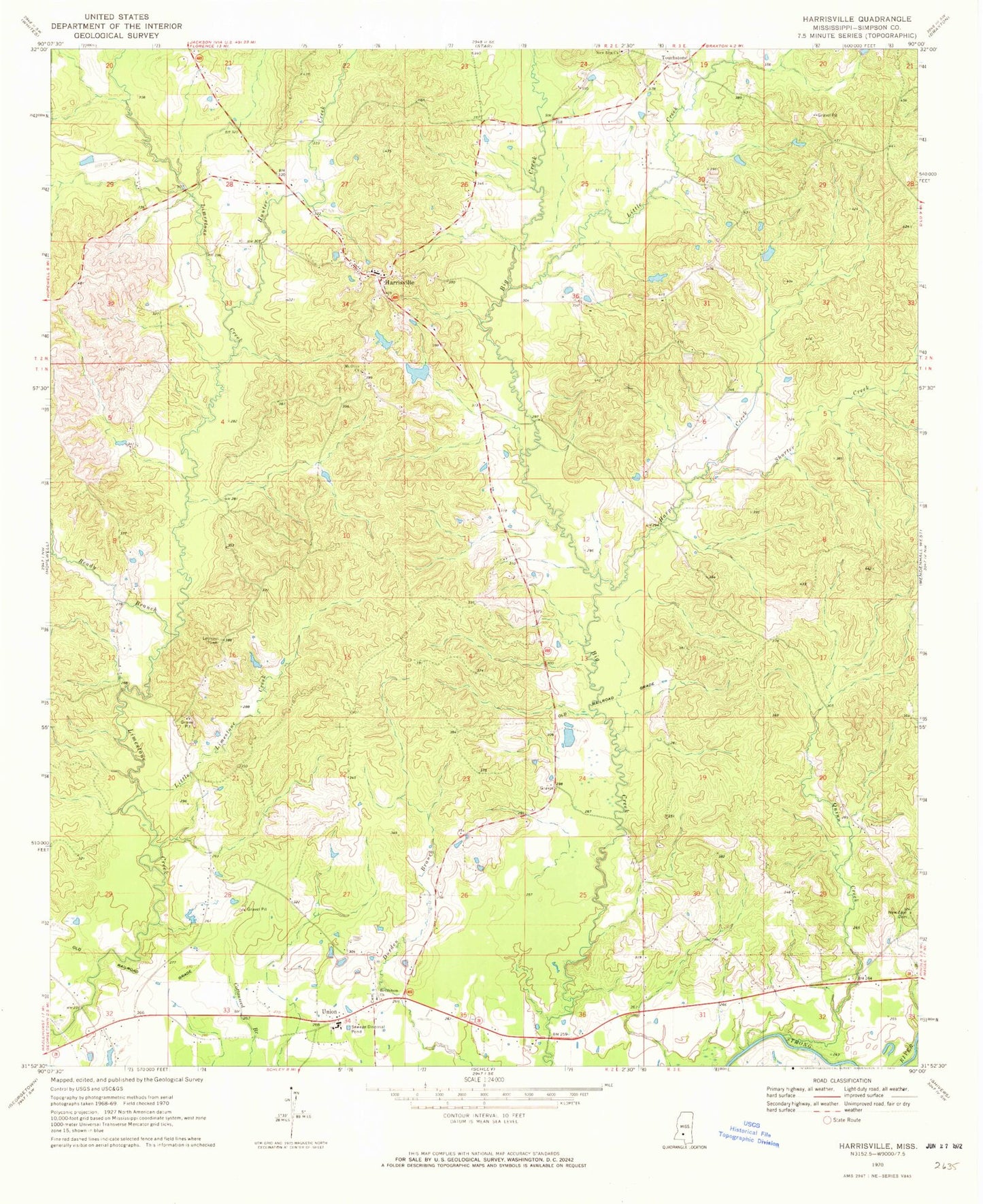
Classic USGS Harrisville Mississippi 7.5'x7.5' Topo Map
Couldn't load pickup availability
Historical USGS topographic quad map of Harrisville in the state of Mississippi. Map scale may vary for some years, but is generally around 1:24,000. Print size is approximately 24" x 27"
This quadrangle is in the following counties: Simpson.
The map contains contour lines, roads, rivers, towns, and lakes. Printed on high-quality waterproof paper with UV fade-resistant inks, and shipped rolled.
Contains the following named places: Bethlehem Baptist Church, Bethlehem Cemetery, Bluff Springs School, Calhoun Branch, Crum School, Doctor W G Munn Lake Dam, G D Neely Lake Dam, Harper Creek, Harrisville, Harrisville Attendance Center, Harrisville Baptist Church, Harrisville Cemetery, Harrisville Post Office, Harrisville Volunteer Fire Department, Hunter Creek, Little Creek, Little Limestone Creek, Loretta School, Midway School, Mount Olive Cemetery, Mount Olive Church, Mount Pisgah Church, New Covenant Church, New Hym Missionary Baptist Church, New Zion Cemetery, New Zion Church, Perline School, Pine Ridge School, Quinn Creek, Ready Branch, Shorter Creek, Spring Hills Church, Spring Valley Church, Supervisor District 5, Touchstone, Union, ZIP Code: 39082