MyTopo
Classic USGS Harrisville New York 7.5'x7.5' Topo Map
Couldn't load pickup availability
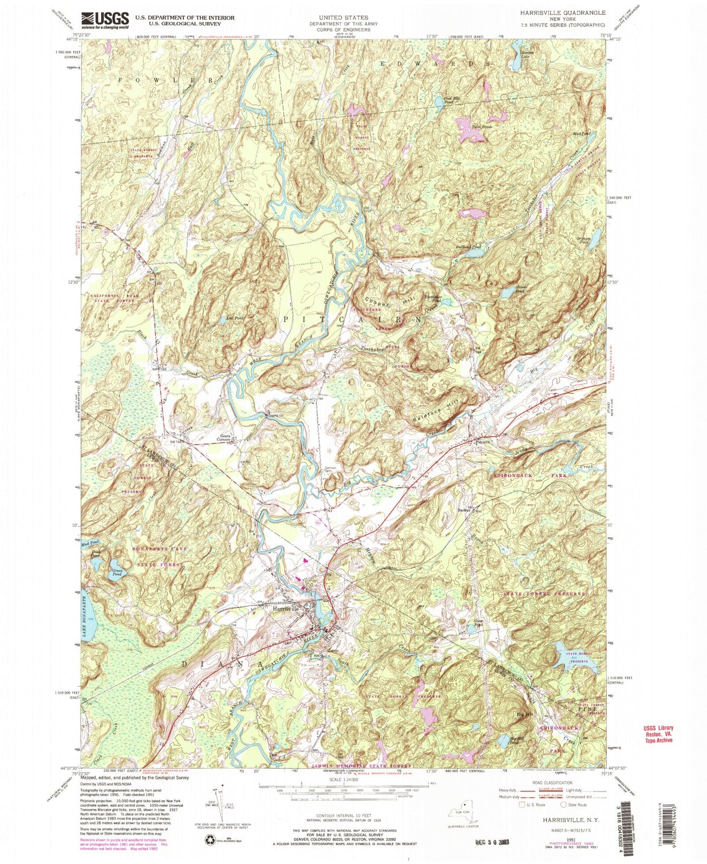
Historical USGS topographic quad map of Harrisville in the state of New York. Typical map scale is 1:24,000, but may vary for certain years, if available. Print size: 24" x 27"
This quadrangle is in the following counties: Lewis, St. Lawrence.
The map contains contour lines, roads, rivers, towns, and lakes. Printed on high-quality waterproof paper with UV fade-resistant inks, and shipped rolled.
Contains the following named places: Big Hill, Big Hill Pond, Duck Pond, Green Pond, Harrisville, Mud Pond, Backus, Baldface Hill, Big Creek, Black Creek, Bowman Creek, Bullhead Pond, Clear Creek, Cooper Hill, Garrison Cemetery, Geers Corners, Goose Pond, Graham Pond, Jenny Creek, Lost Pond, Meadow Brook, Mud Pond, Pine Hill Pond, Pitcairn, Shiner Pond, South Creek, Toothaker Creek, Toothaker Pond, Twin Ponds, Beaver Lake, Town of Pitcairn, Village of Harrisville (historical), Marshey Road Bridge, Saint Francis Solanus Church, Harrisville Elementary School, Harrisville Junior - Senior High School, Harrisville Volunteer Fire Department, Harrisville Post Office, Harrisville Census Designated Place