MyTopo
Classic USGS Harrisville Ohio 7.5'x7.5' Topo Map
Couldn't load pickup availability
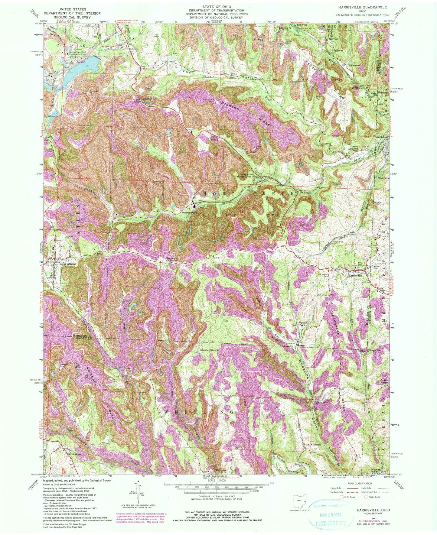
Historical USGS topographic quad map of Harrisville in the state of Ohio. Map scale may vary for some years, but is generally around 1:24,000. Print size is approximately 24" x 27"
This quadrangle is in the following counties: Belmont, Harrison, Jefferson.
The map contains contour lines, roads, rivers, towns, and lakes. Printed on high-quality waterproof paper with UV fade-resistant inks, and shipped rolled.
Contains the following named places: Alley Cemetery, Bassage Lake Dam, Belknap, Belleve, Blairmont, Blairmont Post Office, Bradford Dam, Branson Ridge, Campbell Ridge, Campbell Run, Chickwan, Coal Run, Consoldiation Coal Company Pond 0107-034 Dam, Consolidation Coal Company Dam 0107-0, Consolidation Coal Company Dam 0107-013, Consolidation Coal Company Pond 0107-, Crabapple Cemetery, Culbertson Drift Mine, D Number 11 Mine, Decorte Number 2 Mine, Dickerson Cemetery, Dickerson Church, Dickerson Number 10 Mine, Duncanwood, Duncanwood Post Office, Fairpoint Elementary School, Flag Run, Fox Bottom, Franklin Number 125 Mine, Friends Meeting House Cemetery, Furbay Cemetery, Georgetown, Georgetown Coal Preparation Plant, Georgetown Mine, Georgetown Plant Lower Supply Dam, Georgetown Plant Lower Supply Pond, Georgetown Plant Upper Supply Dam, Georgetown Plant Upper Supply Pond, Georgetown Prep Plant Freshwater Lake, Georgetown Upper Dam Number One, Georgetown Upper Dam Number One Pond, Georgetown Upper Dam Number Two, Georgetown Upper Dam Number Two Pond, Ginther, Ginther Post Office, Glen Castle Number 6 Mine, Glencastle Mine, Goodyear Mine, Hagan Addition, Halls Siding, Hammond Crossroad, Harrison Post Office, Harrisville, Harrisville Fire Company, Harrisville Post Office, Henderson Ridge, Horton, Hurford, Hurford Post Office, Jamison Mine, Kinsman, Liming Creek, Longview Cemetery, McCoy Mine, Middle Fork Short Creek, Mill Run, New Athens, New Athens Post Office, New Athens Volunteer Fire and Emergency Department, Newtown, Number 2 Mine, Old Uniontown Cemetery, Olive Branch Cemetery, Patton Run, Robyville, Robyville Number 80 Drift Number 2 Mine, Rose Valley, Rose Valley Creek, Ross Run, Sally Buffalo Creek, Science Hill, Science Hill Post Office, Seleski Pond, Seleski Pond Dam, Sheperdstown Post Office, Shepherdstown, Short Creek Cemetery, Short Creek Number 1 Mine, Short Creek Number 2 Mine, South Fork Short Creek, Springdale Church, Stidds Trailer Court, Stiers Cemetery, Township of Short Creek, Township of Wheeling, Uniontown, Uniontown Post Office, Unity Cemetery, Village of Adena, Village of Harrisville, Village of New Athens, West Grove Cemetery, Wheeling Valley, Wheeling Valley Cemetery, Wilson Cemetery, ZIP Code: 43974