MyTopo
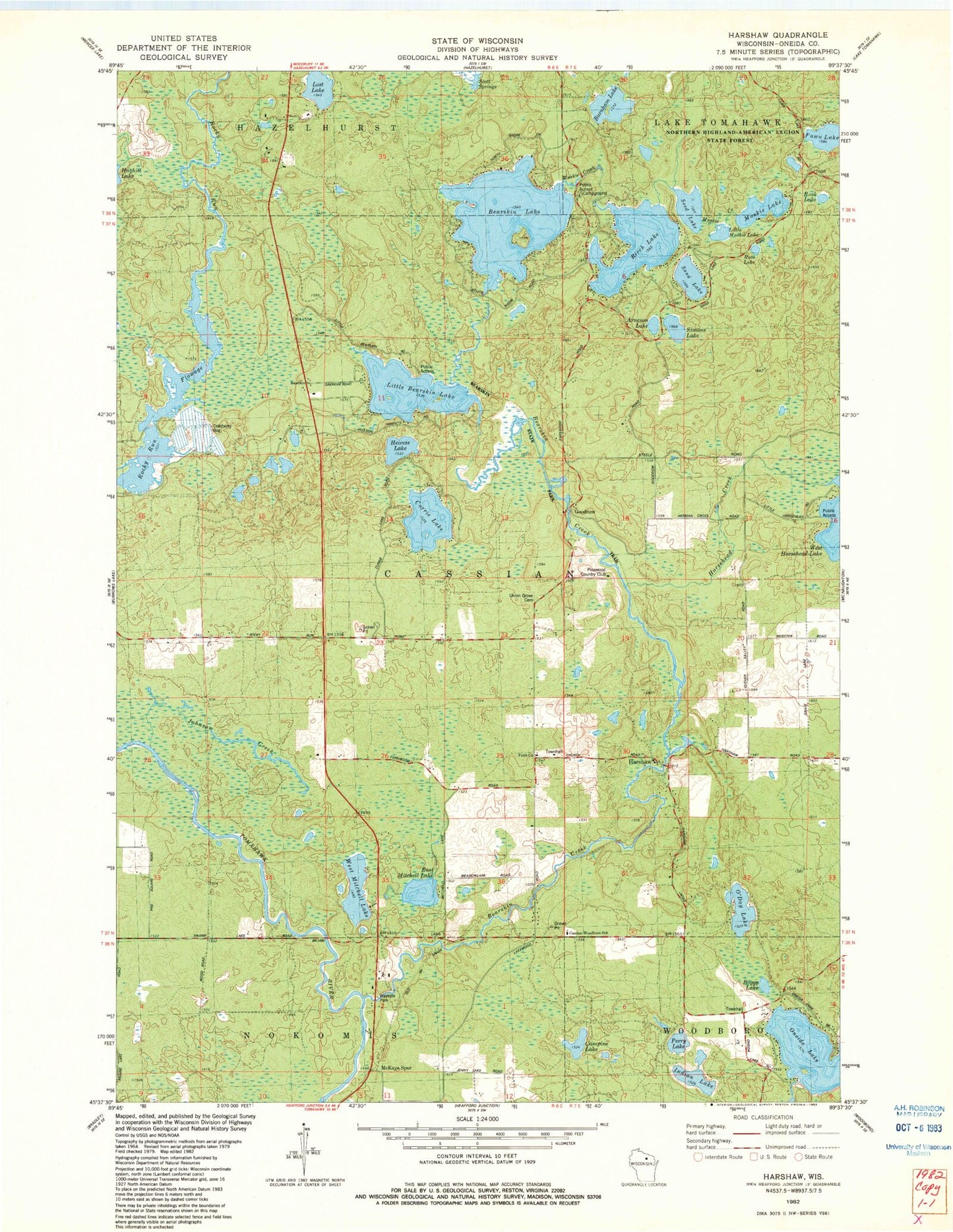
Classic USGS Harshaw Wisconsin 7.5'x7.5' Topo Map
Couldn't load pickup availability
Historical USGS topographic quad map of Harshaw in the state of Wisconsin. Map scale may vary for some years, but is generally around 1:24,000. Print size is approximately 24" x 27"
This quadrangle is in the following counties: Oneida.
The map contains contour lines, roads, rivers, towns, and lakes. Printed on high-quality waterproof paper with UV fade-resistant inks, and shipped rolled.
Contains the following named places: Arneson Lake, Bearskin Creek, Bearskin Lake, Bearskin State Park Trail, Birch Lake, Boggy Lake, Buck Lake, Burnham Lake, Campine Lake, Cassian Townhall, Cassian Volunteer Fire Department, Currie Lake, East Mitchell Lake, Faith Church, Fawn Lake, Fernwood School, Goodnow, Goodnow School, Harshaw, Harshaw Post Office, Heiress Lake, Horsehead Creek, Indian Lake, Johnson Creek, Little Bearskin Lake, Little Muskie Lake, Lost Lake, McKays Spur, Muskie Lake, Northwoods Community Elementary School, O'Day Lake, Oneida Lake, Perry Lake, Pinewood Air Park, Pinewood Country Club, Rocky Run Flowage, Ruth Lake, Sand Lake, Seed Lake, Simons Lake, Stewart School, Town of Cassian, Union Grove Cemetery, West Mitchell Lake, Woodboro Townhall, ZIP Code: 54529