MyTopo
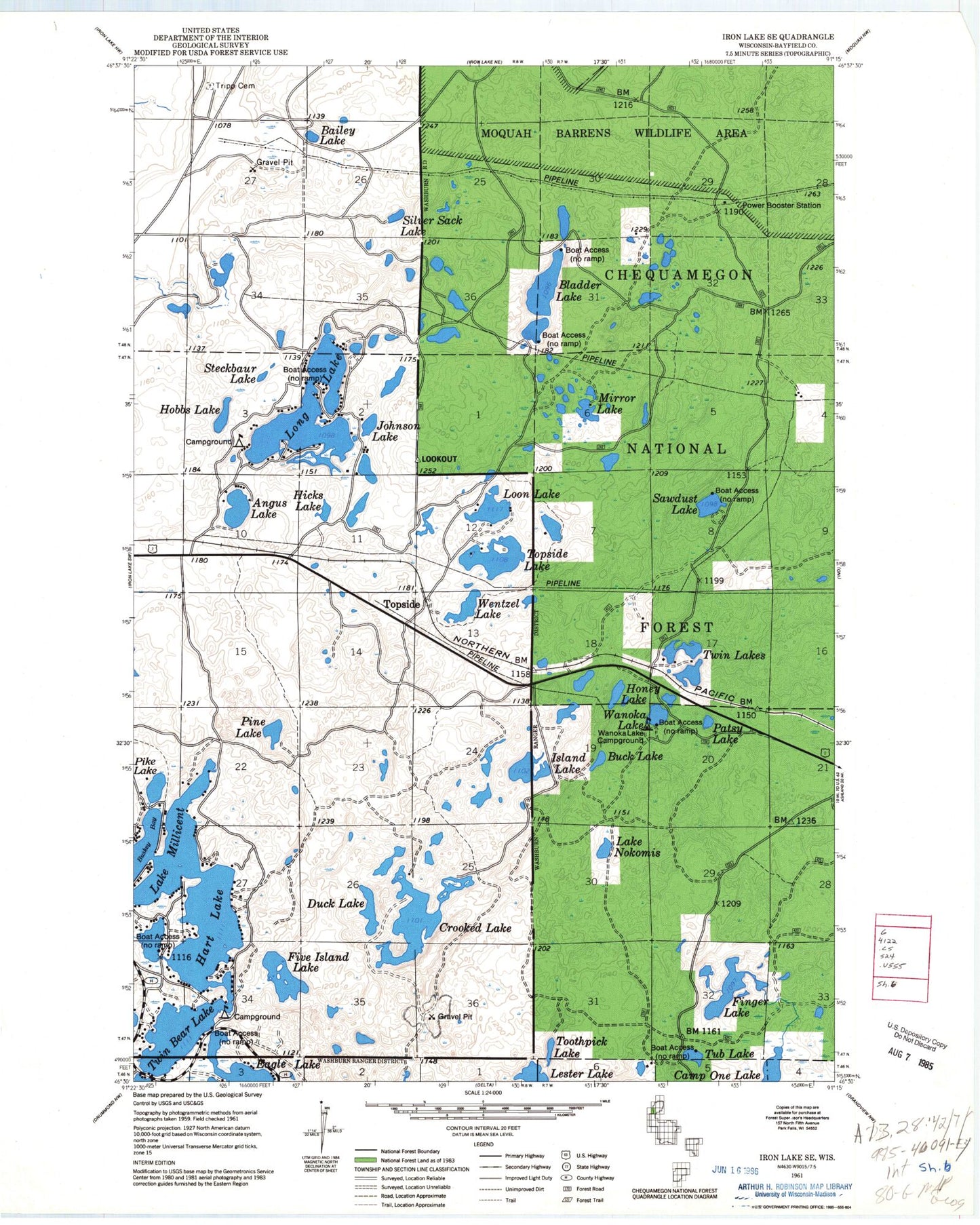
Classic USGS Hart Lake Wisconsin 7.5'x7.5' Topo Map
Couldn't load pickup availability
Historical USGS topographic quad map of Hart Lake in the state of Wisconsin. Map scale may vary for some years, but is generally around 1:24,000. Print size is approximately 24" x 27"
This quadrangle is in the following counties: Bayfield.
The map contains contour lines, roads, rivers, towns, and lakes. Printed on high-quality waterproof paper with UV fade-resistant inks, and shipped rolled.
Contains the following named places: Angus Lake, Bailey Lake, Bladder Lake, Buck Lake, Buskey Bay, Camp One Lake, Crooked Lake, Duck Lake, Finger Lake, Five Island Lake, Hart Lake, Hicks Lake, Hobbs Lake, Honey Lake, Iron River Lookout Tower, Island Lake, Johnson Lake, Lake Millicent, Lake Nokomis, Lester Lake, Long Lake, Loon Lake, McCarry Lake, Mirror Lake, Patsy Lake, Pike Lake, Pine Lake, Sawdust Lake, Silver Sack Lake, Steckbaur Lake, Toothpick Lake, Topside, Topside Lake, Town of Iron River, Tub Lake, Twin Bear Lake, Twin Lakes, Valley View Cemetery, Wanoka Lake, Wanoka Lake Recreation Site, Wentzel Lake