MyTopo
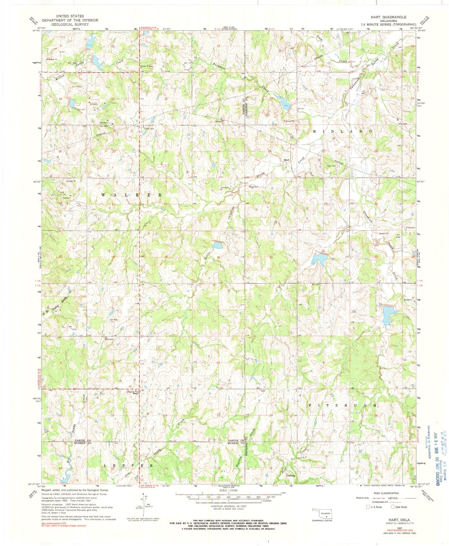
Classic USGS Hart Oklahoma 7.5'x7.5' Topo Map
Couldn't load pickup availability
Historical USGS topographic quad map of Hart in the state of Oklahoma. Map scale may vary for some years, but is generally around 1:24,000. Print size is approximately 24" x 27"
This quadrangle is in the following counties: Garvin, Murray, Pontotoc.
The map contains contour lines, roads, rivers, towns, and lakes. Printed on high-quality waterproof paper with UV fade-resistant inks, and shipped rolled.
Contains the following named places: Burkhart Creek, Cherokee Sandy Site 8b Dam, Cherokee Sandy Site 8b Reservoir, Cherokee Sandy Site 8c Dam, Cherokee Sandy Site 8c Reservoir, Cherokee Sandy Site 8d Dam, Cherokee Sandy Site 8d Reservoir, Coon Creek, Corley Cemetery, Dolberg, Dolberg Oil Field, Hart, Hart Cemetery, Little Canadian Sandy Creek, Prairie View Mission, Rock Creek Site 3 Dam, Rock Creek Site 3 Reservoir, Rock Creek Site 4a Dam, Sandy Creek 9 Dam, Sandy Creek 9 Reservoir, Sandy Creek Site 10 Dam, Sandy Creek Site 10 Reservoir, Sandy Creek Site 12 Dam, Sandy Creek Site 12 Reservoir, Sandy Creek Site 13 Dam, Sandy Creek Site 13 Reservoir, Sandy Creek Site 14 Dam, Sandy Creek Site 14 Reservoir, Sandy Creek Site 15 Dam, Sandy Creek Site 15 Reservoir, Sandy Creek Site 16 Dam, Sandy Creek Site 16 Reservoir