MyTopo
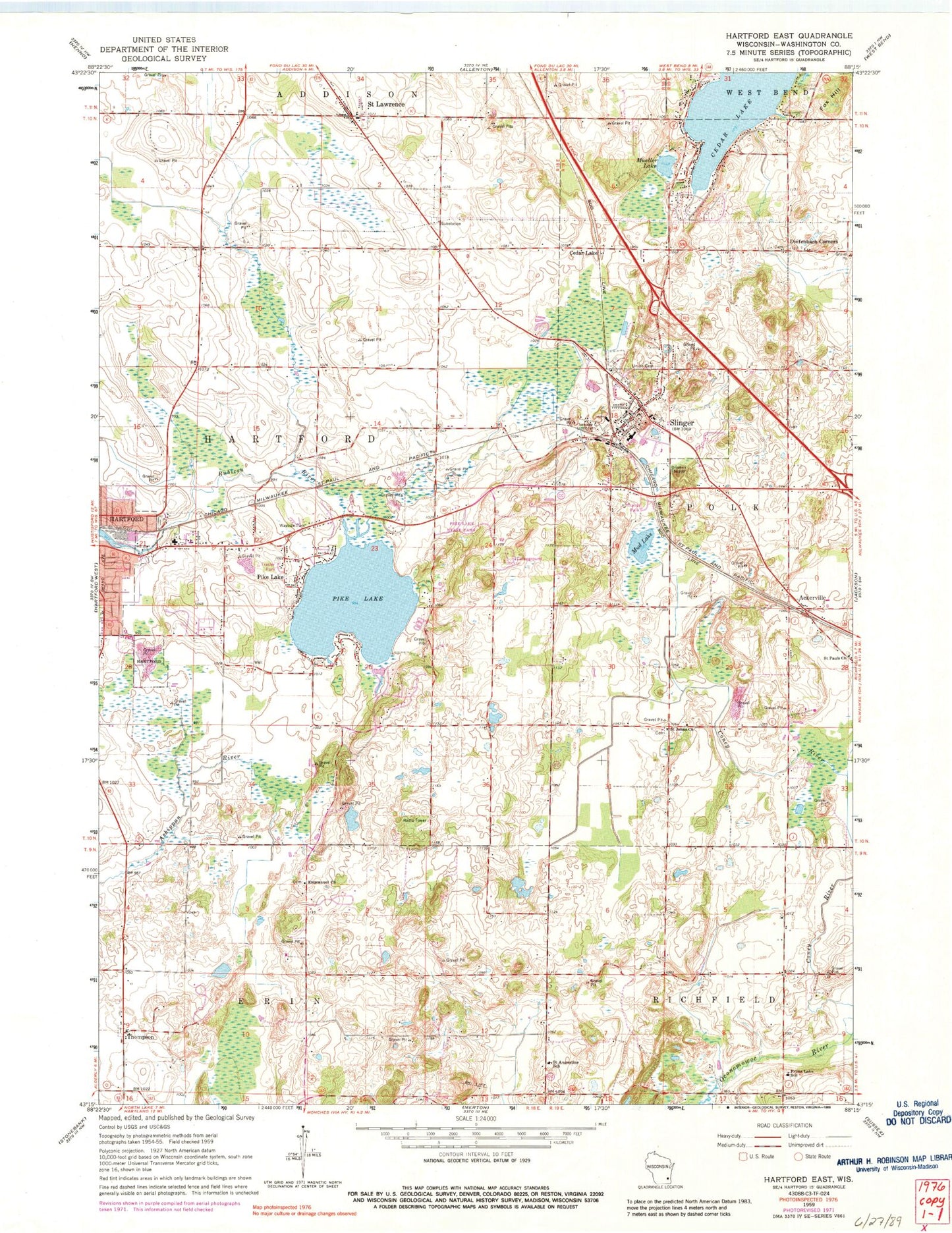
Classic USGS Hartford East Wisconsin 7.5'x7.5' Topo Map
Couldn't load pickup availability
Historical USGS topographic quad map of Hartford East in the state of Wisconsin. Map scale may vary for some years, but is generally around 1:24,000. Print size is approximately 24" x 27"
This quadrangle is in the following counties: Washington.
The map contains contour lines, roads, rivers, towns, and lakes. Printed on high-quality waterproof paper with UV fade-resistant inks, and shipped rolled.
Contains the following named places: Ackerville, Aurora Medical Center, Becker Farms, Cedar Lake, Diefenbach Corners, Ehmke Farms, Emmanuel Church, Fox Hill, Friess Lake School, Gehring Farms, Gehring View Farms, Hartford Millpond 32, Heartfield Farm, Highland Acres, Kettle Hills Farm, Kratz Farms, Lepien Farview Farm, Log House Farm, Lohr Pond, Mayer Farms, Misty Meadows, Mud Lake, Mueller Lake, Old Saint Peter Cemetery, Pike Lake, Pike Lake 13, Pike Lake 2WP1323 Dam, Pike Lake State Park, Rossman Elementary School, Saint Augustine School, Saint Johns Church, Saint Lawrence, Saint Lawrence Volunteer Fire Department, Saint Paul Little Learners Preschool, Saint Pauls Church, Saint Peter Catholic School, Saint Peters Catholic Church, Schwendimann Farm, Slinger, Slinger Elementary School, Slinger Fire Department, Slinger High School, Slinger Middle School, Slinger Police Department, Slinger Post Office, Slinger Wastewater Treatment Facility, Strupp Dairy Farm, Thompson, Town of Hartford, Union Cemetery, Village of Slinger, Werner Pond, Zuern Farm, ZIP Codes: 53027, 53086