MyTopo
Classic USGS Hartford Kansas 7.5'x7.5' Topo Map
Couldn't load pickup availability
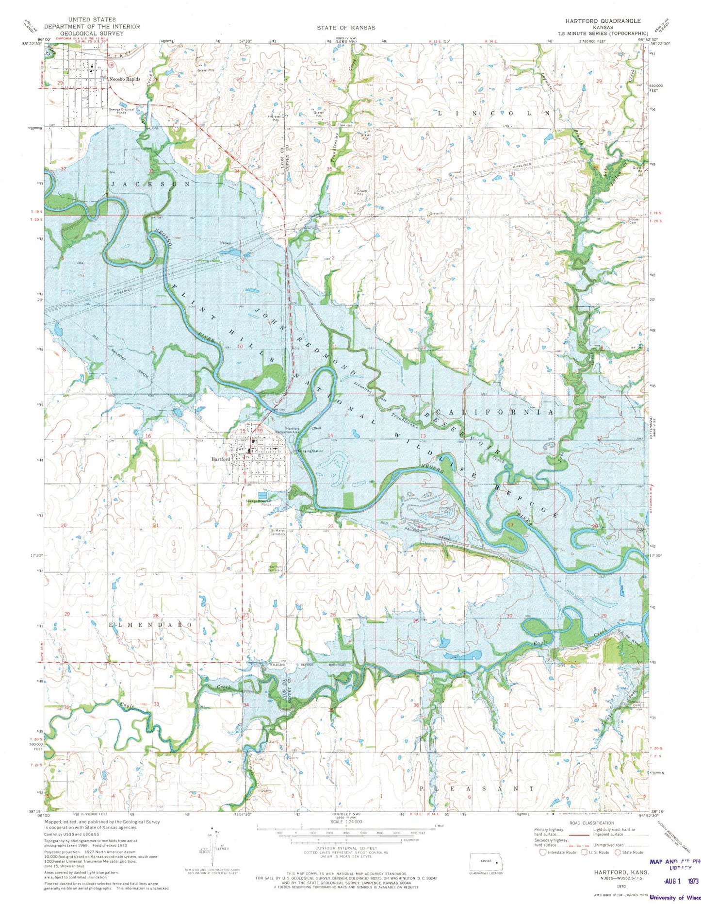
Historical USGS topographic quad map of Hartford in the state of Kansas. Map scale may vary for some years, but is generally around 1:24,000. Print size is approximately 24" x 27"
This quadrangle is in the following counties: Coffey, Lyon.
The map contains contour lines, roads, rivers, towns, and lakes. Printed on high-quality waterproof paper with UV fade-resistant inks, and shipped rolled.
Contains the following named places: City of Hartford, City of Neosho Rapids, Darbyshire Farm, Dill Farms, Eagle Creek, Elmendaro Township Library - Hartford, Flint Hills National Wildlife Refuge, Fourmile Creek, Hartford, Hartford Cemetery, Hartford Christian Church, Hartford Elevator Grain Elevator Number 1, Hartford Elevator Grain Elevator Number 2, Hartford Junior / Senior High School, Hartford Post Office, Hartford Recreation Area, Hartford Sewer Treatment Plant, Jordan Creek, Lebo Creek, Logwater Branch, Lyon County Fire District 5 Station 1, Lyon County Fire District 5 Station 2, Neosho Rapids, Neosho Rapids Elementary School, Neosho Rapids Post Office, Neosho Rapids United Methodist Church, Neosho Rapids Wastewater Treatment Plant, Nixon Farms, Plum Creek, Saint Mary's Cemetery, Scoggin Farms, Strawn Cemetery, Township of California, Township of Lincoln, Troublesome Creek, ZIP Codes: 66854, 66864