MyTopo
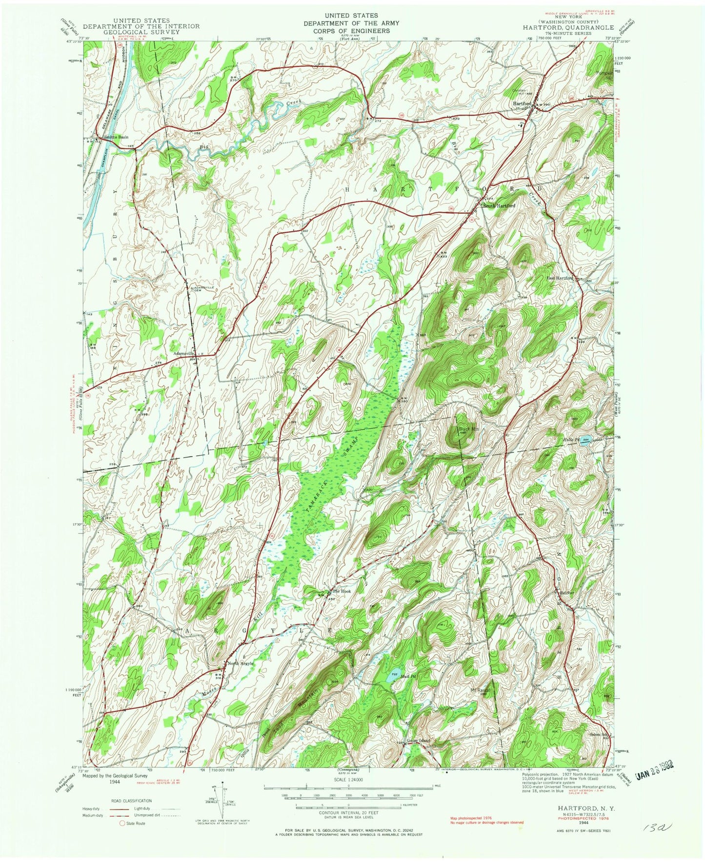
Classic USGS Hartford New York 7.5'x7.5' Topo Map
Couldn't load pickup availability
Historical USGS topographic quad map of Hartford in the state of New York. Map scale may vary for some years, but is generally around 1:24,000. Print size is approximately 24" x 27"
This quadrangle is in the following counties: Washington.
The map contains contour lines, roads, rivers, towns, and lakes. Printed on high-quality waterproof paper with UV fade-resistant inks, and shipped rolled.
Contains the following named places: Adamsville, Adamsville Baptist Church, Adamsville Cemetery, Argyle Airport, Belcher, Big Creek, Black Mountain, Christian Hill, Double Bar D Ranch, East Hartford, Goose Island, Goose Island Farm, Halls Pond, Hartford, Hartford Baptist Church, Hartford Central School, Hartford Post Office, Hartford Volunteer Fire Company, McWhorters Orchard, Mount Rascal, Mountain View Airport, Mud Pond, North Argyle, North Argyle Cemetery, North Argyle Community Church, Old North Argyle Cemetery, Pole Valley Players Club, Salem School, Silver Eagles Farm, Smiths Basin, South Hartford, Tamarack Swamp, The Hook, Todd Mountain, Town of Hartford, Washington County, Wood Creek, ZIP Code: 12838