MyTopo
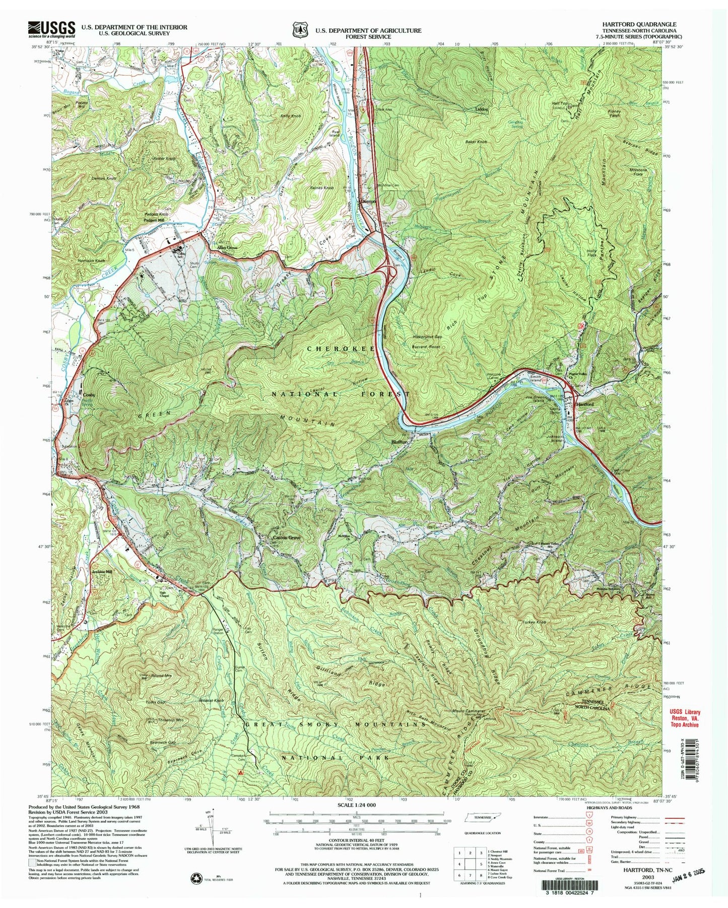
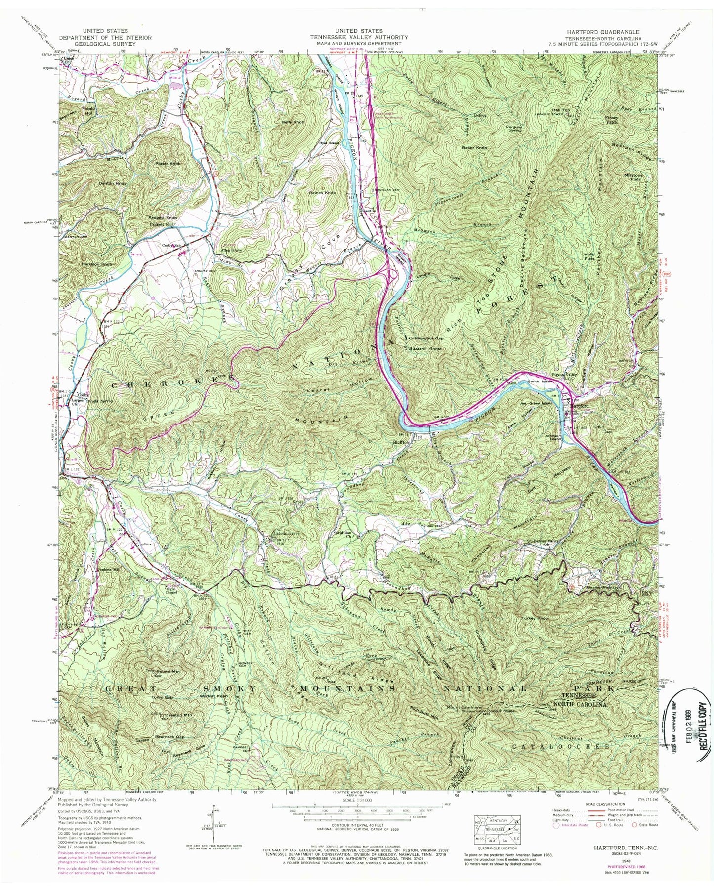
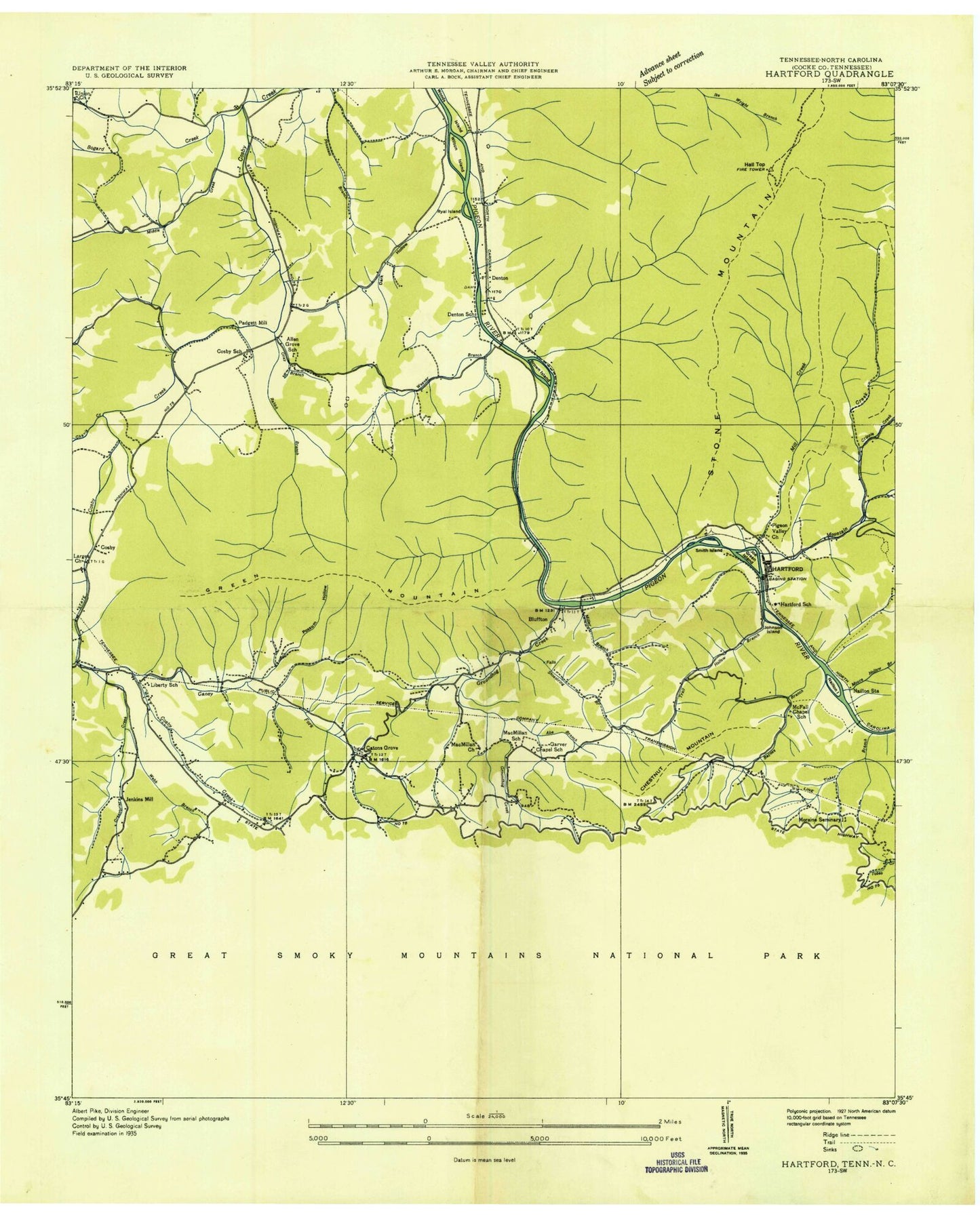
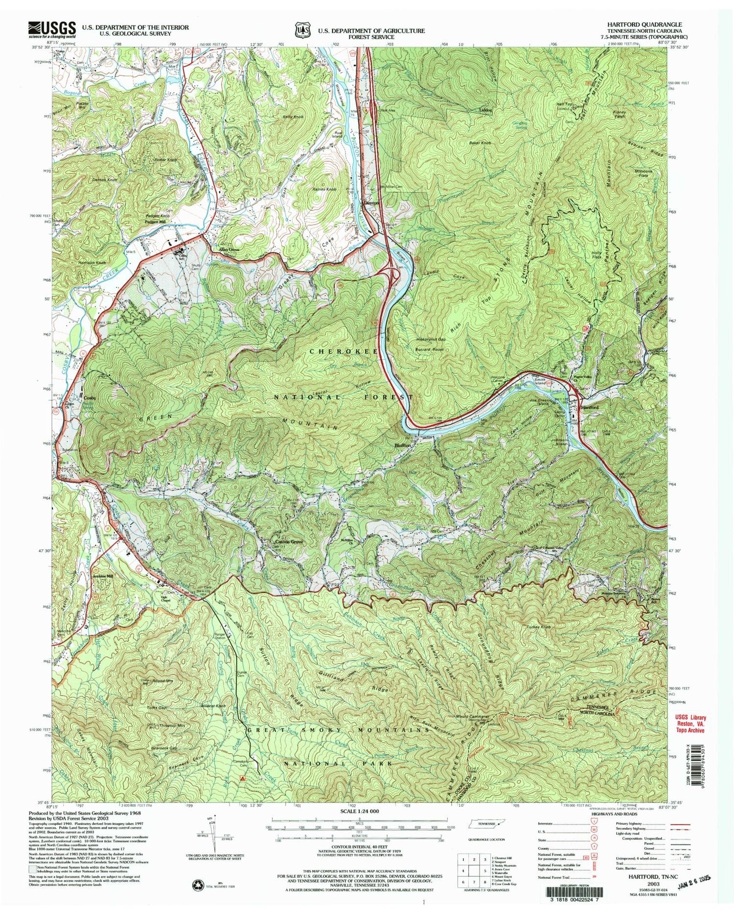
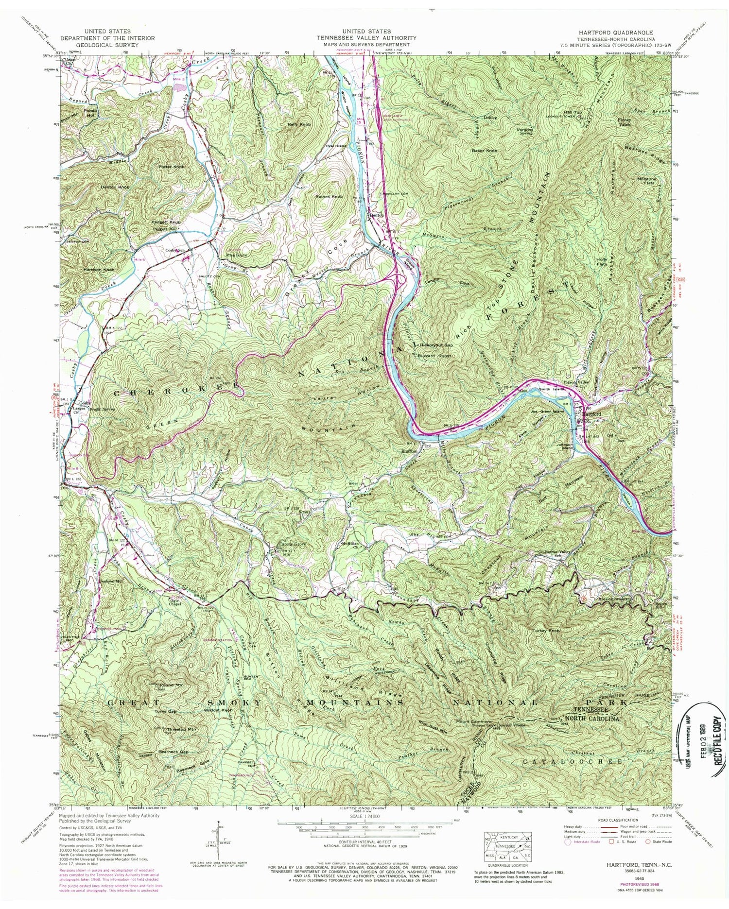
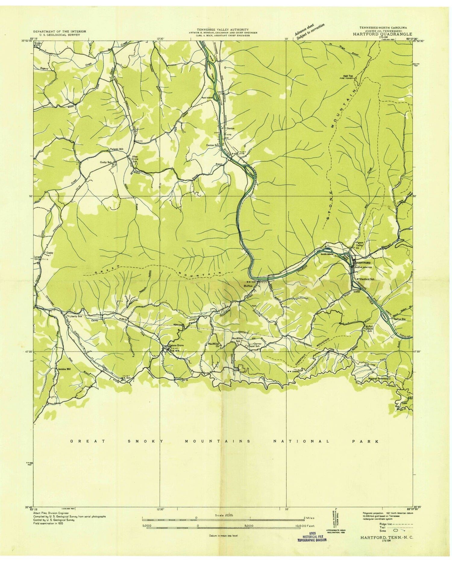
Classic USGS Hartford Tennessee 7.5'x7.5' Topo Map
Couldn't load pickup availability
Historical USGS topographic quad map of Hartford in the states of Tennessee, North Carolina. Typical map scale is 1:24,000, but may vary for certain years, if available. Print size: 24" x 27"
This quadrangle is in the following counties: Cocke, Haywood.
The map contains contour lines, roads, rivers, towns, and lakes. Printed on high-quality waterproof paper with UV fade-resistant inks, and shipped rolled.
Contains the following named places: Cammerer Ridge, Mine Ridge, Bearpen Ridge, Cosby Ranger Station, Indian Camp Creek, Shoestring Branch, Shultz Cemetery, Smith Island, Stillhouse Branch, Stone Mountain, Sutton Ridge, Three Top Mountain, Tinker Branch, Toms Creek, Toms Gap, Trail Hollow, Tritt Cemetery, Turkey Knob, Turnalay Creek, Union Baptist Church, Valentine Cemetery, Watertank Branch, Weaver Branch, Webb Branch, Wildcat Knob, Wilson Island, Woods Island, Zachy Hollow, Abe Branch, Abe Cemetery, Allen Grove, Bailey Branch, Baker Knob, Barnes Branch, Barnes Valley School, Bearneck Cove, Bear Neck Gap, Big Branch, Bluffton, Bogard Creek, Brown Island, Brown School, Buzzard Roost, Campbell Cemetery, Cane Hollow, Caney Creek, Carolina Prong, Catons Grove, Chavis Creek, Chestnut Mountain, Cloverfield Hollow, Cosby, Cripple Creek, Crying Creek, Dark Hollow, Denton, Denton Cemetery, Denton Knob, Devils Backbone, Dry Branch, Finney Patch, Fletcher Spring Branch, Gabes Mountain, Gilliland Fork, Gilliland Ridge, Gray Branch, Greasy Cove, Green Mountain, Greenbrier Creek, Groundhog Creek, Groundhog Ridge, Gulf Mountain, Gunter Cemetery, Gurgling Spring, Hall Mountain, Hall Top, Harrison Knob, Hartford, Hen Wallow Creek, Hickorynut Gap, Holly Flats, Huskycamp Branch, Jenkins Mill, Joe Green Island, Johnson Island, Kelly Knob, Landin Cove, Larges Church, Laurel Hollow, Laurel Hollow, Leadmine Ridge, Licklog, Lower Falling Branch, Lower Whiterock Trail, McFalls Branch, McMillan Cemetery, McMillan Church, Messer Branch, Messer Trail, Middle Creek, Mill Creek, Miller Branch, Millstone Flats, Moraine Seminary Church, Naillon Branch, Naillon Island, Ogle Chapel, Padgett Knob, Padgett Mill, Panther Branch, Panther Mountain, Pigeon Valley Church, Pigeonroost Branch, Polecat Branch, Polly Elbert Branch, Possum Hollow, Potato Hill, Potter Knob, Proffit Spring, Rabbit Branch, Raines Knob, Rich Butt Mountain, Rich Top, Richtop Branch, Riding Fork, Robinson Creek, Rock Creek, Round Mountain, Rowdy Creek, Rowdy Ridge, Ryal Island, Hartford Elementary School, McFall Chapel School (historical), McFalls Chapel (historical), Naillontown (historical), Smoky Mountain School (historical), Moraine Seminary (historical), Garver Chapel School (historical), MacMillan School (historical), Denton School (historical), Allen Grove Church, Catons Grove School (historical), Smoky Mountain Elementary School, Mountain Grove School (historical), Mountain Rest School (historical), Browns Baptist Church, Denton Baptist Church, Liberty School (historical), Hall Top Lookout, Cosby Academy (historical), Catons Grove Methodist Church, Trail Hollow Branch, Stone Mountain Trail, Cosby Elementary School, Hartford Division (historical), Hartford Post Office, Cosby Post Office, Gilliland Creek Campsite, Commissioner District 5, Cosby Volunteer Fire Department Station 1, Cosby Volunteer Fire Department Station 2, Kyle Carver Orchards, Cosby Campground, Cosby Group Camp, Dorsey Cemetery, Gilliland Cemetery, Haner / Fish Cemetery, Jennifer Cemetery, Johnson Cemetery, Mack - McMahan Cemetery, McGaha Cemetery, McKinney McMahan Cemetery, O M Caton Cemetery, Phillips Cemetery, Sallie Sutton Cemetery, Cosby Census Designated Place, Mount Cammerer, Mount Cammerer Lookout Tower, Cammerer Ridge, Mine Ridge, Bearpen Ridge, Cosby Ranger Station, Indian Camp Creek, Shoestring Branch, Shultz Cemetery, Smith Island, Stillhouse Branch, Stone Mountain, Sutton Ridge, Three Top Mountain, Tinker Branch, Toms Creek, Toms Gap, Trail Hollow, Tritt Cemetery, Turkey Knob, Turnalay Creek, Union Baptist Church, Valentine Cemetery, Watertank Branch, Weaver Branch, Webb Branch, Wildcat Knob, Wilson Island, Woods Island, Zachy Hollow, Abe Branch, Abe Cemetery, Allen Grove, Bailey Branch, Baker Knob, Barnes Branch, Barnes Valley School, Bearneck Cove, Bear Neck Gap, Big Branch, Bluffton, Bogard Creek, Brown Island, Brown School, Buzzard Roost, Campbell Cemetery, Cane Hollow, Caney Creek, Carolina Prong, Catons Grove, Chavis Creek, Chestnut Mountain, Cloverfield Hollow, Cosby, Cripple Creek, Crying Creek, Dark Hollow, Denton, Denton Cemetery, Denton Knob
