
MyTopo
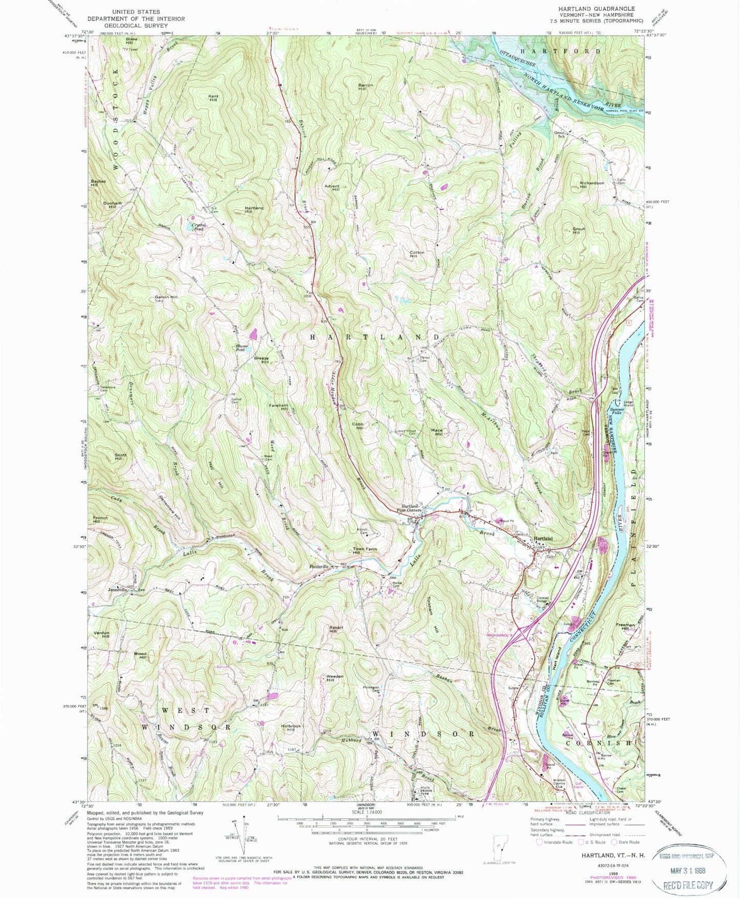
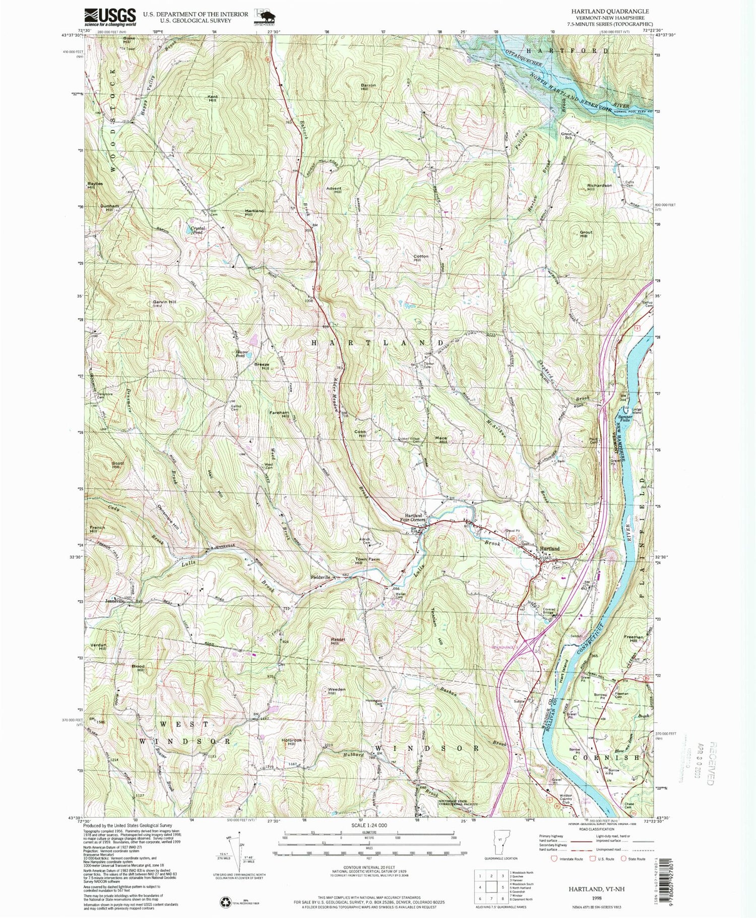
Classic USGS Hartland Vermont 7.5'x7.5' Topo Map
Couldn't load pickup availability
Historical USGS topographic quad map of Hartland in the states of Vermont, New Hampshire. Typical map scale is 1:24,000, but may vary for certain years, if available. Print size: 24" x 27"
This quadrangle is in the following counties: Sullivan, Windsor.
The map contains contour lines, roads, rivers, towns, and lakes. Printed on high-quality waterproof paper with UV fade-resistant inks, and shipped rolled.
Contains the following named places: Advent Hill, Alder Meadow Brook, Aldrich Cemetery, Barron Hill, Bashan Brook, Baylies Hill, Beaver Pond, Blood Hill, Breeze Hill, Cady Brook, Center Cemetery, Cobb Hill, Cotton Hill, Crystal Pond, Cutts Cemetery, Densmore Brook, Densmore Cemetery, Densmore Hill, Dunham Hill, Fareham Hill, French Hill, Fulling Brook, Gallup Cemetery, Garvin Hill, Gill Cemetery, Grout Hill, Grout School, Hall Hill, Harlow Brook, Hartland, Hartland Four Corners, Hartland Hill, Hoisington Cemetery, Holbrook Hill, Kent Hill, Lulls Brook, Mace Hill, McArthur Brook, North Hartland Reservoir, Plains Cemetery, Quaker-Willard Cemetery, Rabbit Hill, Richardson Hill, Scott Hill, Shepherd Brook, Tinkham Hill, Town Farm Hill, Verdun Hill, Walker Cemetery, Weed Brook, Weed Cemetery, Weeden Hill, Snody Dock Lighthouse, Fieldsville, Jenneville, Windsor Country Club, WMXR-FM (Woodstock), Town of Hartland, Bronson Dam, Frizzel Cemetery, Hartland Cemetery, Hartland Elementary School, Hartland Four Corners Post Office, Hartland Post Office, Hour Glass Country Club and Golf Course, Jenneville Cemetery, Martins Mill Covered Bridge, Unitarian Universalist Church, Southeast State Correctional Facility - Windsor, Hartland Volunteer Fire Department and Rescue Squad Incorporated Station 1, Meadowbrook School, Hartland Census Designated Place, Hart Island, Chase Cemetery, Freeman Cemetery, Freeman Hill, Ledge Island, Sumner Falls