MyTopo
Classic USGS Hartley Lake Minnesota 7.5'x7.5' Topo Map
Regular price
$16.95
Regular price
Sale price
$16.95
Unit price
per
Couldn't load pickup availability
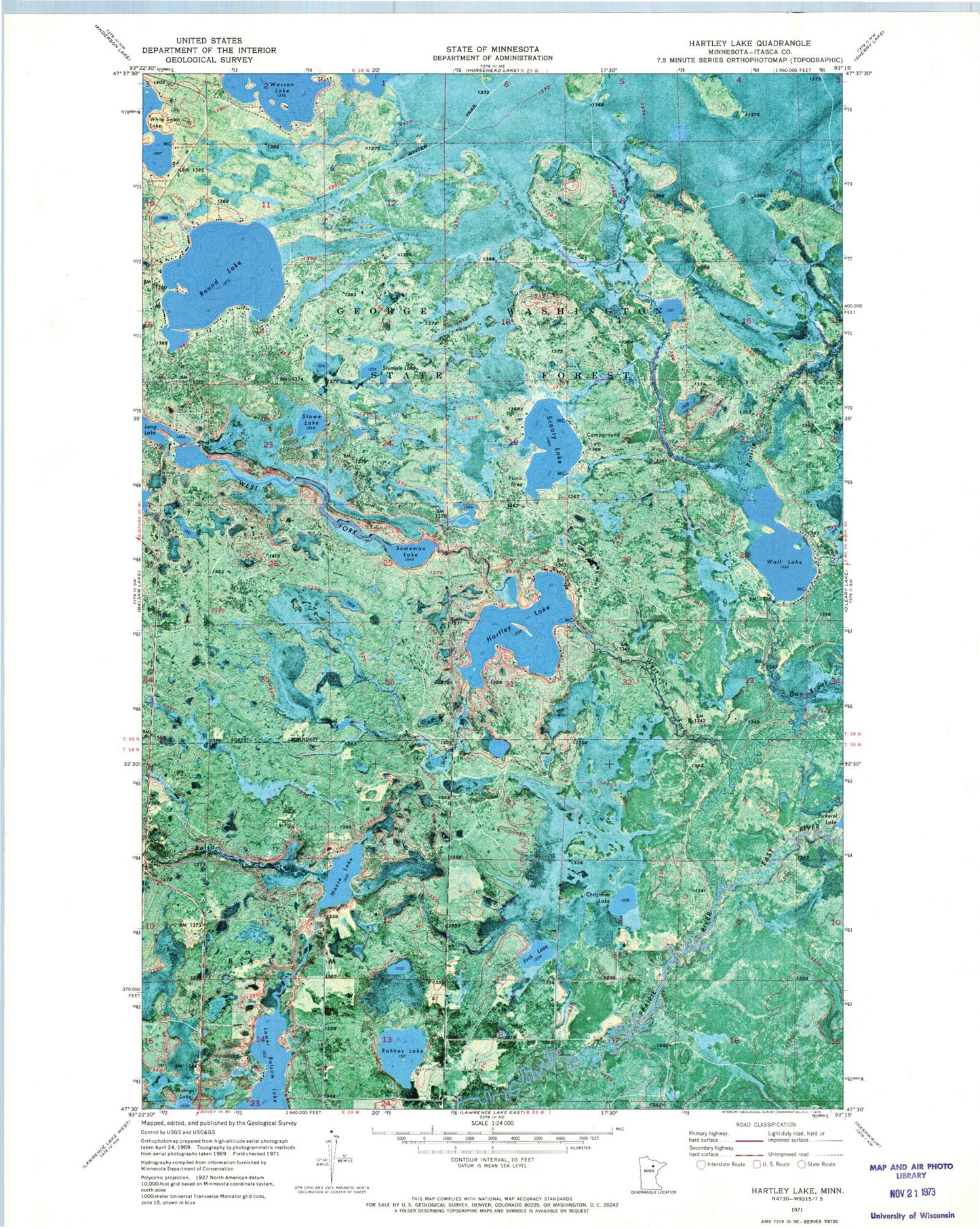
Historical USGS topographic quad map of Hartley Lake in the state of Minnesota. Map scale may vary for some years, but is generally around 1:24,000. Print size is approximately 24" x 27"
This quadrangle is in the following counties: Itasca.
The map contains contour lines, roads, rivers, towns, and lakes. Printed on high-quality waterproof paper with UV fade-resistant inks, and shipped rolled.
Contains the following named places: Christmas Lake, Day Brook, East River, Hartley Lake, Hartley Lake Dam, Jack Lake, Lower Balsam Lake, Moose Lake, Rahkos Lake, Round Lake, Scooty Lake, Someman Lake, Stowe Lake, Stumple Lake, Taconite Trail, Wasson Lake, West Fork Prairie River, Wolf Lake, Wolf Lake Dam