MyTopo
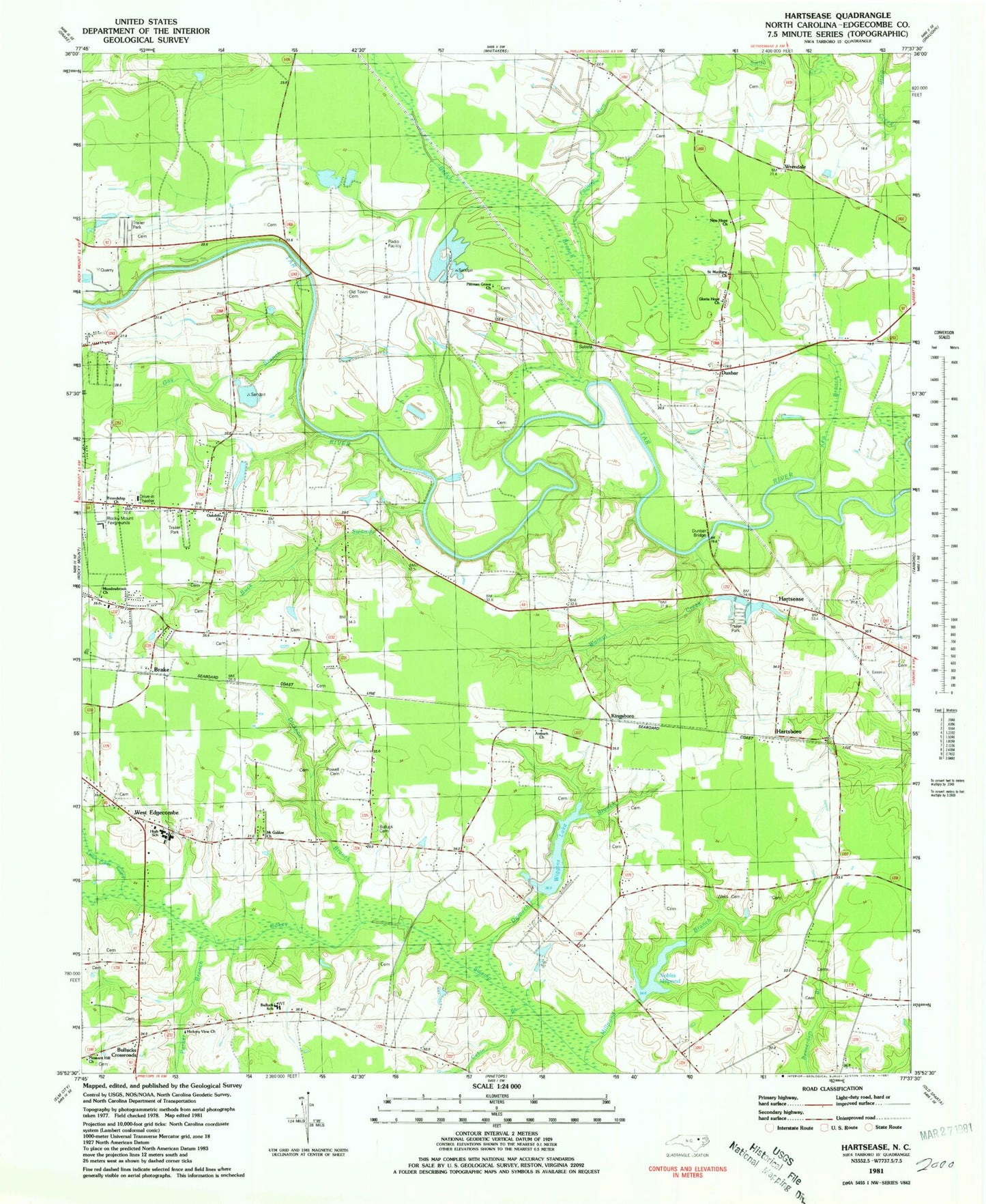
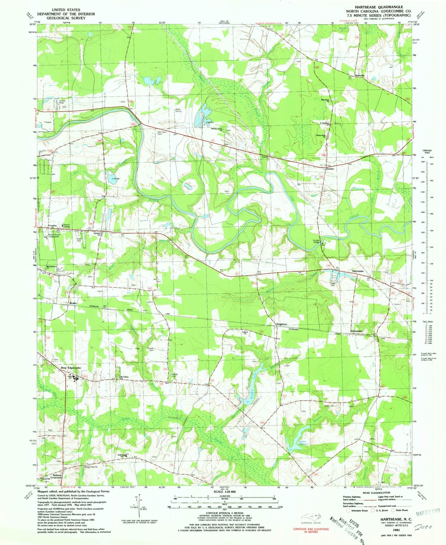
Classic USGS Hartsease North Carolina 7.5'x7.5' Topo Map
Couldn't load pickup availability
Historical USGS topographic quad map of Hartsease in the state of North Carolina. Map scale may vary for some years, but is generally around 1:24,000. Print size is approximately 24" x 27"
This quadrangle is in the following counties: Edgecombe.
The map contains contour lines, roads, rivers, towns, and lakes. Printed on high-quality waterproof paper with UV fade-resistant inks, and shipped rolled.
Contains the following named places: Antioch Church, Beech Branch, Brake, Buck Swamp, Bullock School, Bulluck Cemetery, Bullucks Crossroads, Cabin Branch, Deloach Branch, Dickson Branch, Dunbar, Dunbar Bridge, Falling Run, Friendship Church, Gay Branch, Gloria Hope Church, Hartsboro, Hartsease, Heartsease Volunteer Fire Department, Hickory View Church, Key Branch, Kungsboro, Little Cokey Swamp, Meadowbrook Church, Mount Galilee Church, New Hope Church, Nobles Mill Pond Dam, Nobles Millpond, Oakdale Church, Old Town Cemetery, Penelo, Pitman Grove Church Cemetery, Pittman Grove Church, Pleasant Hill Church, Powell Cemetery, Rocky Mount Fairgrounds, Rocky Mount Pit, Rocky Mount Quarry 11, Saint Matthew Church, Township 11-Walnut Creek, Township 12-Rocky Mount, Township 7-Swift Creek, Walnut Creek, West Edgecombe, West Edgecombe Junior High School, West Edgecombe Rescue Squad Ambulance Service, West Edgecombe Volunteer Fire Department, Wiggins Lake, Wiggins Lake Dam, Wrendale, ZIP Code: 27801