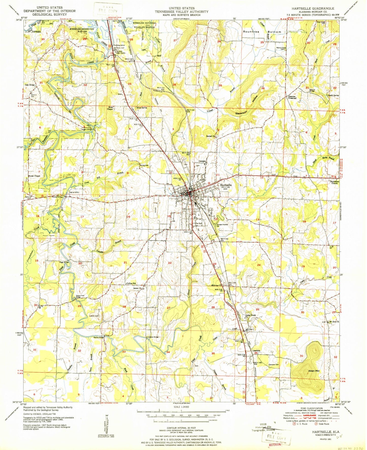
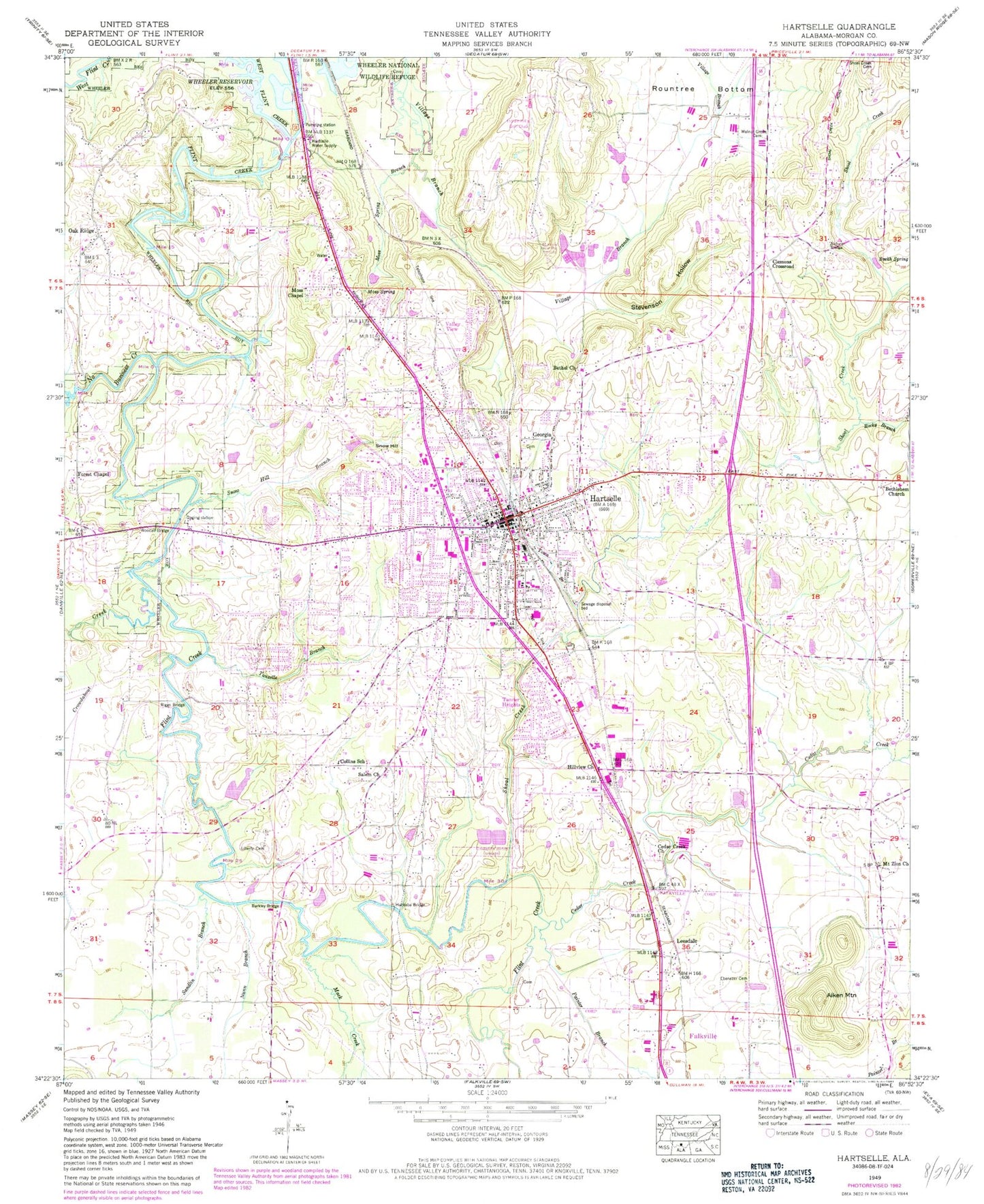
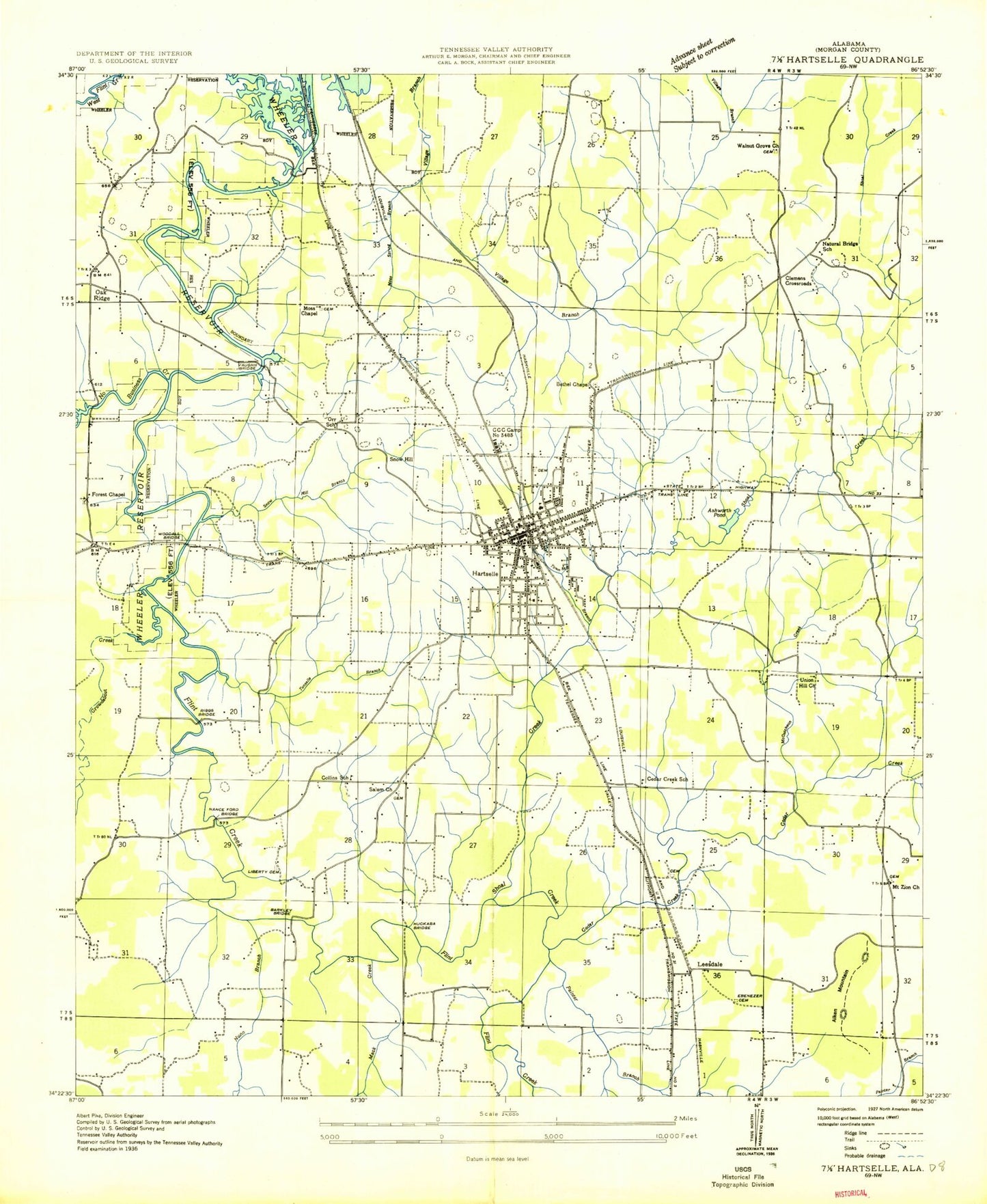
MyTopo
Classic USGS Hartselle Alabama 7.5'x7.5' Topo Map
Couldn't load pickup availability
Historical USGS topographic quad map of Hartselle in the state of Alabama. Map scale may vary for some years, but is generally around 1:24,000. Print size is approximately 24" x 27"
This quadrangle is in the following counties: Morgan.
The map contains contour lines, roads, rivers, towns, and lakes. Printed on high-quality waterproof paper with UV fade-resistant inks, and shipped rolled.
Contains the following named places: Aiken Mountain, Ashworth Pond, Barkley Bridge, Bethel Baptist Church, Bethlehem Baptist Church, Bethlehem Cemetery, Burleson Elementary School, Burnetts Salt Well, Cedar Creek, Cedar Creek Free Will Baptist Church, Cedar Creek School, Church of Christ, City of Hartselle, Civilian Conservation Corps Camp Number 3485, Clemons Crossroad, Collins School, Crestline Elementary School, Crestwood Shopping Center, Crowdabout Creek, Ebenezer Cemetery, First Baptist Church of Hartselle, First Christian Church, First Church of God, First Presbyterian Church, First United Methodist Church, Forest Chapel, Georgia, Gospel Baptist Church, Hartselle, Hartselle City Police Department, Hartselle Division, Hartselle Fire and Rescue Station 1, Hartselle Fire and Rescue Station 2, Hartselle High School, Hartselle Junior High School, Hartselle Medical Center, Hartselle Memory Gardens, Hartselle Natural Bridge, Hartselle Post Office, Hartselle Utilities Wastewater Treatment Plant, Hartselle Water Supply, Hartselle-Morgan County Regional Airport, Hilview Church, Huckaba Bridge, Indian Hills Golf Club, Leesdale, Liberty Cemetery, Mack Creek, McCutcheon Creek, Moss Chapel, Moss Spring, Moss Spring Branch, Mount Olive Church, Mount Zion Baptist Church, Mount Zion Cemetery, Nance Ford Bridge, Natural Bridge School, NEW-AM (Hartselle), No Business Creek, Nunn Branch, Oak Lane Dam, Oak Ridge, Oak Ridge Church, Oak Ridge School, Oak Ridge Volunteer Fire Department Station 2, Orr School, Outlaw Spring Branch, Painter Branch, Pattillo Street Church of God, Reeves Cemetery, Riggs Bridge, Roberts Lake, Rocky Branch, Rountree Bottom, Salem Methodist Church, Sandlin Branch, Shoal Creek, Sleighton Branch, Smith Spring, Snow Hill, Snow Hill Branch, Snow Spring, Stevenson Hollow, Tanner Heights, Tanner Heights Plaza Shopping Center, Tiger Stadium, Town Branch, Town of Falkville, Tunselle Branch, Union Hill Church, Valley View, Vaughn Bridge, Walnut Grove Baptist Church, Walnut Grove Cemetery, West Flint Creek, West Hartselle Baptist Church, WHRT-AM (Hartselle), Woodall Bridge, ZIP Code: 35640