MyTopo
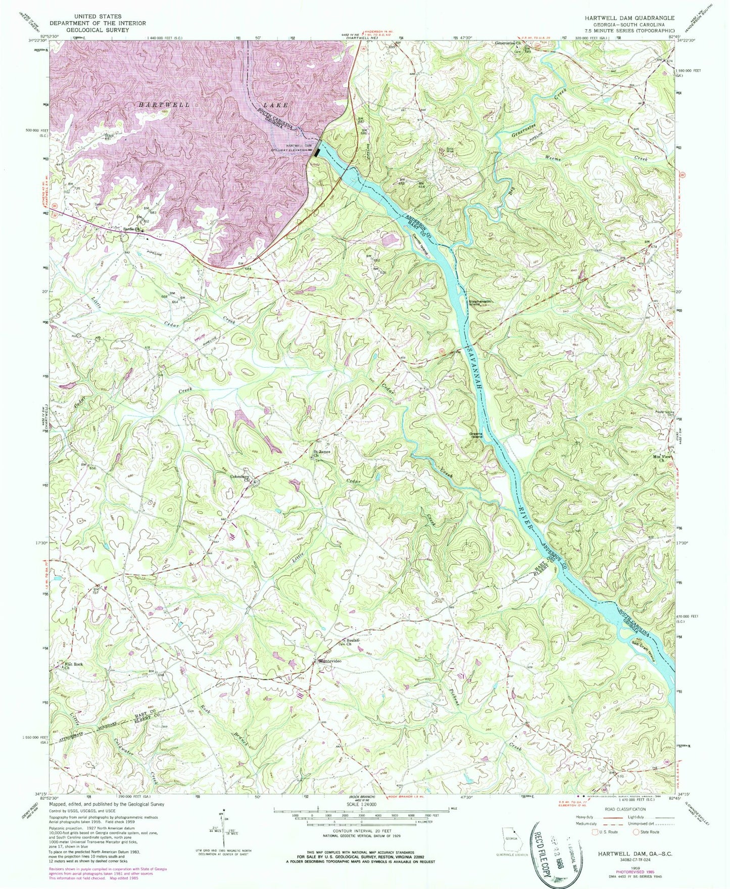
Classic USGS Hartwell Dam Georgia 7.5'x7.5' Topo Map
Couldn't load pickup availability
Historical USGS topographic quad map of Hartwell Dam in the states of Georgia, South Carolina. Map scale may vary for some years, but is generally around 1:24,000. Print size is approximately 24" x 27"
This quadrangle is in the following counties: Anderson, Elbert, Hart.
The map contains contour lines, roads, rivers, towns, and lakes. Printed on high-quality waterproof paper with UV fade-resistant inks, and shipped rolled.
Contains the following named places: Beulah Church, Big Generostee Creek, Byers Creek, Cedar Creek, Cokesbury Cemetery, Cokesbury Church, Cole Dam One, Cole Dam Three, Cole Dam Two, Cole Lake One, Cole Lake Three, Cole Lake Two, Cooley School, Cordell Mill, Derritt Island, Dooleys Ferry, Flat Rock Cemetery, Flat Rock Church, Gaines Chapel, Gaines Chapel Cemetery, Generostee Baptist Church, Greens Island, Grove School, Hardscrabble Mills, Hart County Fire Department Station 6 Nancy Hart, Hartwell Dam, Hewin Island, Little Cedar Creek, Louis Morris Memorial Bridge, Lucas Creek, McLaughlin Lake, McLaughlin Lake Dam, McMullins Mill, Monteideo, Montevideo, Mount Hebron Church, Mount View School, Mountain View Cemetery, Oak Grove Associate Reformed Presbyterian Church, Parks Ferry, Poplar Spring Cemetery, Sadlers Ferry, Saint James Cemetery, Saint James Church, Sardis Cemetery, Sardis Church, Seb Craft Island, Smith-McGee Bridge, Stephenson Island, Weems Creek