MyTopo
Classic USGS Hartwick Iowa 7.5'x7.5' Topo Map
Couldn't load pickup availability
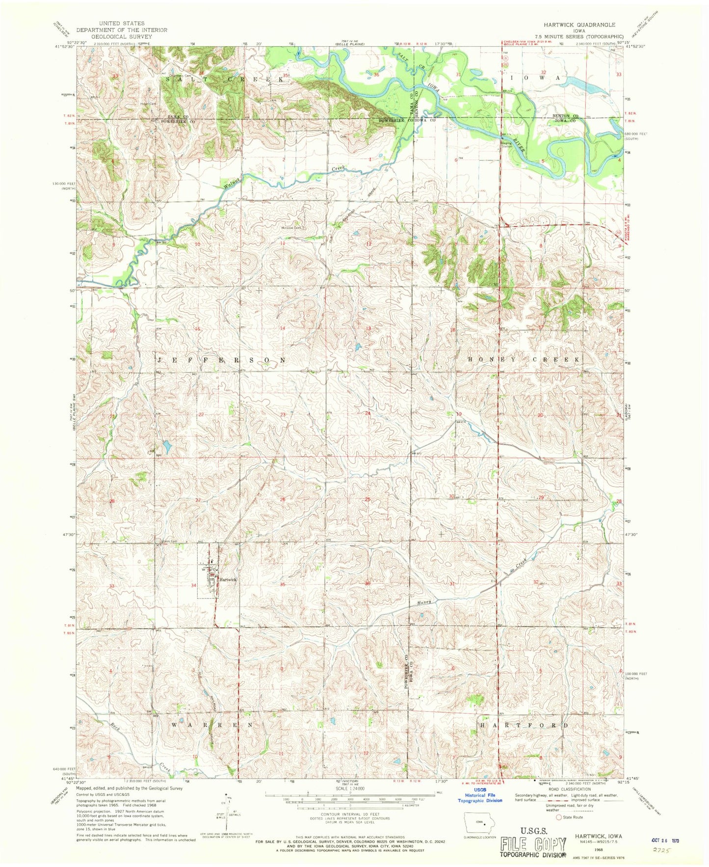
Historical USGS topographic quad map of Hartwick in the state of Iowa. Map scale may vary for some years, but is generally around 1:24,000. Print size is approximately 24" x 27"
This quadrangle is in the following counties: Benton, Iowa, Poweshiek, Tama.
The map contains contour lines, roads, rivers, towns, and lakes. Printed on high-quality waterproof paper with UV fade-resistant inks, and shipped rolled.
Contains the following named places: Blake Cemetery, Chambers Cemetery, City of Hartwick, Dove Post Office, Dover, Dover Cemetery, Farmer's Four County Co-op Elevator, Hartwick, Hartwick Cemetery, Hartwick City Hall, Hartwick Fire Department, Hartwick Post Office, Holan Cemetery, Moriah, Moriah Post Office, Riverdale, Riverdale Post Office, Salt Creek, Township of Jefferson, Walnut Creek, Winslow Cemetery, ZIP Code: 52232