MyTopo
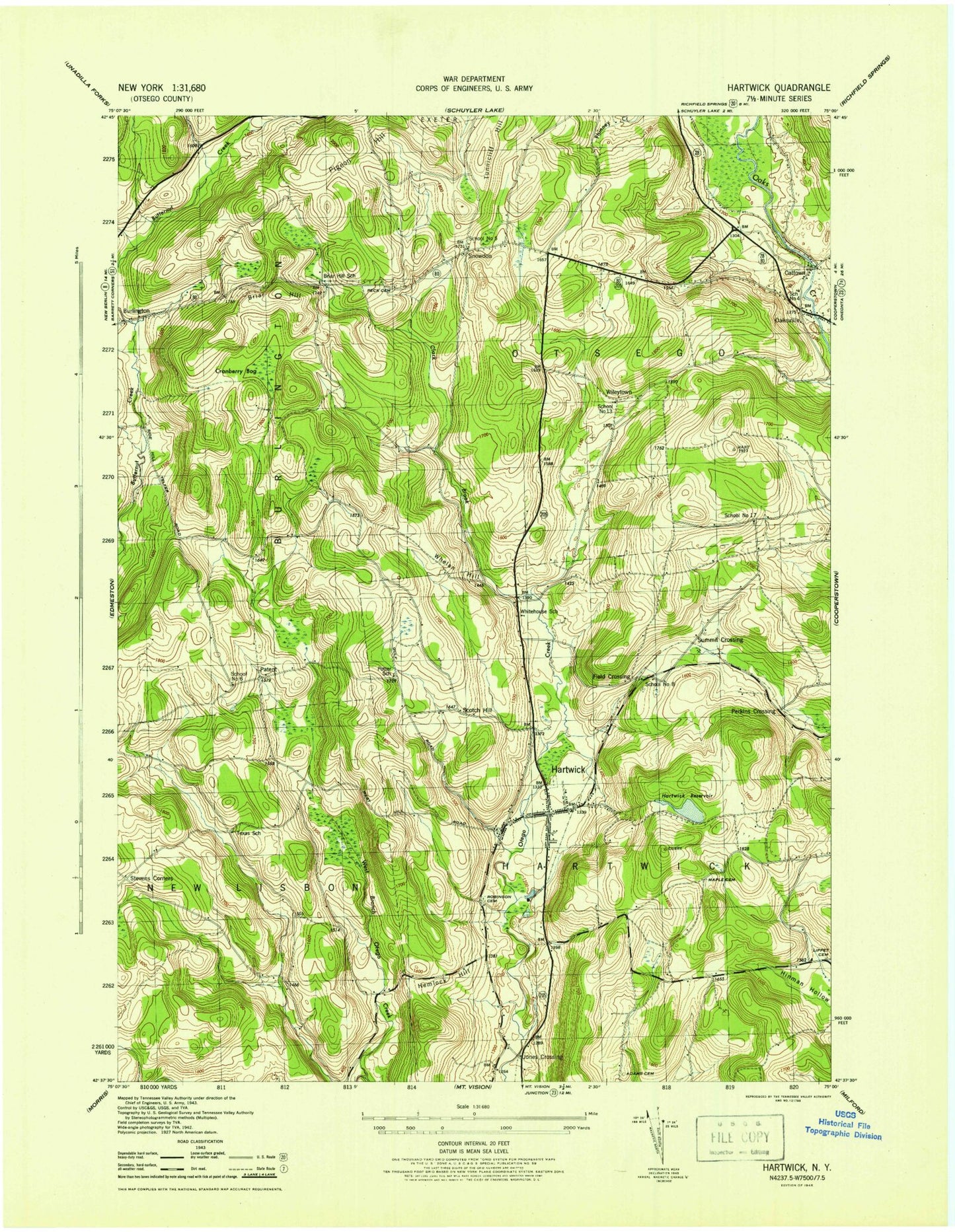
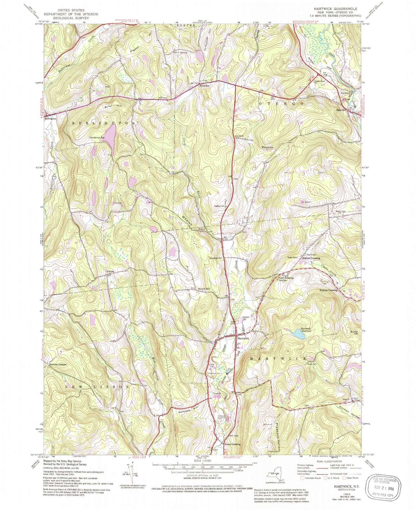
Classic USGS Hartwick New York 7.5'x7.5' Topo Map
Couldn't load pickup availability
Historical USGS topographic quad map of Hartwick in the state of New York. Typical map scale is 1:24,000, but may vary for certain years, if available. Print size: 24" x 27"
This quadrangle is in the following counties: Otsego.
The map contains contour lines, roads, rivers, towns, and lakes. Printed on high-quality waterproof paper with UV fade-resistant inks, and shipped rolled.
Contains the following named places: Briar Hill, Briar Hill School (historical), Cattown, Clark Brook, Cranberry Bog, Field Crossing, Hartwick, Hartwick Reservoir, Hemlock Hill, Jones Crossing, Maple Cemetery, Oaksville, Peck Cemetery, Pigeon Hill, Potter School (historical), Robinson Cemetery, Scotch Hill, Stevens Corners, Texas School (historical), Tunnicliff Hill, Whitehouse School (historical), Whalen Hill, Patent, Perkins Crossing, Snowdon, Summit Crossing, Wileytown, Otsego County, School Number 17 (historical), School Number 6 (historical), Old United Presbyterian Church Cemetery, Town of Hartwick, School Number 4 (historical), School Number 5 (historical), School Number 8 (historical), School Number 13 (historical), Winsor Babbitt Cemetery, Pierce Cemetery, Field Cemetery, Butterfield Cemetery, Hartwick Heights Mobile Home Park, Paige Mobile Home Park, Snowden Hill Cemetery, Cooperstown Assembly of God, Cooperstown Family Campground, Hartwick Census Designated Place, Hartwick Fire Department Company 1, Hawkins Hill, Hartwick Post Office