MyTopo
Classic USGS Harvey Arkansas 7.5'x7.5' Topo Map
Couldn't load pickup availability
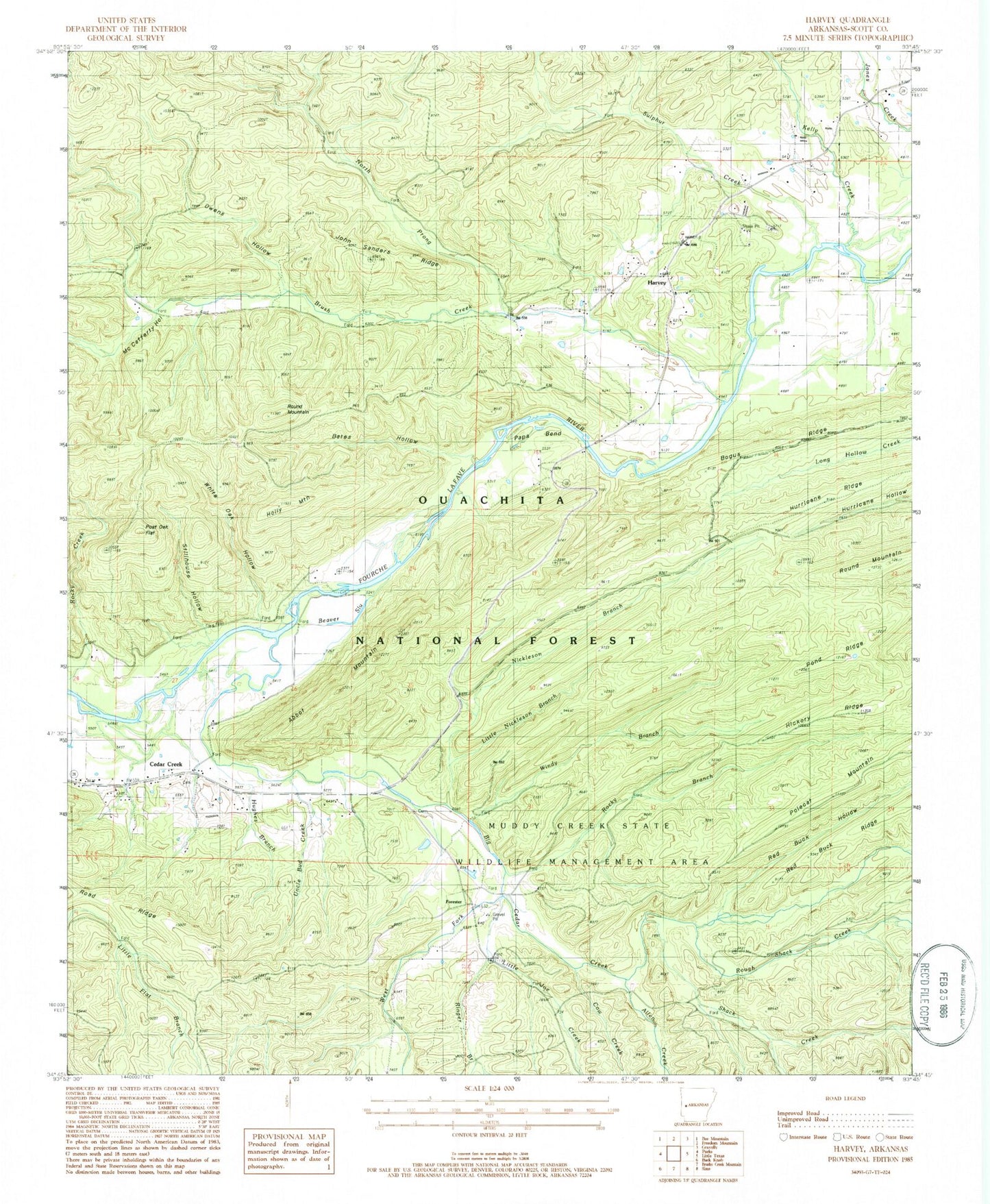
Historical USGS topographic quad map of Harvey in the state of Arkansas. Map scale may vary for some years, but is generally around 1:24,000. Print size is approximately 24" x 27"
This quadrangle is in the following counties: Scott.
The map contains contour lines, roads, rivers, towns, and lakes. Printed on high-quality waterproof paper with UV fade-resistant inks, and shipped rolled.
Contains the following named places: Abbot Lookout Tower, Abbot Mountain, Allen Creek, Bates Hollow, Beaver Slough, Big Cedar Cemetery, Big Cedar Creek, Bogus Ridge, Brush Creek, Camp Buck Creek, Cedar Creek, Cow Creek, Forester, Harvey, Harvey Cemetery, Harvey Nola Volunteer Fire Station, Harvey Post Office, Hickory Ridge, Holly Mountain, Hughes Branch, Hurricane Ridge, John Sanders Ridge, Kelly Creek, Little Joe Creek, Little Nickleson Branch, McCafferty Hollow, Nebraska, Nickleson Branch, North Prong Brush Creek, Owens Hollow, Papa Bend, Parks Volunteer Fire Department Substation, Pond Ridge, Post Oak Flat, Red Buck Hollow, Ringer Branch, Road Ridge, Rocky Branch, Rocky Creek, Rough Shack Creek, Round Mountain, Sanders Cemetery, Shack Creek, Stillhouse Hollow, Sulphur Creek, Township of Cedar, Township of La Fave, Uncle Bud Creek, West Fork Big Cedar Creek, White Oak Hollow, Windy Branch, ZIP Code: 72841