MyTopo
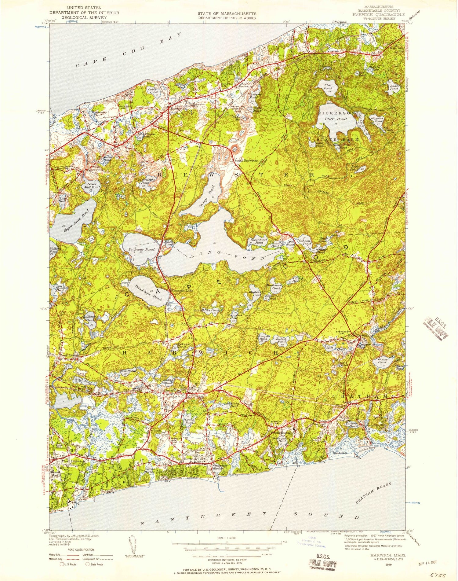
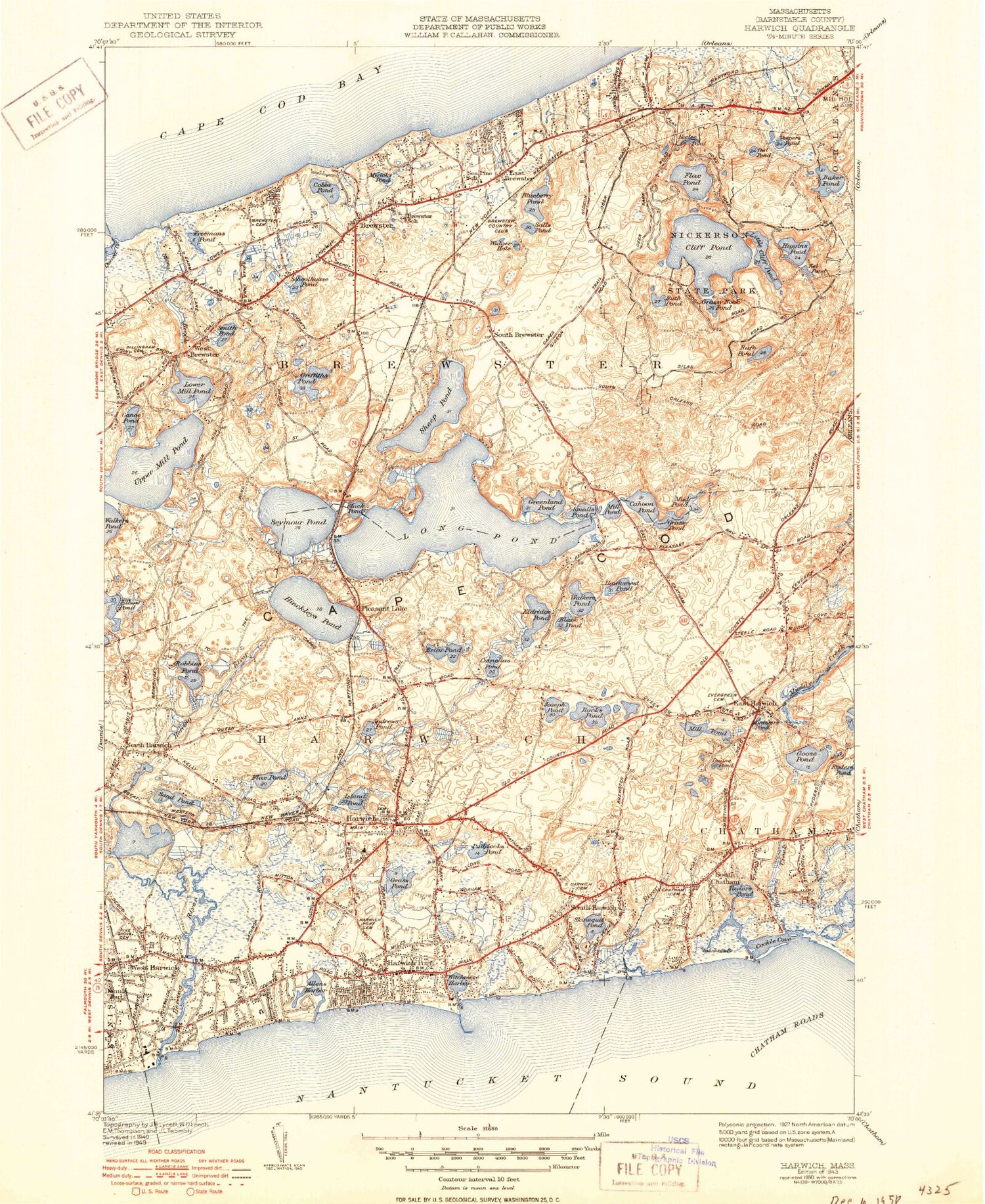
Classic USGS Harwich Massachusetts 7.5'x7.5' Topo Map
Couldn't load pickup availability
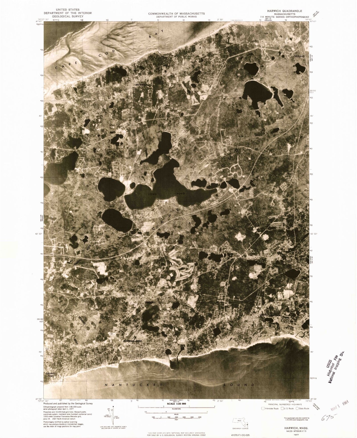
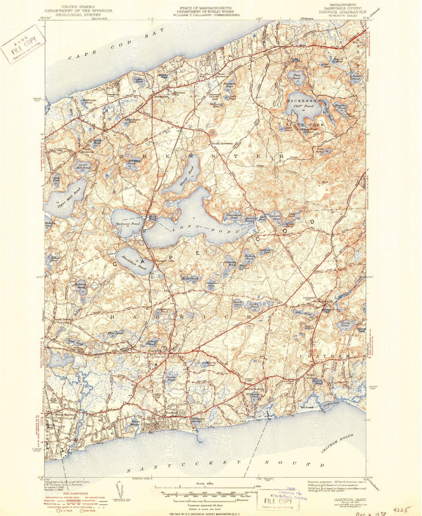
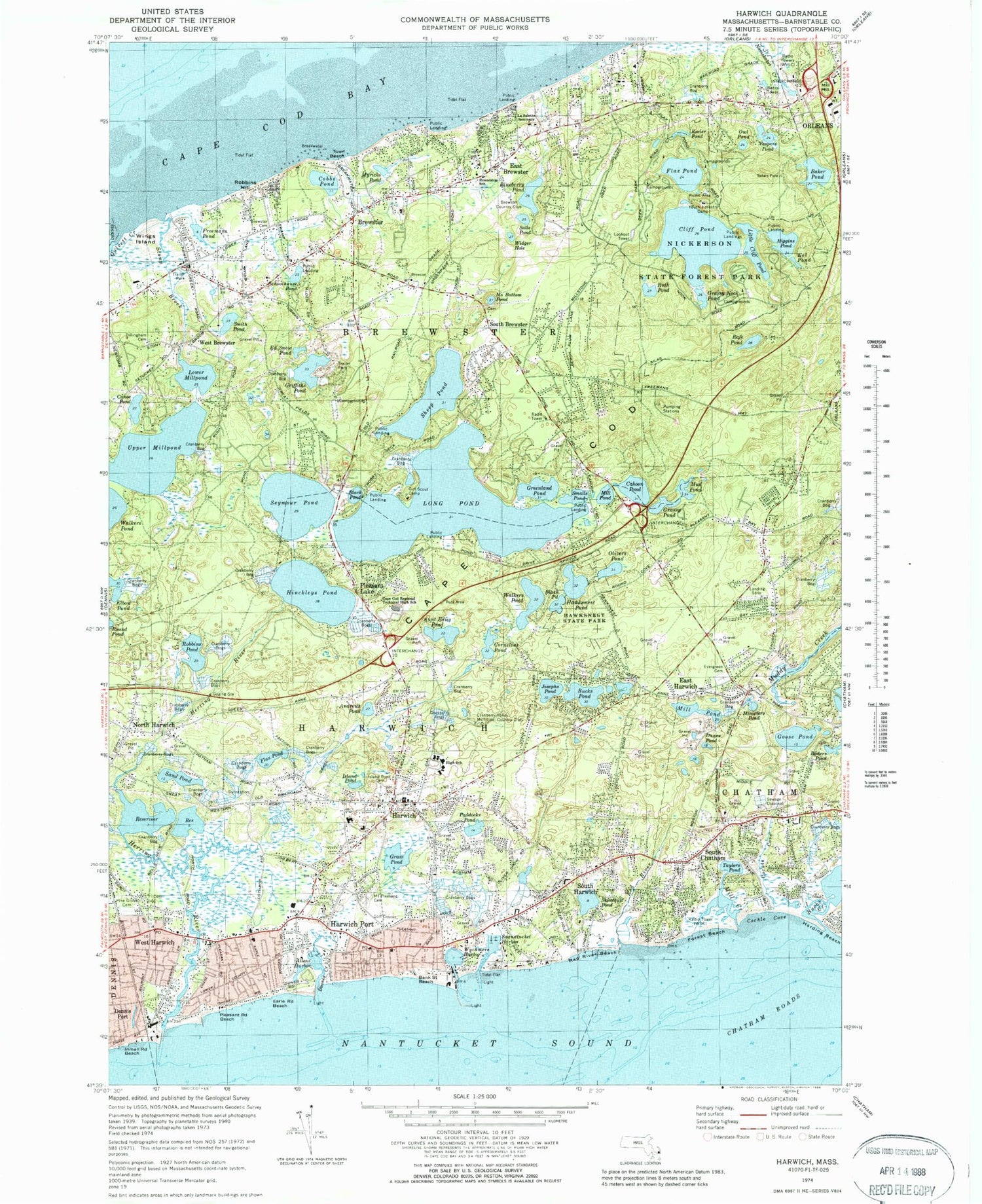
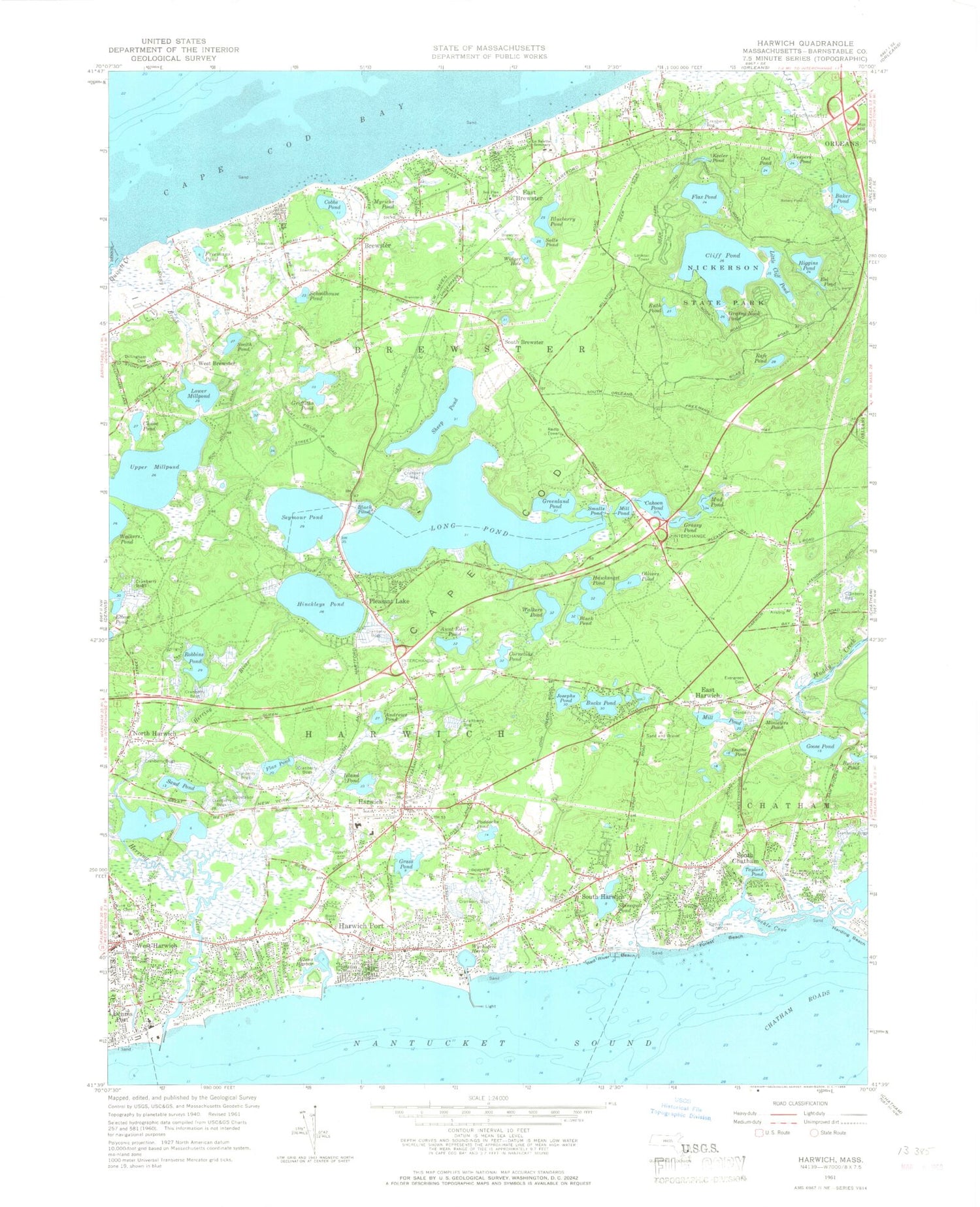
Historical USGS topographic quad map of Harwich in the state of Massachusetts. Typical map scale is 1:24,000, but may vary for certain years, if available. Print size: 24" x 27"
This quadrangle is in the following counties: Barnstable.
The map contains contour lines, roads, rivers, towns, and lakes. Printed on high-quality waterproof paper with UV fade-resistant inks, and shipped rolled.
Contains the following named places: Andrews River East Jetty Light, Wychmere Harbor Jetty Light, Allens Harbor Breakwater Light, Girl Scout Camp, Monomoy Regional High School, Friendship School, La Salette Seminary, Brewster County Club, Cape Cod Regional Technical High School, Dillingham Cemetery, Pine Grove Cemetery, Brewster Cemetery, Island Pond Cemetery, Mount Pleasant Cemetery, Quivett Creek Marshes, Herring River Marshes, Bucks Creek Marshes, Youth Forestry Camp, Evergreen Cemetery, Hawksnest State Park, Pine Grove Cemetery, Old Higgins Windmill, Drummer Boy Museum, Sealand of Cape Cod, Stony Brook Mill, Cape Cod Museum of Natural History, Brooks Library, Pine Grove Seminary, Congregational Church, Lower Mill Pond Dam, Captains Church, Winslows Narrows, Brewster Station (historical), Clarks Point, Cobbs Point, Kellys Wharf (historical), Bells Neck, South Chatham Station (historical), Harwich Station (historical), Pleasant Lake Station (historical), Kolb Rock, Sand Pond, Grass Pond Bog, Grassy Nook, Tawasentha Hill, Cape Cod Rail Trail, Nickerson State Forest Park, WVLC, Cape Cod, Quivett Neck, Allen Harbor, Andrews Pond, Andrews River, Aunt Edies Pond, Black Pond, Black Pond, Blueberry Pond, Brewster, Bucks Creek, Bucks Pond, Cahoon Pond, Canoe Pond, Cobbs Pond, Cornelius Pond, Doanes Creek, Duane Pond, East Brewster, East Harwich, Flax Pond, Forest Beach, Freemans Pond, Goose Pond, Grass Pond, Grassy Pond, Greenland Pond, Griffiths Pond, Harwich, Harwich Port, Hawksnest Pond, Herring River, Hinckleys Pond, Island Pond, Josephs Pond, Long Pond, Lower Millpond, Mill Creek, Mill Pond, Mill Pond, Ministers Pond, Mud Pond, Myricks Pond, North Harwich, Olivers Pond, Paddocks Pond, Pleasant Lake, Quivett Creek, Rafe Pond, Red River, Red River Beach, Robbins Pond, Ryders Pond, Salls Pond, Sand Pond, Saquatucket Harbor, Schoolhouse Pond, Seymour Pond, Sheep Pond, Skinequit Pond, Smalls Pond, Smith Pond, South Brewster, South Chatham, South Harwich, Stony Brook, Taylors Pond, Upper Millpond, Walkers Pond, West Brewster, West Harwich, Widger Hole, Wychmere Harbor, Baker Pond, Cliff Pond, Eel Pond, Flax Pond, Grassy Nook Pond, Higgins Pond, Keeler Pond, Little Cliff Pond, Owl Pond, Ruth Pond, Vespers Pond, Black Pond, Lewis Pond, Round Pond, Cockle Cove Creek, Town of Brewster, Town of Harwich, Cockle Cove, WKPE-AM (Orleans), WFCC-FM (Chatham), WCCT-FM (Harwich), WFXR-FM (Harwich Port), WKPE-FM (Orleans), Long Pond Seaplane Base, East Harwich Airport (historical), Cape Cod Bible Alliance Church, West Reservoir, The Church of Jesus Christ of Latter Day Saints, 333 Main Street Shopping Center, Ellis Landing Beach, Ellis Landing, Point of Rocks Landing, Point of Rocks Landing Beach, Breakwater Landing, Town Beach, Saints Landing Beach, Robbins Hill Beach, Paine's Creek Beach, Inman Road Beach, Pleasant Road Beach, Earle Road Beach, Bank Street Beach, Bay Path Regional Vocational Technical High School Media Center, Cape Cod Regional Technical High School Library, The Family School, Harwich Elementary School Library Media Center, The Laurel School, Brewster Census Designated Place, East Harwich Census Designated Place, Harwich Center Census Designated Place, Harwich Port Census Designated Place, Northwest Harwich Census Designated Place, Brewster Fire Department Station 1, Harwich Fire Department Station 1 Headquarters, Chatham Fire and Rescue Department Station 2, Harwich Fire Department Station 2, Ebenezar Weekes Island, Oak Island, Harwich Police Department, Brewster Police Department, South Chatham Cemetery, Brewster Post Office, Harwich Post Office, Harwich Port Post Office, South Chatham Post Office, West Harwich Post Office, South Harwich Post Office, South Harwich Cemetery, Brewster Memorial Cemetery, Eldredge Family Cemetery, Andrews River East Jetty Light, Wychmere Harbor Jetty Light, Allens Harbor Breakwater Light, Girl Scout Camp, Monomoy Regional High School, Friendship School, La Salette Seminary, Brewster County Club, Cape Cod Regional Technical High School, Dillingham Cemetery, Pine Grove Cemetery, Brewster Cemetery, Island Pond Cemetery, Mount Pleasant Cemetery, Quivett Creek Marshes, Herring River Marshes, Bucks Creek Marshes, Youth Forestry Camp, Evergreen Cemetery, Hawksnest State Park, Pine Grove Cemetery, Old Higgins Windmill, Drummer Boy Museum, Sealand of Cape Cod, Stony Brook Mill, Cape Cod Museum of Natural History, Brooks Library, Pine Grove Seminary, Congregational Church, Lower Mill Pond Dam, Captains Church, Winslows Narrows, Brewster Station (historical), Clarks Point, Cobbs Point, Kellys Wharf (historical), Bells Neck, South Chatham Station (historical), Harwich Station (historical), Pleasant Lake Station (historical), Kolb Rock, Sand Pond, Grass Pond Bog, Grassy Nook, Tawasentha Hill