
MyTopo
Classic USGS Harwood Bench Montana 7.5'x7.5' Topo Map
Regular price
$16.95
Regular price
Sale price
$16.95
Unit price
per
Couldn't load pickup availability
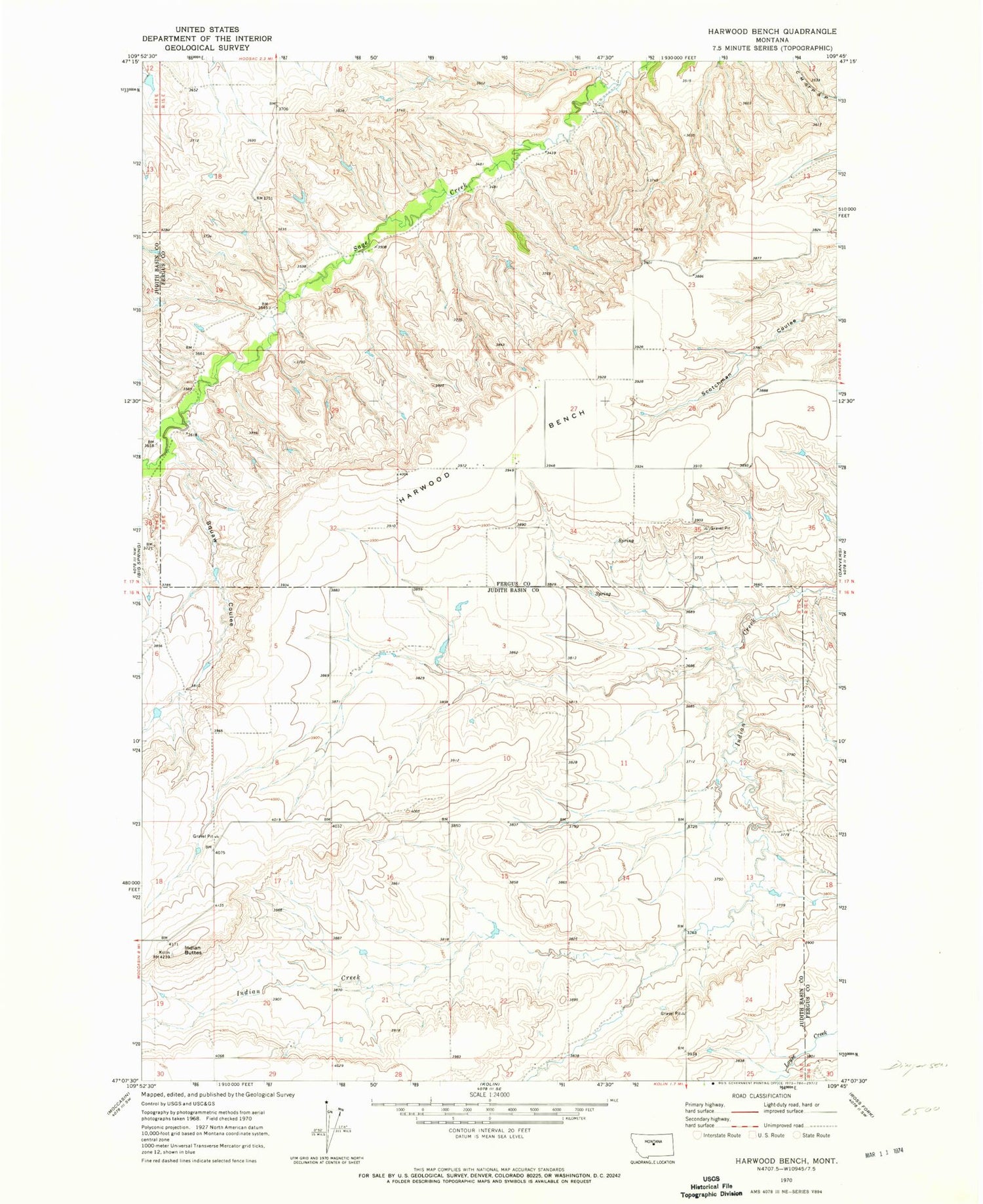
Historical USGS topographic quad map of Harwood Bench in the state of Montana. Map scale may vary for some years, but is generally around 1:24,000. Print size is approximately 24" x 27"
This quadrangle is in the following counties: Fergus, Judith Basin.
The map contains contour lines, roads, rivers, towns, and lakes. Printed on high-quality waterproof paper with UV fade-resistant inks, and shipped rolled.
Contains the following named places: 16N15E12CBD_01 Well, 16N15E13BAB_01 Well, 16N15E15CCC_01 Well, 16N15E30AB__01 Well, 17N15E19DADB01 Well, 17N15E27BCA_01 Well, 17N15E27CCC_01 Well, 17N15E27DC__01 Well, 17N15E34BDCC01 Well, Big Sagebrush Coulee, Harwood Bench, Indian Buttes, Prairie View School


