MyTopo
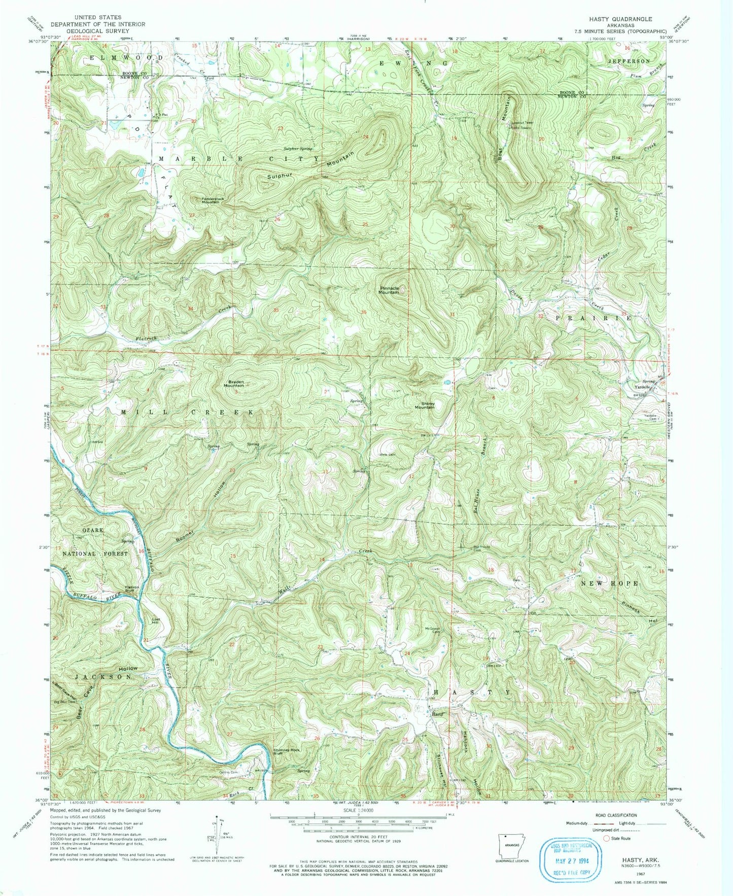
Classic USGS Hasty Arkansas 7.5'x7.5' Topo Map
Couldn't load pickup availability
Historical USGS topographic quad map of Hasty in the state of Arkansas. Map scale may vary for some years, but is generally around 1:24,000. Print size is approximately 24" x 27"
This quadrangle is in the following counties: Boone, Newton.
The map contains contour lines, roads, rivers, towns, and lakes. Printed on high-quality waterproof paper with UV fade-resistant inks, and shipped rolled.
Contains the following named places: Agee Cemetery, Bat House Branch, Bear Cave Hollow, Boat Mountain, Boomer Hollow, Braden Mountain, Cedar Creek, Chimney Rock Bluff, Collins Cemetery, Deffenbaugh Cemetery, Flatiron Bluff, Fodderstack Mountain, Gray Bluff, Hasty, Hasty Post Office, Hasty Volunteer Fire Department, KCWD-FM (Harrison), Little Bear Cave Hollow, Little Buffalo River, Lost Hill, Marble Falls Post Office, P D Flat, P D Flat Church, Pinnacle Mountain, Rock Creek, Shirey Mountain, Sulphur Mountain, Sulphur Spring, Township of Hasty, Township of Mill Creek, Township of Prairie, Wells Cemetery, Wells Creek, Yardelle, Yardelle Branch, Yardelle Cemetery, ZIP Code: 72640