MyTopo
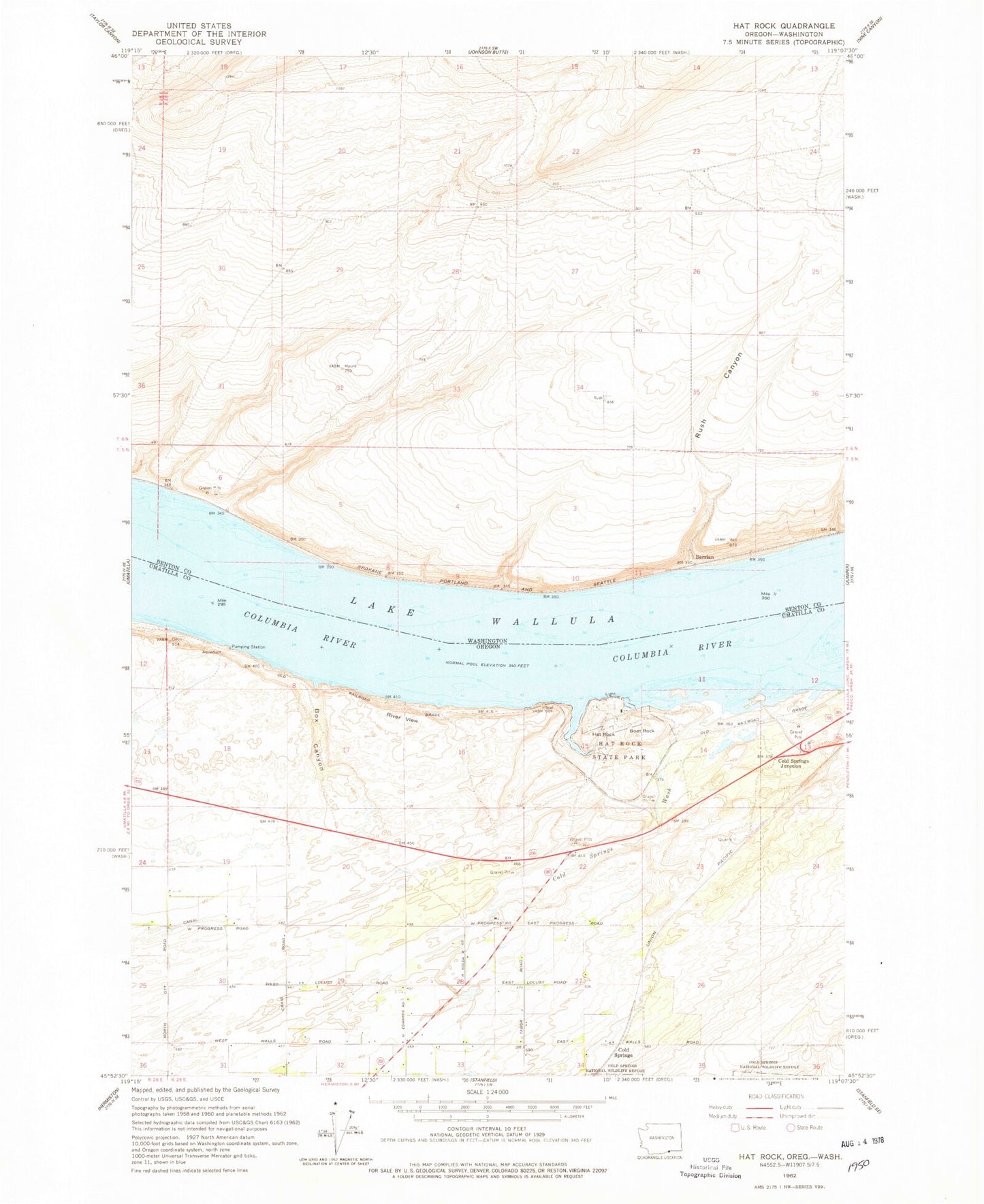
Classic USGS Hat Rock Oregon 7.5'x7.5' Topo Map
Couldn't load pickup availability
Historical USGS topographic quad map of Hat Rock in the states of Oregon, Washington. Map scale may vary for some years, but is generally around 1:24,000. Print size is approximately 24" x 27"
This quadrangle is in the following counties: Benton, Umatilla.
The map contains contour lines, roads, rivers, towns, and lakes. Printed on high-quality waterproof paper with UV fade-resistant inks, and shipped rolled.
Contains the following named places: Beef City Feedlot, Berrian, Boat Rock, Box Canyon, Cold Springs, Cold Springs Drain, Cold Springs Junction, Cold Springs Wash, Dodd Ponds, Hat Rock, Hat Rock Drain, Hat Rock State Park, Hat Rock State Park Boat Ramp, McNary Yacht Club Boat Ramp, McNary Yacht Club Marina, Memaloose Island, Mottinger, River View, Riverview, Rush Canyon, T Canal, Techumtas Island, Warehouse Beach Recreation Center