MyTopo
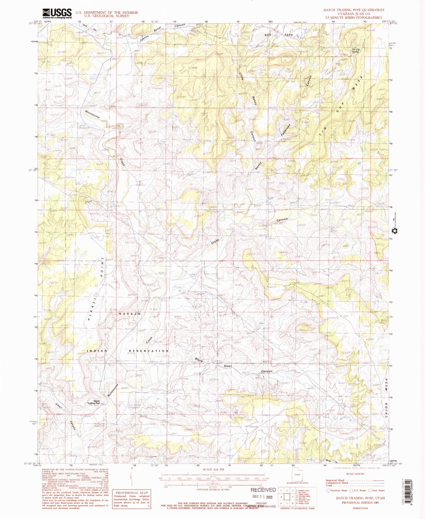
Classic USGS Hatch Trading Post Utah 7.5'x7.5' Topo Map
Regular price
$16.95
Regular price
Sale price
$16.95
Unit price
per
Couldn't load pickup availability
Historical USGS topographic quad map of Hatch Trading Post in the state of Utah. Map scale may vary for some years, but is generally around 1:24,000. Print size is approximately 24" x 27"
This quadrangle is in the following counties: San Juan.
The map contains contour lines, roads, rivers, towns, and lakes. Printed on high-quality waterproof paper with UV fade-resistant inks, and shipped rolled.
Contains the following named places: Alkali Canyon, Alkali Creek, Black Steer Canyon, Black Steer Park, Bug Park, Cave Canyon, Cross Canyon, Hatch Trading Post, Hatch Trailer School, Little Nancy Canyon, Nancy Patterson Canyon, Perkins Ranch, Tin Cup Mesa, Tin Cup Spring