MyTopo
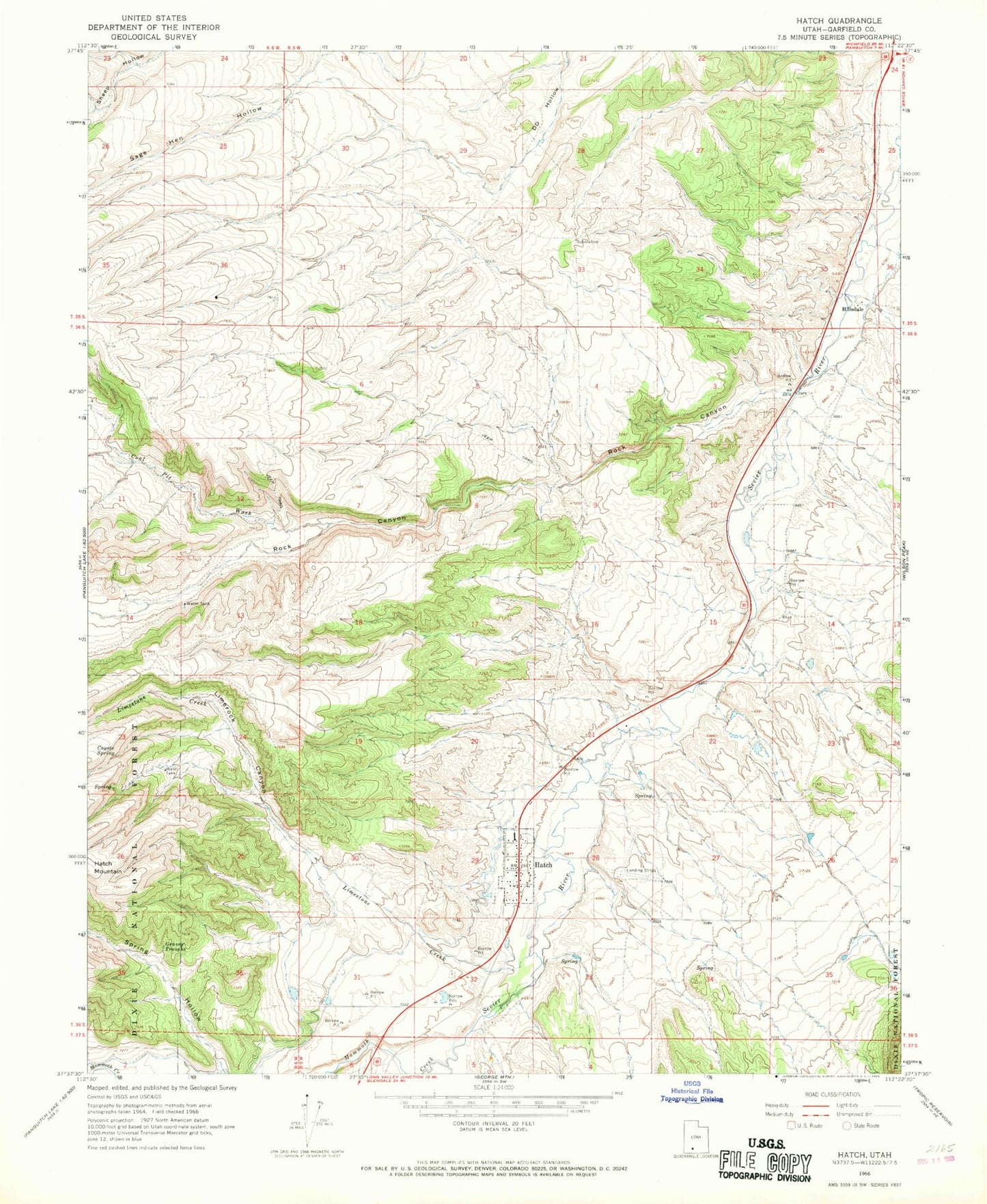
Classic USGS Hatch Utah 7.5'x7.5' Topo Map
Couldn't load pickup availability
Historical USGS topographic quad map of Hatch in the state of Utah. Map scale may vary for some years, but is generally around 1:24,000. Print size is approximately 24" x 27"
This quadrangle is in the following counties: Garfield.
The map contains contour lines, roads, rivers, towns, and lakes. Printed on high-quality waterproof paper with UV fade-resistant inks, and shipped rolled.
Contains the following named places: Coal Pit Wash, Coyote Spring, Garfield County Ambulance, Grassy Troughs, Hatch, Hatch City Cemetery, Hatch Post Office, Hatch Volunteer Fire Department, Hillsdale, Hillsdale Cemetery, Johnsonville Site, Limerock Canyon, Limestone Creek, Mammoth Creek, Mountain Ridge RV Park, Riverside Campground, Rock Canyon, Sage Hen Hollow, Spring Hollow, The Church of Jesus Christ of Latter Day Saints, Town of Hatch, ZIP Code: 84735