
MyTopo
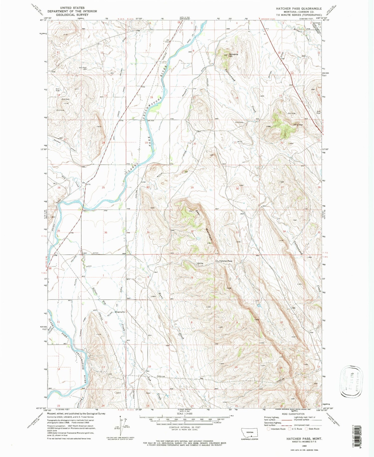
Classic USGS Hatcher Pass Montana 7.5'x7.5' Topo Map
Couldn't load pickup availability
Historical USGS topographic quad map of Hatcher Pass in the state of Montana. Map scale may vary for some years, but is generally around 1:24,000. Print size is approximately 24" x 27"
This quadrangle is in the following counties: Carbon.
The map contains contour lines, roads, rivers, towns, and lakes. Printed on high-quality waterproof paper with UV fade-resistant inks, and shipped rolled.
Contains the following named places: 07S22E23DDBB01 Well, 07S22E25DDAD01 Well, 07S22E26DDDD01 Well, 07S23E06CDAA01 Well, 07S23E08CACB01 Well, 07S23E10DBBD01 Well, 07S23E15ABCD01 Well, 07S23E18ABDD01 Well, 07S23E19AACC01 Well, 07S23E29BBBB01 Well, 07S23E34ABCA01 Well, 08S22E01ADAA01 Well, 08S22E01CCDC01 Well, 08S22E02BACC01 Well, 08S22E11CDCC01 Well, Bear Creek, Belfry Census Designated Place, Cottonwood Creek, Cub Creek, Deer Mountain, Dry Creek, Dry Creek Canal, Golden, Golden Ditch, Golden Post Office, Golden School, Hatcher Pass, Holland Ditch, Hunt Creek, Jack Creek, Jennings, Mutual Ditch, New Prospect School, Schwend Hill, Shupak, Silver Tip Creek, Tucker School


