MyTopo
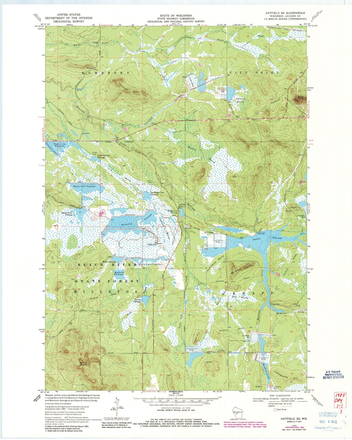
Classic USGS Hatfield SE Wisconsin 7.5'x7.5' Topo Map
Couldn't load pickup availability
Historical USGS topographic quad map of Hatfield SE in the state of Wisconsin. Typical map scale is 1:24,000, but may vary for certain years, if available. Print size: 24" x 27"
This quadrangle is in the following counties: Jackson.
The map contains contour lines, roads, rivers, towns, and lakes. Printed on high-quality waterproof paper with UV fade-resistant inks, and shipped rolled.
Contains the following named places: Battle Point Flowage, Black Duck Flowage, Campground Hill, Circle Hill, City Marsh, Crawford Creek, Crawford Hills, Dresher Marsh, Hawkins Creek, Hawkins Lake, Hay Marsh, Johnson Marsh, Little Thunder Flowage, Martin Marsh, McKenna Creek, Partridge Crop Flowage, Purrleburg Marsh, Range Line Flowage, Ring Marsh, Saddle Mound, Schwartz Pool, Seventeen Flowage, Speck Marsh, Tanner Flowage, Town Line Creek, Town Line Flowage, Wangreen Hill, Weber Flowage, White Tail Flowage, Wildcat Mound, Speck Oaks, Potter Flowage, Potter 2WP695 Dam, Normington E7395 Dam, Resettlement Administration 2 Dam, Resettlement Administration 4 Dam, Resettlement Administration 5 Dam, Mallard Flowage, Resettlement Administration 6 Dam, Resettlement Administration 8 East Dam, Townline Reservoir, Resettlement Administration 8 Dam, Resettlement Administration 9 Dam, Resettlement Administration 12 Dam, Resettlement Administration 15 Dam, Whitetail Flowage 12