MyTopo
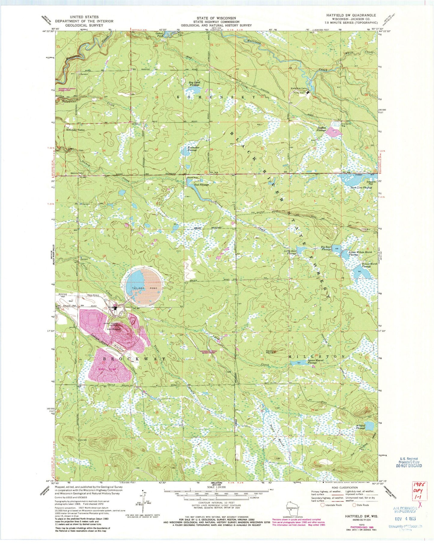
Classic USGS Hatfield SW Wisconsin 7.5'x7.5' Topo Map
Couldn't load pickup availability
Historical USGS topographic quad map of Hatfield SW in the state of Wisconsin. Typical map scale is 1:24,000, but may vary for certain years, if available. Print size: 24" x 27"
This quadrangle is in the following counties: Jackson.
The map contains contour lines, roads, rivers, towns, and lakes. Printed on high-quality waterproof paper with UV fade-resistant inks, and shipped rolled.
Contains the following named places: Big Bear Flowage, Black River Camp Picnic Area, Black River State Forest, Dry Land Flowage, Funmaker Flowage, Iron Mound (historical), Jackson County Iron Mine, Komensky Station, Little Bear Flowage, Lower Wilson Marsh Flowage, Oxbow Pond, Squaw Mound, Staffon Flowage, Trowe Drain, Trowe Marsh, White Creek, Wildcat Flowage, Wilson Marsh Flowage, Resettlement Administration 20 Dam, Squaw Mound Flowage, Resettlement Administration 21 Dam, Resettlement Administration 29 2WP398 Dam, Teal Flowage, Bauer-Brockway Barrens State Natural Area, Black River Correctional Center, Wazee Lake