MyTopo
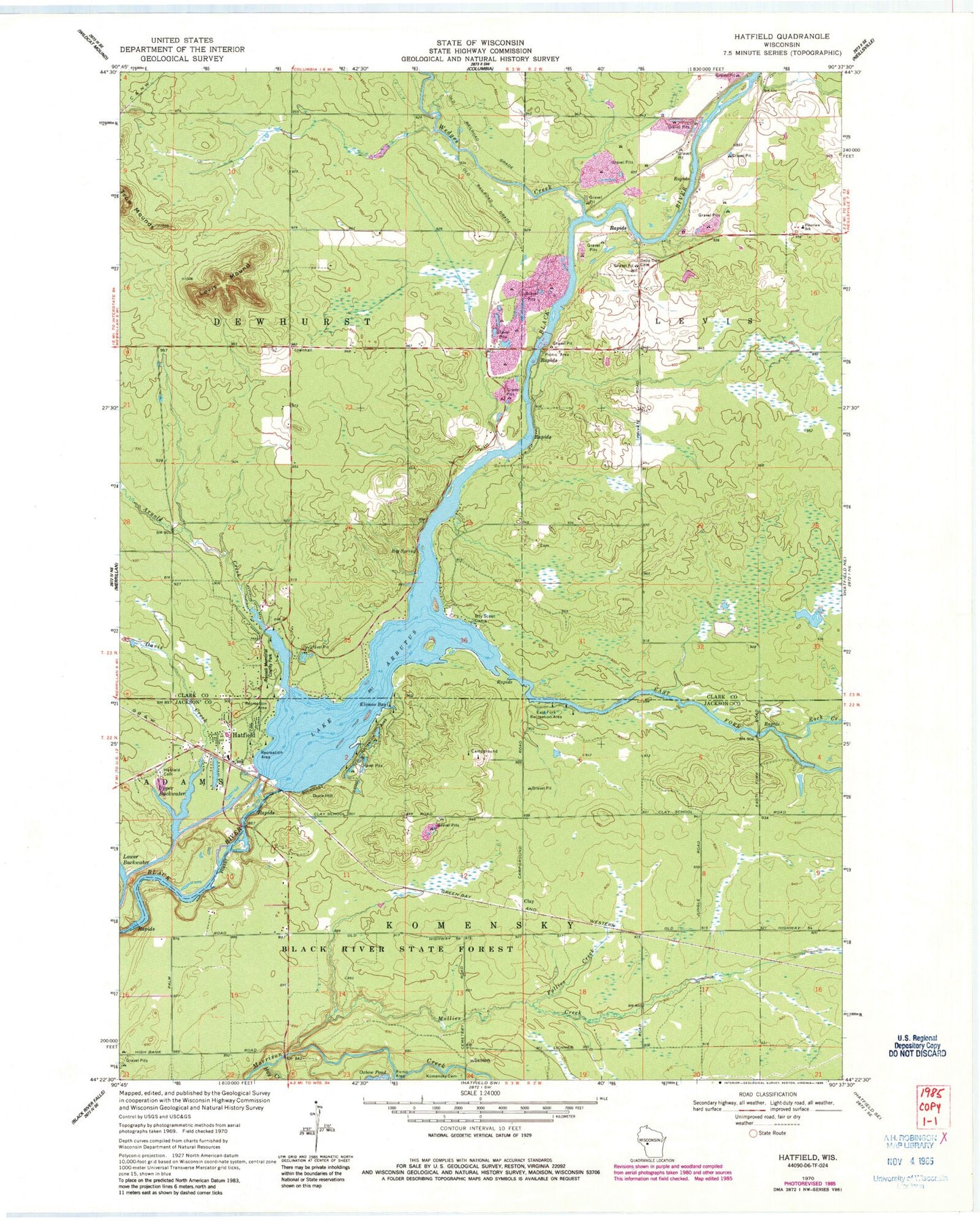
Classic USGS Hatfield Wisconsin 7.5'x7.5' Topo Map
Couldn't load pickup availability
Historical USGS topographic quad map of Hatfield in the state of Wisconsin. Typical map scale is 1:24,000, but may vary for certain years, if available. Print size: 24" x 27"
This quadrangle is in the following counties: Clark, Jackson.
The map contains contour lines, roads, rivers, towns, and lakes. Printed on high-quality waterproof paper with UV fade-resistant inks, and shipped rolled.
Contains the following named places: Lake Arbutus, Arnold Creek, Big Spring, Davis Creek, Dells Dam Cemetery, Duck Hill, East Fork Black River, East Fork Recreation Area, Hatfield, Hatfield Cemetery, Hay Creek, Klimas Bay, Komensky Cemetery, Levis Mound, Mollies Creek, Pineview School, Pollies Creek, Rock Creek, Russell Memorial Park, Upper Backwater, Wedges Creek, Town of Dewhurst, Town of Komensky, Hatfield Dam, Dells Dam School (historical), French Island, Winnebago Indian Cemetery, Hatfield Census Designated Place, Hatfield Fire and Rescue, Opelt Sand and Gravel Pit, Clay (historical)