MyTopo
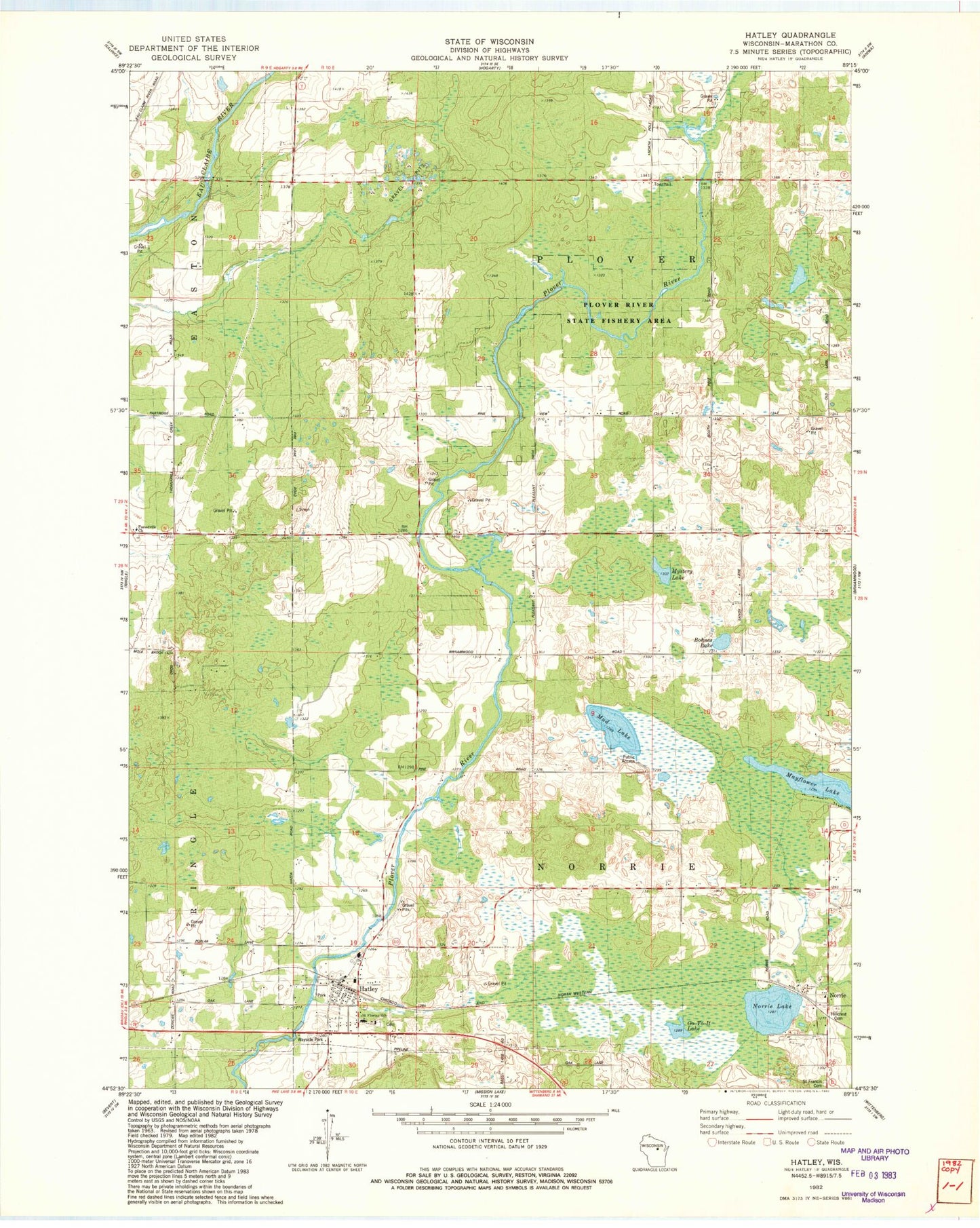
Classic USGS Hatley Wisconsin 7.5'x7.5' Topo Map
Couldn't load pickup availability
Historical USGS topographic quad map of Hatley in the state of Wisconsin. Map scale may vary for some years, but is generally around 1:24,000. Print size is approximately 24" x 27"
This quadrangle is in the following counties: Marathon.
The map contains contour lines, roads, rivers, towns, and lakes. Printed on high-quality waterproof paper with UV fade-resistant inks, and shipped rolled.
Contains the following named places: Birnamwood Church, Bluegill Lake, Bohnes Lake, Forestville Church, Go-To-It Lake, Hatley, Hatley Area Fire and Ambulance District, Hatley Elementary School, Hatley Post Office, Hillcrest Cemetery, Marathon County Public Library Hatley Branch, Mayflower Lake, Mud Lake, Mystery Lake, Norrie, Norrie Lake, Plover Valley School, Saint Florian Parish Cemetery, Saint Florians Grade School, Saint Francis Cemetery, Town of Norrie, Town of Plover, Trunk Line School, Village of Hatley, Wayside Park, Woodland School