MyTopo
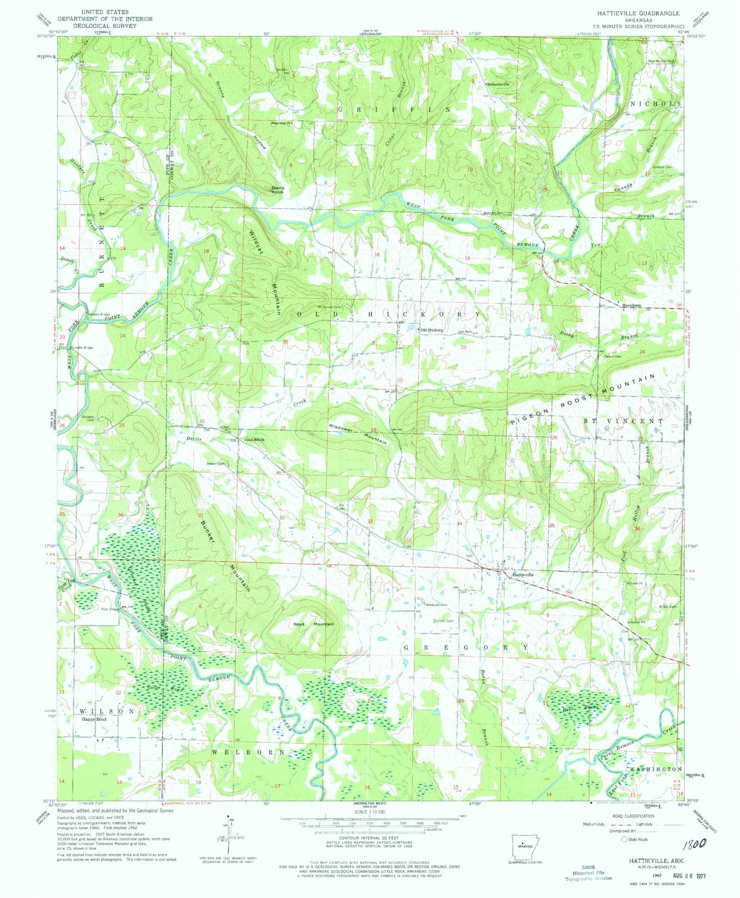
Classic USGS Hattieville Arkansas 7.5'x7.5' Topo Map
Couldn't load pickup availability
Historical USGS topographic quad map of Hattieville in the state of Arkansas. Map scale may vary for some years, but is generally around 1:24,000. Print size is approximately 24" x 27"
This quadrangle is in the following counties: Conway, Pope.
The map contains contour lines, roads, rivers, towns, and lakes. Printed on high-quality waterproof paper with UV fade-resistant inks, and shipped rolled.
Contains the following named places: Beeson Cemetery, Boltman Cemetery, Boyd Mountain, Bunker Mountain, Burnetts Bridge, Canady Branch, Cargile Lake, Cargile Lake Dam, Cedar Branch, Childers Cemetery, Cleaver Cemetery, Cooks Cemetery, Devils Creek, Devils Knob, Dunham Cemetery, Earl Brake, East Fork Point Remove Site 11 Dam, East Fork Point Remove Site 11 Reservoir, Goose Pond, Granny Hollow, Grinnel Pond, Gum Log Creek, Hackers Bridge, Hackers Creek, Happy Bend, Hattieville, Hattieville Census Designated Place, Hattieville Post Office, Isabell Creek, Macedonia, Mount Vernon Cemetery, Mount Zion School, New Mount Zion Church, Nichols Church, Old Hickory, Old Hickory Gas Field, Pigeon Roost Mountain, Plainview Church, Pool Hollow Branch, Prim Bridge, Robertsville, Rocky Branch, Taw Branch, Township of Gregory, Township of Old Hickory, West Fork Point Remove Creek Site 12 Dam, West Fork Point Remove Creek Site 12 Reservoir, West Fork Point Remove Creek Site 13 Dam, West Fork Point Remove Creek Site 13 Reservoir, West Fork Point Remove Creek Site 14 Dam, West Fork Point Remove Creek Site 14 Reservoir, West Fork Point Remove Creek Site 15 Dam, West Fork Point Remove Creek Site 15 Reservoir, West Fork Point Remove Creek Site 16 Dam, West Fork Point Remove Creek Site 16 Reservoir, Wiedower Cemetery, Wiedower Mountain, Wildcat Mountain, Wilson Cemetery, Zion Hill Church, ZIP Code: 72063