MyTopo
Classic USGS Hatton Alabama 7.5'x7.5' Topo Map
Couldn't load pickup availability
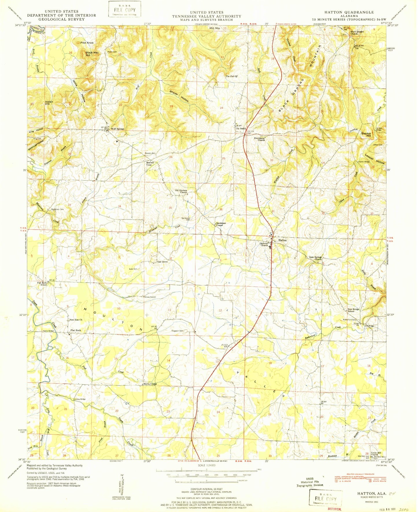
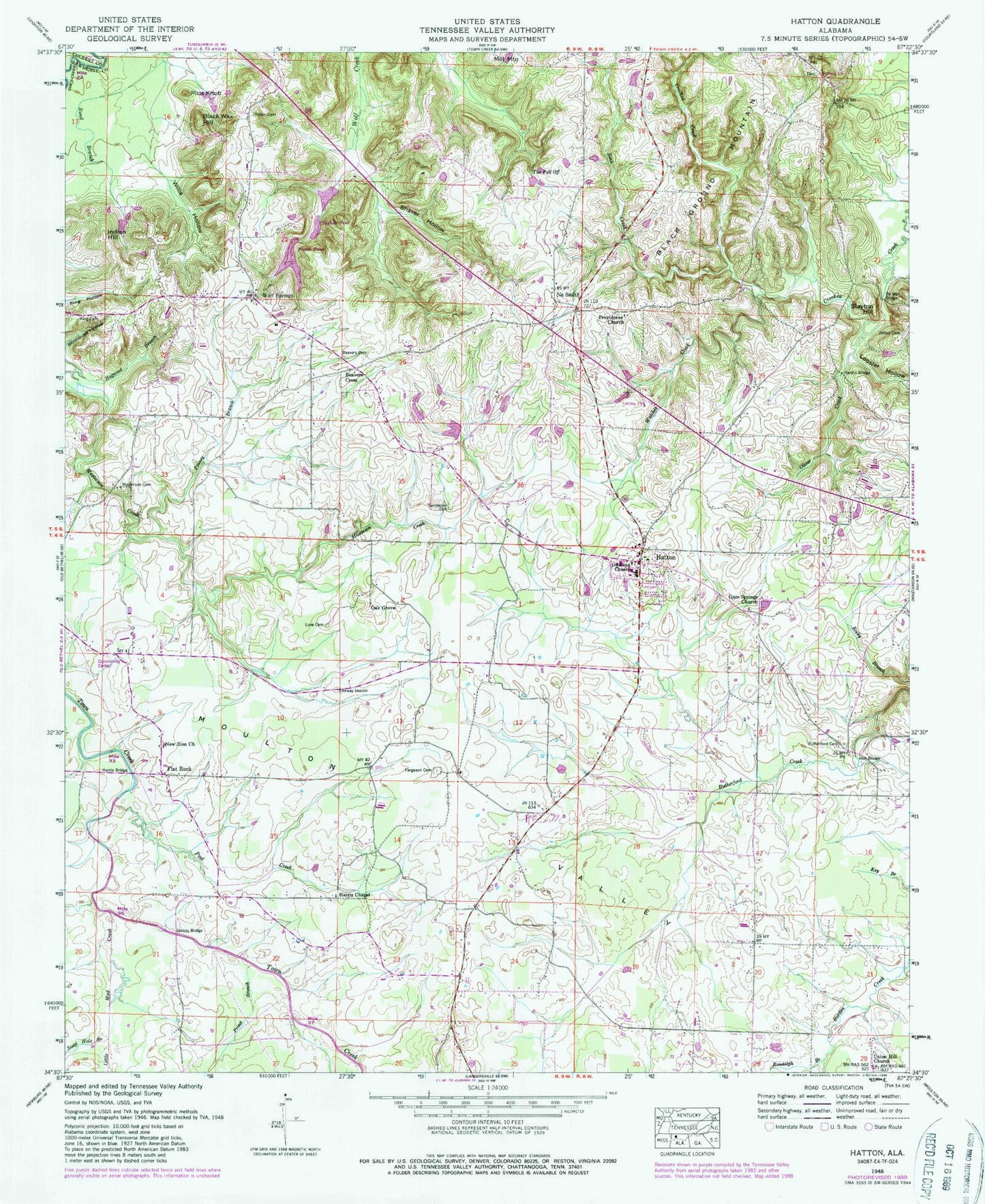
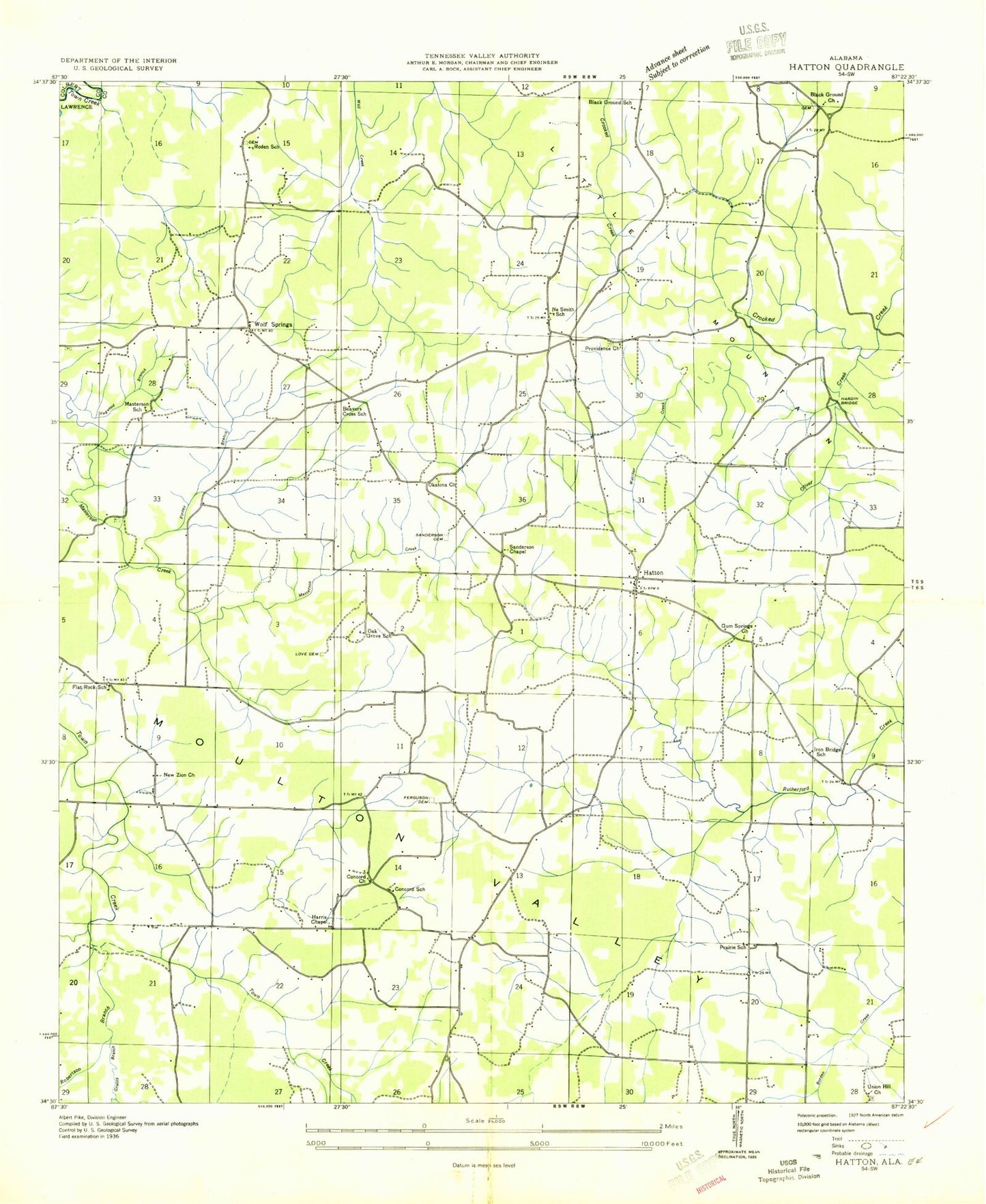
Historical USGS topographic quad map of Hatton in the state of Alabama. Map scale may vary for some years, but is generally around 1:24,000. Print size is approximately 24" x 27"
This quadrangle is in the following counties: Colbert, Lawrence.
The map contains contour lines, roads, rivers, towns, and lakes. Printed on high-quality waterproof paper with UV fade-resistant inks, and shipped rolled.
Contains the following named places: Beavers Cemetery, Beavers Cross, Beavers Cross School, Beck Creek, Black Ground Church, Black Ground Church Cemetery, Black Ground School, Black Wax Hill, Bond Branch, Calvary Baptist Church, Cedar Grove Church, Concord, Concord Church, Concord Post Office, Concord School, Fergason Cemetery, Finney Branch, Flat Rock, Flat Rock Community Center, Flat Rock School, Gum Springs Church, Hardin Bridge, Harris Bridge, Harris Chapel, Hatton, Hatton Census Designated Place, Hatton Church of Christ, Hatton Division, Hatton Elementary School, Hatton High School, Hatton Volunteer Fire Department, Hogwood Branch, Indian Hill, Iron Bridge School, Jetton Cemetery, King Cemetery, Lackey Bridge, Lawrence County Associaton Church Camp, Little Mud Creek, Loosier Hollow, Love Cemetery, Masterson Cemetery, Masterson School, Mount Zion Church, Ne Smith, Ne Smith School, New Zion Church, Oak Grove, Oak Grove School, Oil Well Bridge, Okalona Church, Okolona Baptist Church, Oliver Creek, Pilot Knob, Pool Creek, Pooles Pond, Pooles Pond Dam, Prairie School, Privet Branch, Providence Baptist Church, Providence Church Cemetery, Randolph Branch, Roden Cemetery, Roden School, Rutherford Cemetery, Sanderson Cemetery, Sanderson Chapel Methodist Church, Shaver Hollow, Slayton Hill, Soap Hole Branch, Taylors Dam, Taylors Pond, The Fall Off, Union Hill Missionary Baptist Church, Vickery Lake, Watches Creek, Willis Hollow, Wolf Springs, Wolf Springs Elementary School, Wolfe Spring Church