MyTopo
Classic USGS Hauer Wisconsin 7.5'x7.5' Topo Map
Couldn't load pickup availability
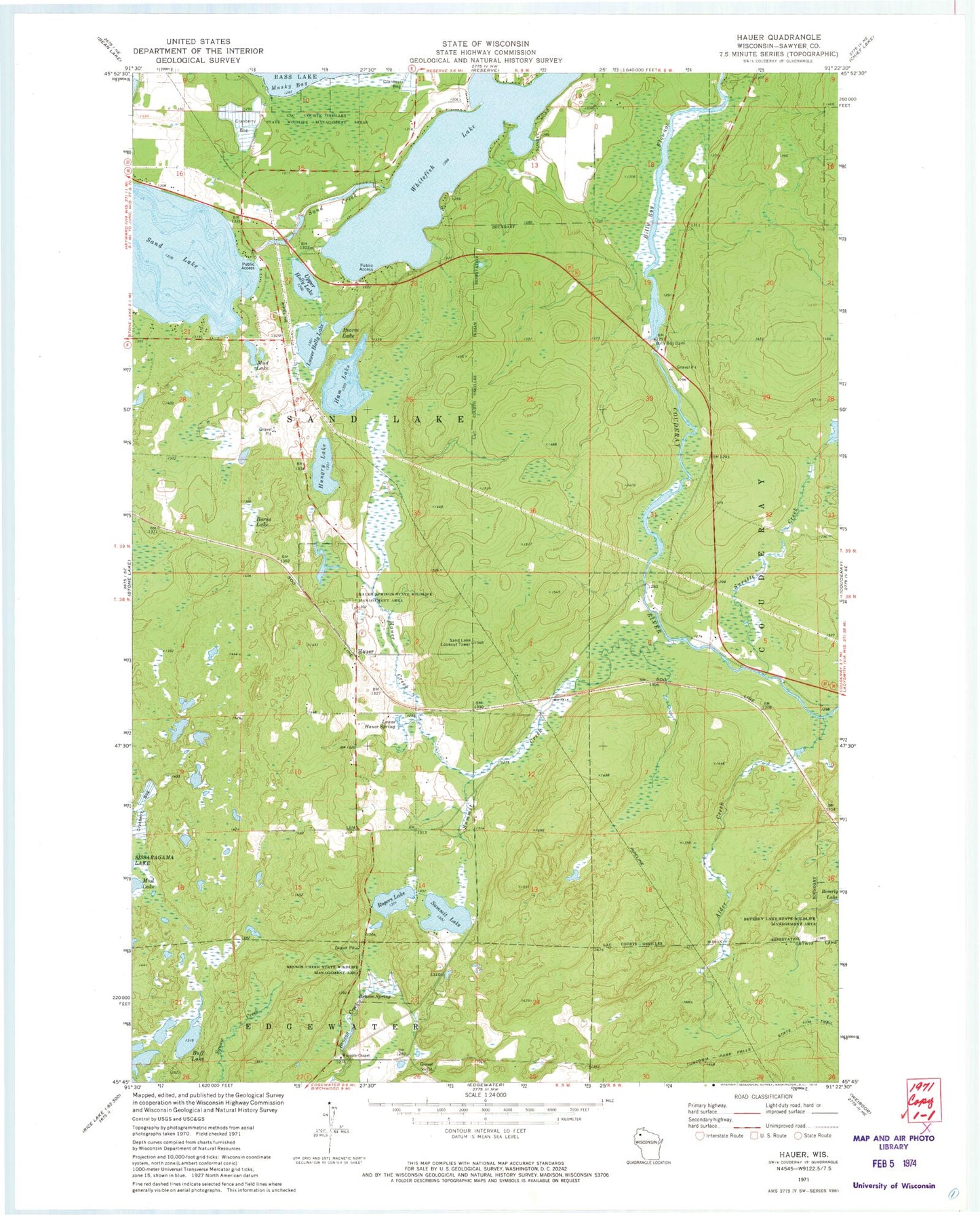
Historical USGS topographic quad map of Hauer in the state of Wisconsin. Map scale may vary for some years, but is generally around 1:24,000. Print size is approximately 24" x 27"
This quadrangle is in the following counties: Sawyer.
The map contains contour lines, roads, rivers, towns, and lakes. Printed on high-quality waterproof paper with UV fade-resistant inks, and shipped rolled.
Contains the following named places: Alder Creek, Benson Creek State Wildlife Management Area, Benson Spring, Billy Boy Dam, Billy Boy Flowage, Borns Lake, Buff Lake, Enbridge Energy-Pipeline Station, Ham Lake, Hauer, Hauer Creek, Hauer School, Hauer Springs State Wildlife Management Area, Hungry Lake, Lac Courte Oreilles State Wildlife Management Area, Lower Hauer Spring, Lower Holly Lake, Mud Lake, Pearce Lake, Rogers Lake, Sand Creek, Sand Lake, Sand Lake 22, Sand Lake 2WP826 Dam, Sand Lake Lookout Tower, Summit Creek, Summit Lake, Surette Creek, Town of Sand Lake, Upper Holly Lake, Wayside Chapel, Whitefish Lake, ZIP Code: 54876