MyTopo
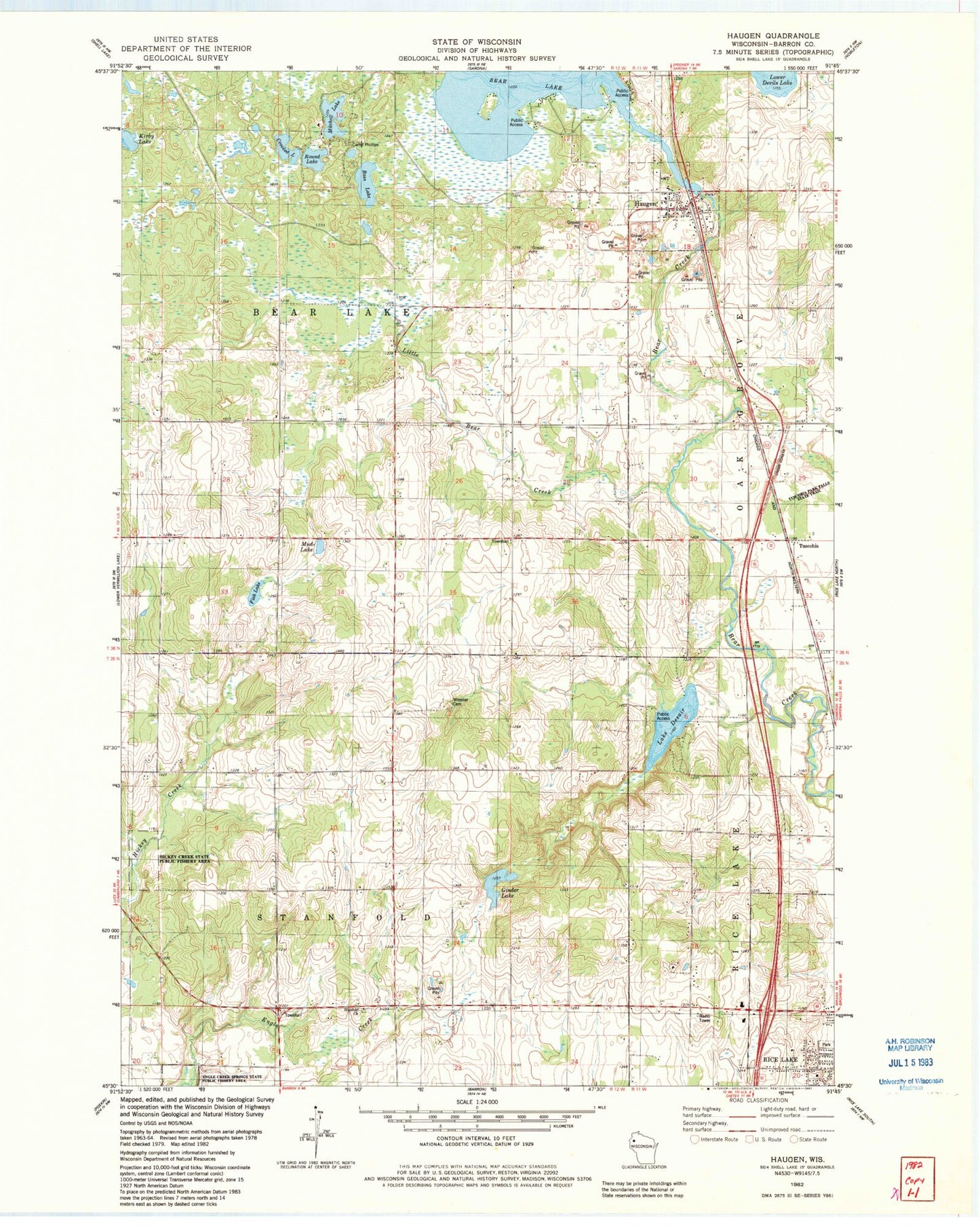
Classic USGS Haugen Wisconsin 7.5'x7.5' Topo Map
Couldn't load pickup availability
Historical USGS topographic quad map of Haugen in the state of Wisconsin. Map scale may vary for some years, but is generally around 1:24,000. Print size is approximately 24" x 27"
This quadrangle is in the following counties: Barron.
The map contains contour lines, roads, rivers, towns, and lakes. Printed on high-quality waterproof paper with UV fade-resistant inks, and shipped rolled.
Contains the following named places: Bass Lake, Bear Lake - Haugen Fire Department, Bear Lake 60, Bear Lake Sedge Meadow State Natural Area, Bear Lake Townhall, Bear Lake WP11 Dam, Bohemian National Cemetery, Camp Phillips, Crooked Lake, First United Methodist Church, Fish Lake, Friends of Miesner Community Chapel, Ginder Lake, Haugen, Haugen Area Historical Museum, Haugen Elementary School, Haugen Post Office, Haugen Sewage Treatment Facilities, Haugen Village Hall, Haugen Water Tower, Hickey Creek State Public Fishery Area, Holy Trinity Catholic Church, Kirby Lake, Lake Desair, Little Bear Creek, Little Bear Creek Dam, Mitchell Lake, Mud Lake, Rice Lake - Marshfield Medical Center, Round Lake, Stanfold Lutheran Cemetery, Stanfold Lutheran Church, Stanfold Townhall, Town of Bear Lake, Town of Stanfold, Tuscobia, Village of Haugen, WAQE-FM (Rice Lake), Wiesner Cemetery, WJMC Radio Station, WJMC-AM (Rice Lake), WJMC-FM (Rice Lake), WMYD-AM (Rice Lake), ZIP Code: 54841