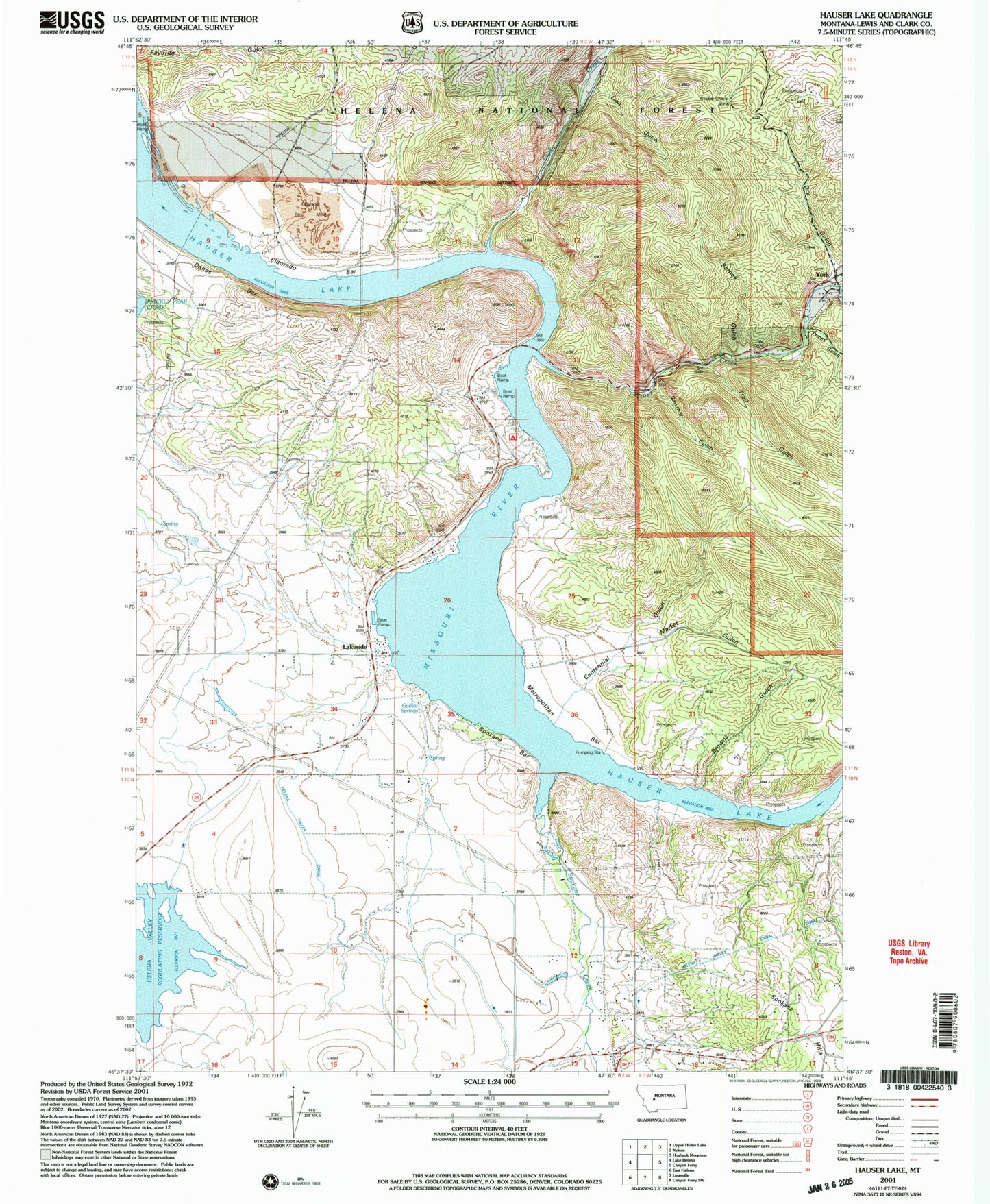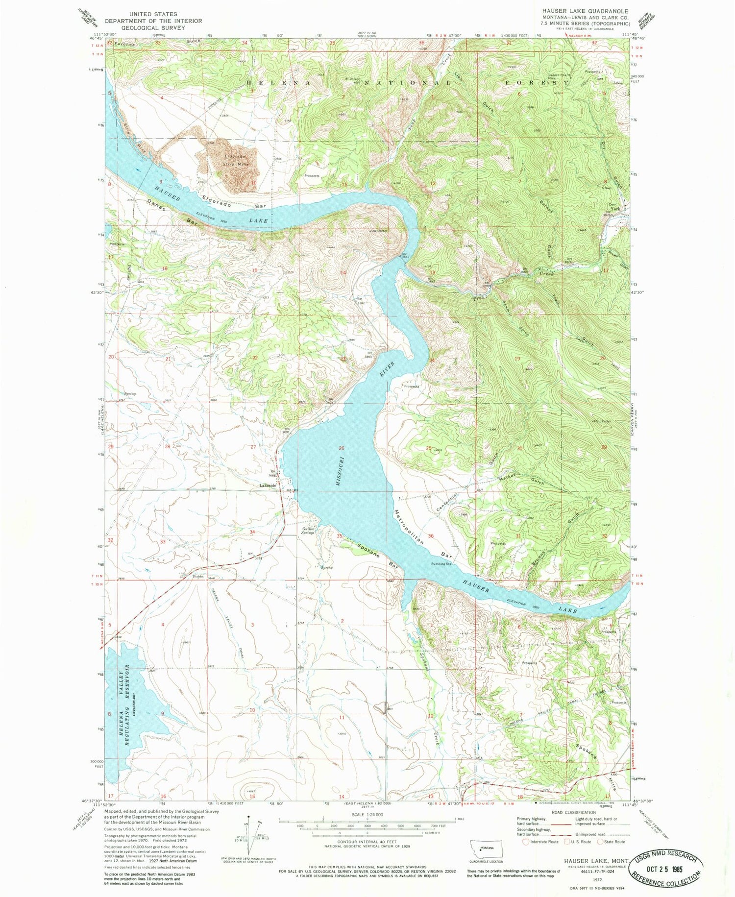
MyTopo
Classic USGS Hauser Lake Montana 7.5'x7.5' Topo Map
Couldn't load pickup availability
Historical USGS topographic quad map of Hauser Lake in the state of Montana. Map scale may vary for some years, but is generally around 1:24,000. Print size is approximately 24" x 27"
This quadrangle is in the following counties: Lewis and Clark.
The map contains contour lines, roads, rivers, towns, and lakes. Printed on high-quality waterproof paper with UV fade-resistant inks, and shipped rolled.
Contains the following named places: 10N02W04CDDC01 Well, 11N02W23CDDD01 Well, 11N02W26BADA01 Well, 11N02W26BBDC01 Well, Barnes Gulch, Brooklyn, Browns Gulch, Centennial Gulch, Danas Bar, Downieville Post Office, Dry Gulch, El Dorado, Eldorado Bar, Eldorado Strip Mine, French Bar Post Office, Golden Charm Mine, Guillot Springs, Hauser Lake, Helena Valley Canal Tunnel, Lakeside, Lakeside Resort, Lakeside School, Lion Gulch, Lonewood Meadows Airport, Market Gulch, Marlo, Metropolitan Bar, Mountain Lakes Field Airport, N Section 5 Prospects Mine, Prices Gulch, Sawmill Gulch, Soup Creek, Spokane Bar, Spokane Creek, Stubbs Ferry, Trail Gulch, Tri - Lakes Volunteer Fire Department Station 2, Trout Creek, York, York Bridge Fishing Access Site, York Cemetery, York Census Designated Place, York Gulch, York Post Office, York School, York Volunteer Fire Department