MyTopo
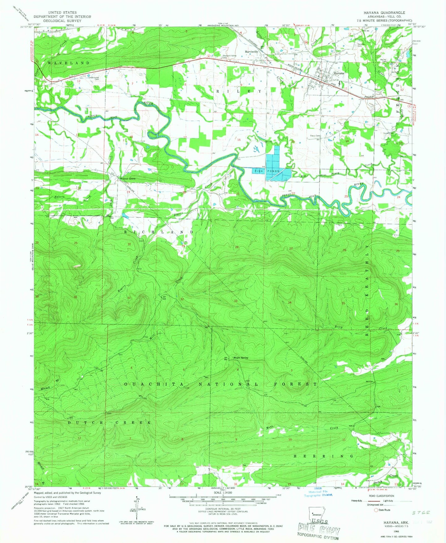
Classic USGS Havana Arkansas 7.5'x7.5' Topo Map
Couldn't load pickup availability
Historical USGS topographic quad map of Havana in the state of Arkansas. Map scale may vary for some years, but is generally around 1:24,000. Print size is approximately 24" x 27"
This quadrangle is in the following counties: Yell.
The map contains contour lines, roads, rivers, towns, and lakes. Printed on high-quality waterproof paper with UV fade-resistant inks, and shipped rolled.
Contains the following named places: Big Piney Creek, Cedar Creek, City of Havana, Clear Creek, Davis Family Cemetery, Dentontown, East Cedar Creek, Guinn Cemetery, Havana, Havana / Moores Chapel Volunteer Fire Department, Havana Post Office, Jack Creek, Jones Lake Dam Number One, Little Piney Creek, Maple Spring, Marvinville, Marvinville School, Mill Creek, Moss Creek School, Owens Lake, Piney Fork Cemetery, Pleasant Valley Cemetery, Rogers Creek, Township of Riley, Truett Creek, Underwood Cemetery, Walker Cemetery, Walnut Grove, Walnut Grove School, Western Yell County High School, ZIP Code: 72842