MyTopo
Classic USGS Havre NW Montana 7.5'x7.5' Topo Map
Regular price
$16.95
Regular price
Sale price
$16.95
Unit price
per
Couldn't load pickup availability
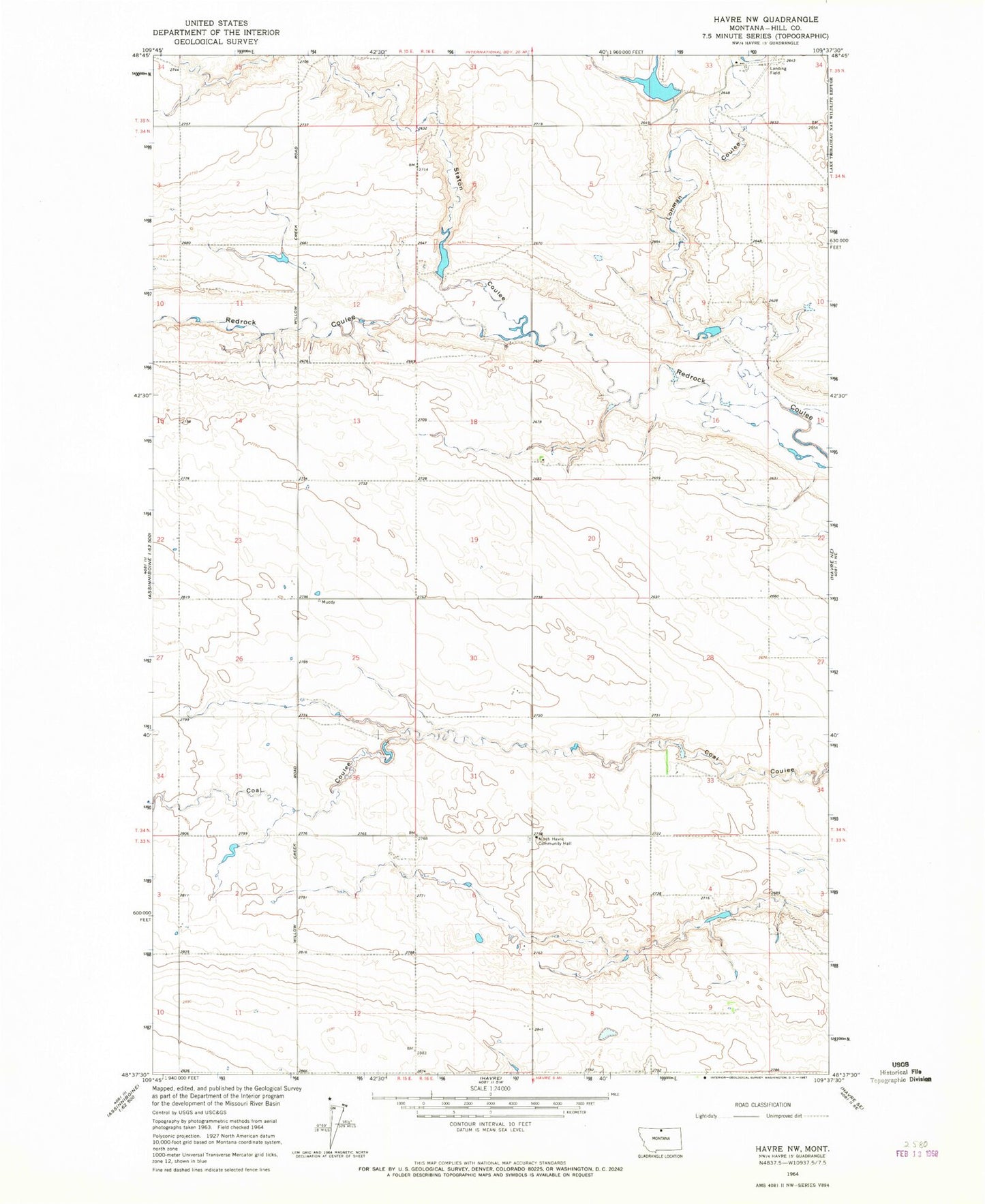
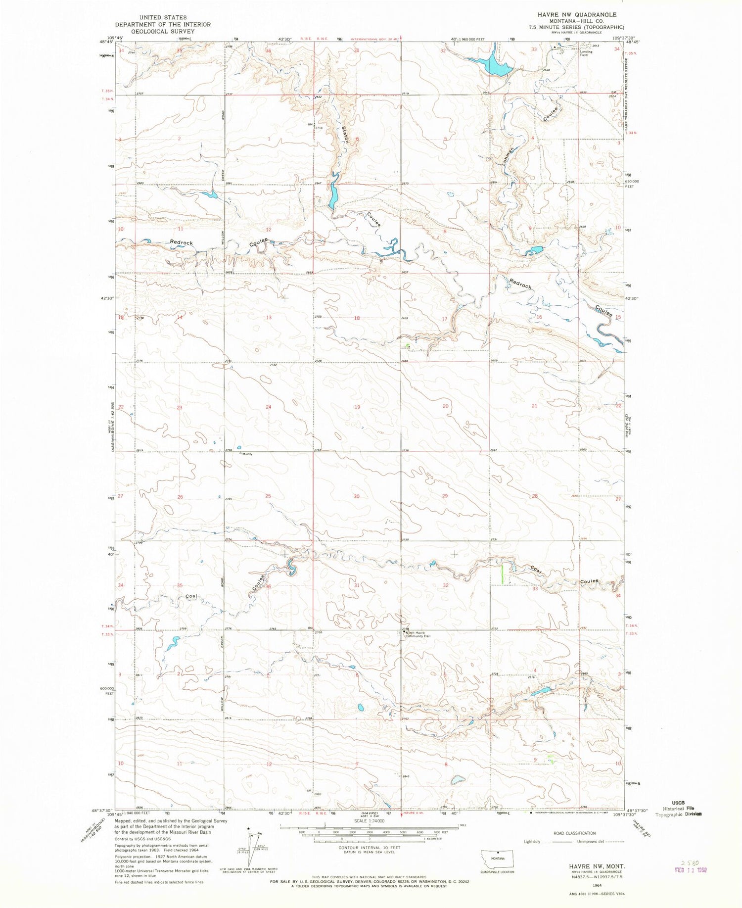
Historical USGS topographic quad map of Havre NW in the state of Montana. Map scale may vary for some years, but is generally around 1:24,000. Print size is approximately 24" x 27"
This quadrangle is in the following counties: Hill.
The map contains contour lines, roads, rivers, towns, and lakes. Printed on high-quality waterproof paper with UV fade-resistant inks, and shipped rolled.
Contains the following named places: 35N16E33ADCB01 Well, Kuntson Number 1 Dam, Kuntson Number 2 Dam, Lohman Coulee, North Havre Community Hall, North Havre Lutheran Church, North Havre Lutheran Church Cemetery, Staton Coulee, Thibadeau Farm Dam