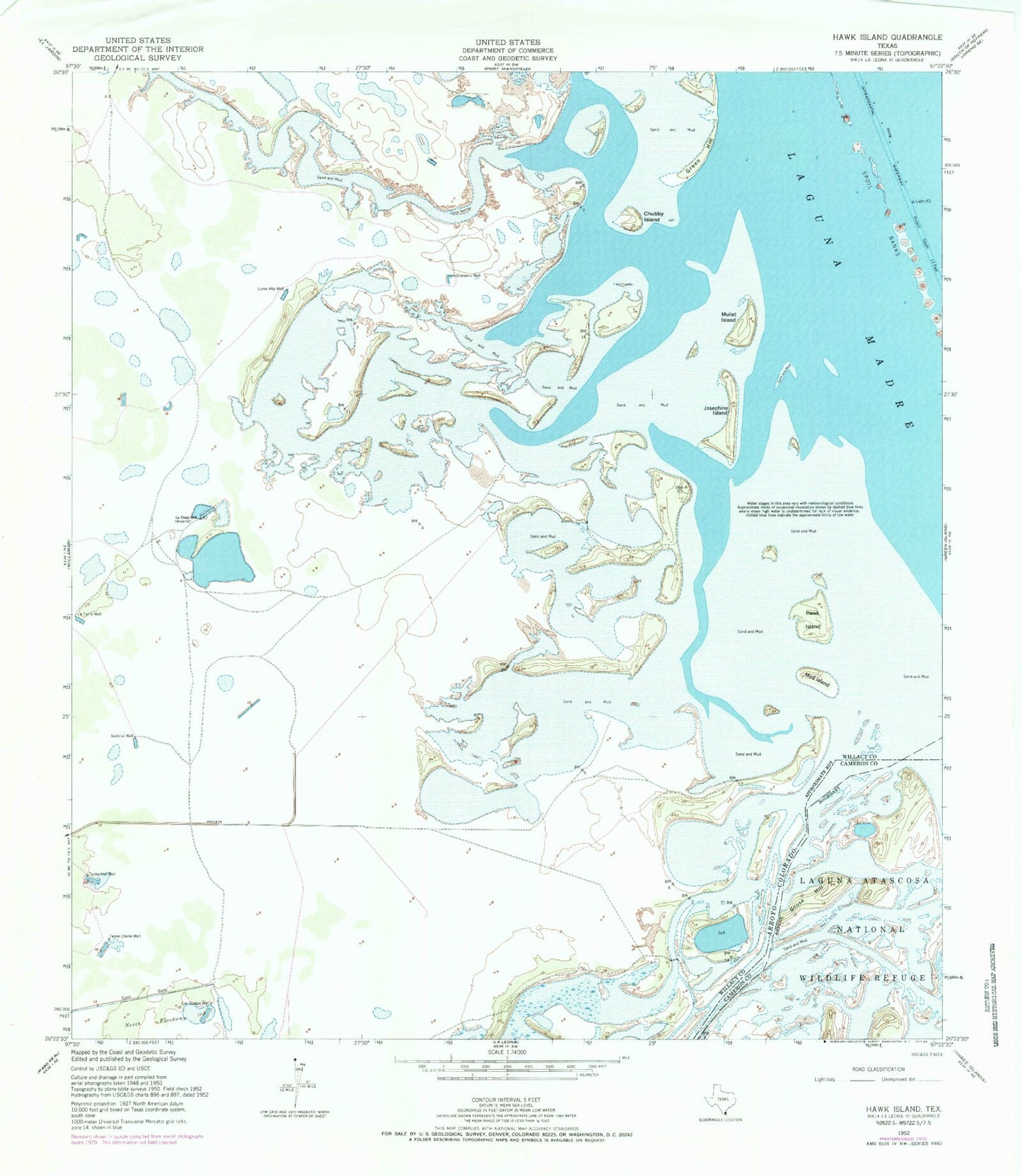
MyTopo
Classic USGS Hawk Island Texas 7.5'x7.5' Topo Map
Regular price
$16.95
Regular price
Sale price
$16.95
Unit price
per
Couldn't load pickup availability
Historical USGS topographic quad map of Hawk Island in the state of Texas. Map scale may vary for some years, but is generally around 1:24,000. Print size is approximately 24" x 27"
This quadrangle is in the following counties: Cameron, Willacy.
The map contains contour lines, roads, rivers, towns, and lakes. Printed on high-quality waterproof paper with UV fade-resistant inks, and shipped rolled.
Contains the following named places: Chubby Island, Goose Hill, Granjeno Well, Green Hill, Hawk Island, Josephine Island, La Oveja Well, La Torre Well, Las Cuatas Well, Loma Alta Well, Mud Island, Mullet Island, San Perlita Division, Tanke Chalie Well, Tanke Hal Well