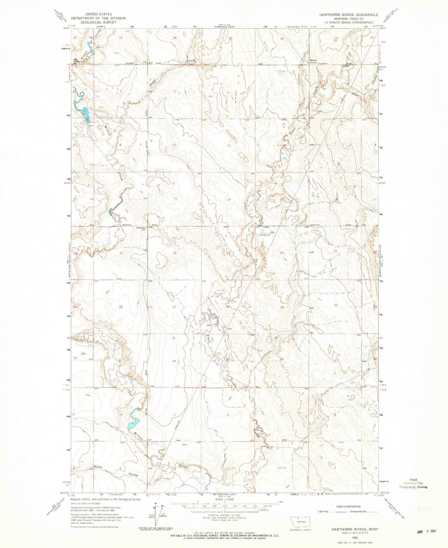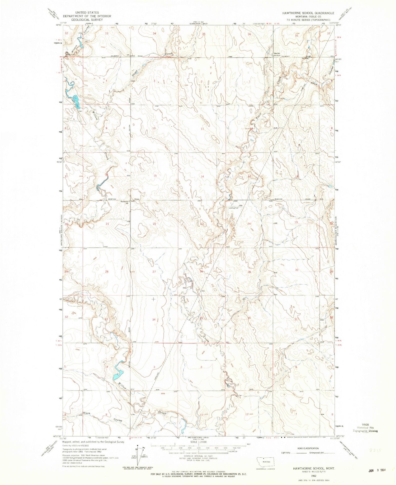
MyTopo
Classic USGS Hawthorne School Montana 7.5'x7.5' Topo Map
Regular price
$16.95
Regular price
Sale price
$16.95
Unit price
per
Couldn't load pickup availability
Historical USGS topographic quad map of Hawthorne School in the state of Montana. Map scale may vary for some years, but is generally around 1:24,000. Print size is approximately 24" x 27"
This quadrangle is in the following counties: Toole.
The map contains contour lines, roads, rivers, towns, and lakes. Printed on high-quality waterproof paper with UV fade-resistant inks, and shipped rolled.
Contains the following named places: 34N02E02BBBC01 Well, 34N02E21ADBC01 Well, Alkali Coulee, Allison Dam, Aster Dam, Black Coulee, Eide Coulee, Eide School, Fernell Coulee, Hawthorne School, Kolstad Number 3 Dam, Lizard Post Office, Price Coulee, Sheep Creek, Tomeyer Number 2 Dam