MyTopo
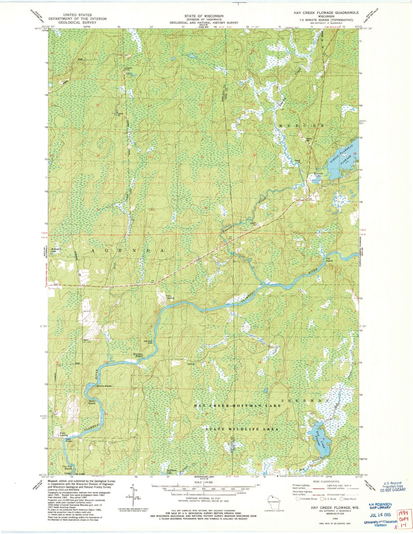
Classic USGS Hay Creek Flowage Wisconsin 7.5'x7.5' Topo Map
Regular price
$16.95
Regular price
Sale price
$16.95
Unit price
per
Couldn't load pickup availability
Historical USGS topographic quad map of Hay Creek Flowage in the state of Wisconsin. Map scale may vary for some years, but is generally around 1:24,000. Print size is approximately 24" x 27"
This quadrangle is in the following counties: Ashland, Iron.
The map contains contour lines, roads, rivers, towns, and lakes. Printed on high-quality waterproof paper with UV fade-resistant inks, and shipped rolled.
Contains the following named places: Bear Skull Rock, Deer Creek, Hay Creek D12.185 Dam, Hay Creek Flowage, Holts Landing, McKaskel Lake, Mercer Fire Department Station 2, Minnow Lake, Petes Landing, Pine Tree Rapids, Quinns Rapids, Simmons Rapids, Stubbs Rapids, Swamp Creek