MyTopo
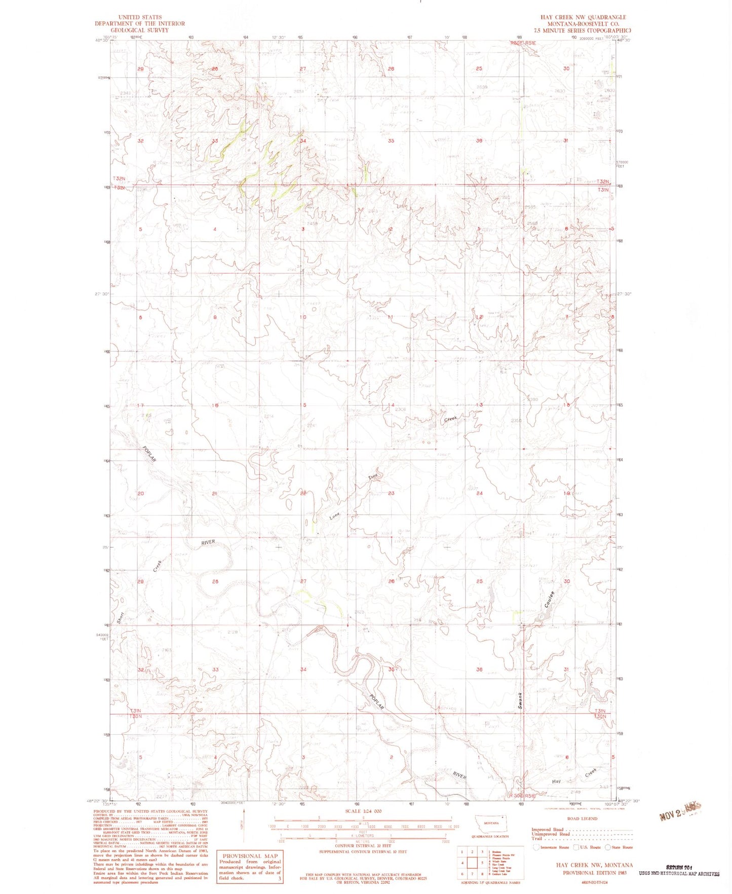
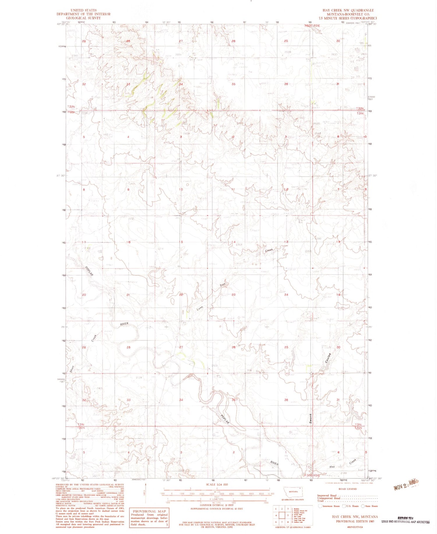
Classic USGS Hay Creek NW Montana 7.5'x7.5' Topo Map
Regular price
$16.95
Regular price
Sale price
$16.95
Unit price
per
Couldn't load pickup availability
Historical USGS topographic quad map of Hay Creek NW in the state of Montana. Map scale may vary for some years, but is generally around 1:24,000. Print size is approximately 24" x 27"
This quadrangle is in the following counties: Roosevelt.
The map contains contour lines, roads, rivers, towns, and lakes. Printed on high-quality waterproof paper with UV fade-resistant inks, and shipped rolled.
Contains the following named places: 30N50E05DCAB01 Well, 31N50E02BBCB01 Well, 31N50E25DDDD01 Well, 31N50E36AAAA01 Well, 32N50E27DCDC01 Well, 32N51E31CCCA01 Well, Beck Dam, CCC Indian Division Number 5 Dam, Lone Tree Creek, Seips School, Short Creek, Swank Airport, Swank Coulee, Swank Reservoir Dam