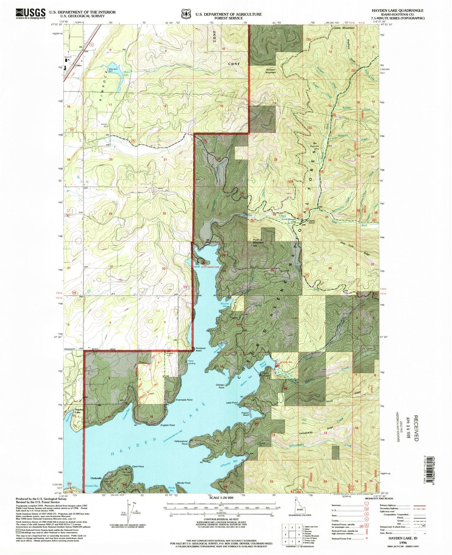
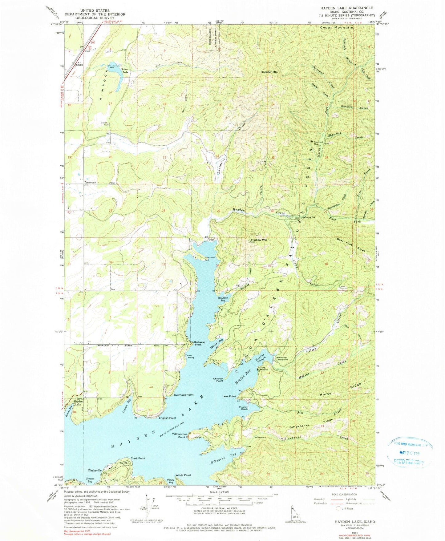
MyTopo
Classic USGS Hayden Lake Idaho 7.5'x7.5' Topo Map
Couldn't load pickup availability
Historical USGS topographic quad map of Hayden Lake in the state of Idaho. Typical map scale is 1:24,000, but may vary for certain years, if available. Print size: 24" x 27"
This quadrangle is in the following counties: Kootenai.
The map contains contour lines, roads, rivers, towns, and lakes. Printed on high-quality waterproof paper with UV fade-resistant inks, and shipped rolled.
Contains the following named places: Cherry Creek, Mokins Bay, Berven Bay, Bradbury Gulch, Buckles Creek, Camp Mivoden, Cardin Creek, Chicken Point, Clark Point, Commonwealth Mine, Coopers Bay, Cramps Bay, East Fork Hayden Creek, English Point, Evernade Point, Falls Creek, Hayden Creek, Hollister Creek, Hudlow Mountain, Jim Creek, Lancaster Creek, Lees Point, Line Creek, McLeans Bay, McLeans Creek, Mokins Bay Campground, Mokins Creek, Mokins Slough, Nilsen Creek, North Fork Hayden Creek, O'Rourke Bay, Preston Beach, Seventy-Five Creek, Shamrock Creek, Shamrock Mine, Skinner Bay, Hayden Lake Sportsman Park, Stump Creek, The Clark House, Timber Creek, Windy Point, Yellowbanks Creek, Yellowbanks Ridge, Yellowstone Point, English Point, English Point National Recreation Trail, Chilco, Clarksville, Harris Landing, Hollister Mountain, Rimrock, Rockaway Beach, Chilco Lake, Lake Hayden, Chilco Dam, Northern Lakes Fire Protection District Station 5