MyTopo
Classic USGS Haymaker Ranch Montana 7.5'x7.5' Topo Map
Regular price
$16.95
Regular price
Sale price
$16.95
Unit price
per
Couldn't load pickup availability
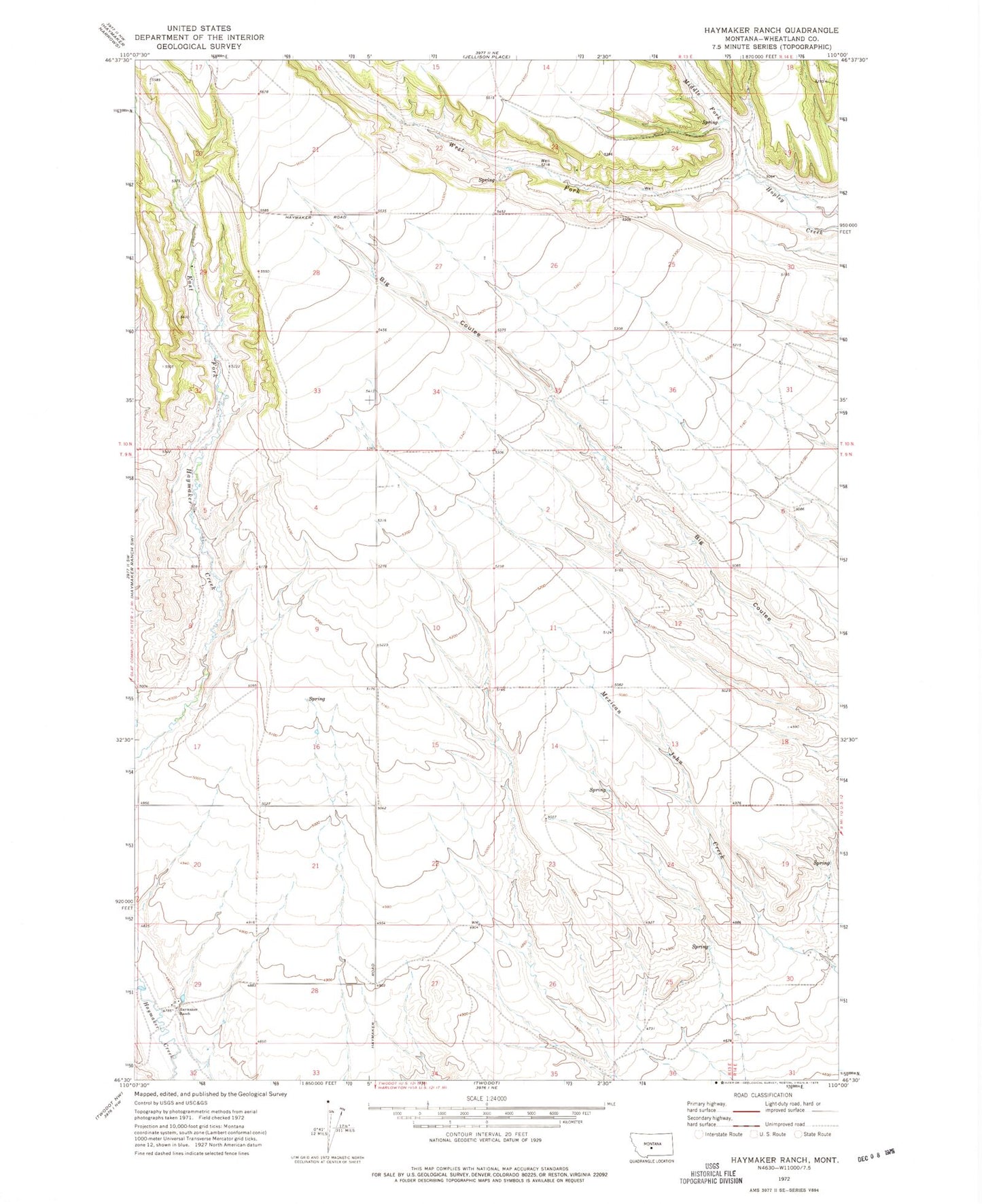
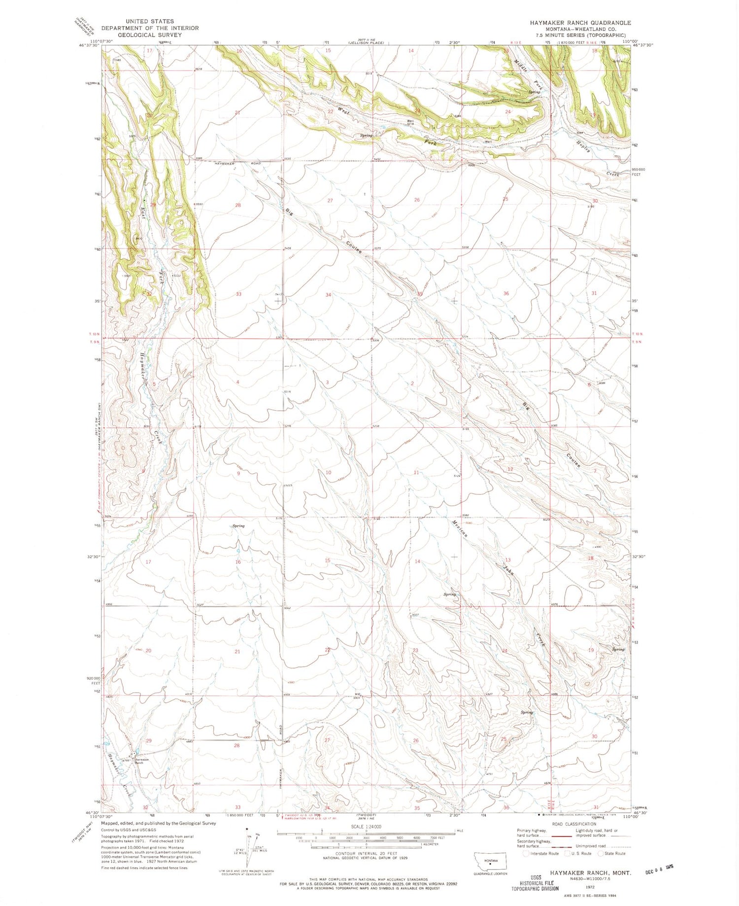
Historical USGS topographic quad map of Haymaker Ranch in the state of Montana. Map scale may vary for some years, but is generally around 1:24,000. Print size is approximately 24" x 27"
This quadrangle is in the following counties: Wheatland.
The map contains contour lines, roads, rivers, towns, and lakes. Printed on high-quality waterproof paper with UV fade-resistant inks, and shipped rolled.
Contains the following named places: 09N13E09____01 Well, 09N13E11CADC01 Well, 09N14E30A___01 Well, 10N13E21____01 Well, 10N13E29C___01 Well, Godfrey, Haymaker Post Office, Haymaker Ranch, Middle Fork Hopley Creek, West Fork Hopley Creek