MyTopo
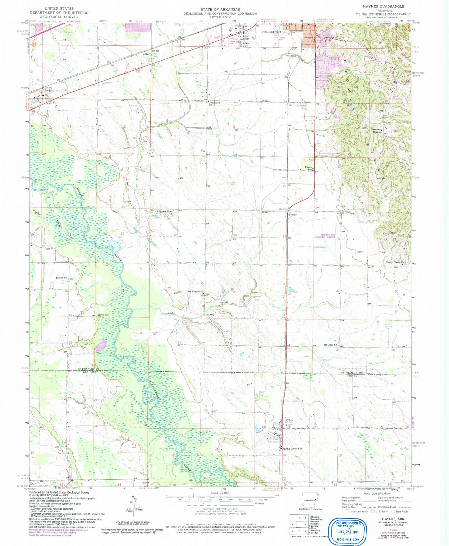
Classic USGS Haynes Arkansas 7.5'x7.5' Topo Map
Couldn't load pickup availability
Historical USGS topographic quad map of Haynes in the state of Arkansas. Map scale may vary for some years, but is generally around 1:24,000. Print size is approximately 24" x 27"
This quadrangle is in the following counties: Lee, St. Francis.
The map contains contour lines, roads, rivers, towns, and lakes. Printed on high-quality waterproof paper with UV fade-resistant inks, and shipped rolled.
Contains the following named places: A W Siding, Becks, Becks Spur Baptist Church, Bonair, Bryanville, Candy Creek, Caney Creek, Coffee Creek, Elcana, Elcana Cemetery, Elcana Church, Evans Elementary School, Forrest City Federal Correctional Complex - Low Security Facility, Forrest City Federal Correctional Complex - Medium Security Facility, Forrest Park Cemetery, Four Forks, Freedonia Cemetery, Freedonia Church, Harmony Chapel, Haynes, Haynes Post Office, Haynes Rural Volunteer Fire Department, Haynes School, Henderson Cemetery, Heustess, Hinton Creek, Hodge Cemetery, Hutfly-Forrest City Airport, Jerusalem Church, KBFC-FM (Forrest City), KXJK-AM (Forrest City), Landmark Church, Longino, McDonald Cemetery, Monica, Mount Olive Church, Mount Vernon Cemetery, Mount Vernon Church, Pentecost Church, Pilgrims Rest Church, Poplar Grove, Redfern, Saint Paul Church, Shady Grove Church, Spring Grove Church, Spring Grove School, Sycamore Street Park, Thomas Cemetery, Town of Haynes, ZIP Code: 72341