MyTopo
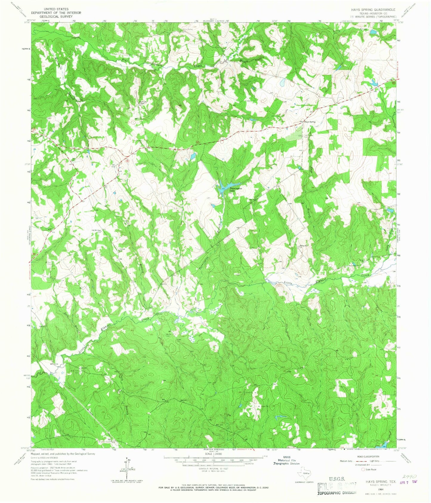
Classic USGS Hays Spring Texas 7.5'x7.5' Topo Map
Couldn't load pickup availability
Historical USGS topographic quad map of Hays Spring in the state of Texas. Map scale may vary for some years, but is generally around 1:24,000. Print size is approximately 24" x 27"
This quadrangle is in the following counties: Houston.
The map contains contour lines, roads, rivers, towns, and lakes. Printed on high-quality waterproof paper with UV fade-resistant inks, and shipped rolled.
Contains the following named places: Bill Huff Dam, Bill Huff Lake, Bird School, Caney Creek, Caney Creek Springs, Clark Branch, Clark Cotton Gin, Coonskin Crossing, Corinth Church, Dalys Church, Dan Pennington Dam, Farm Lake, Ferrell Women Graves, Halls Field Cemetery, Hays Branch, Hays Branch Springs, Hays Spring, Hays Spring Cemetery, Houston County Dam, Houston County Lake, Johua Hall Grain Mill, Johua Hall Sawmill, Ladyville School, Llynwood School, Lynwood Cemetery, Mamie George Branch Library, McCann Cemetery, Meriwether Cemetery, Missouri City Branch Library, Moccasin Branch, Mount Zion Cemetery, Nealy Branch, Old Midway Church, Old Mount Zion Church, Pennington Branch, Pennington Cemetery, Pennington Chapel, Pennington Dam, Pennington Lake, Rising Star Church, Salem Church, Sheridan Graves, Spring Creek, Two Mile Branch, Walling Cemetery, Warner Dam Number 1, Warner Dam Number 2, Warner Lake Number 1, Warner Lake Number 2, Zach Branch