MyTopo
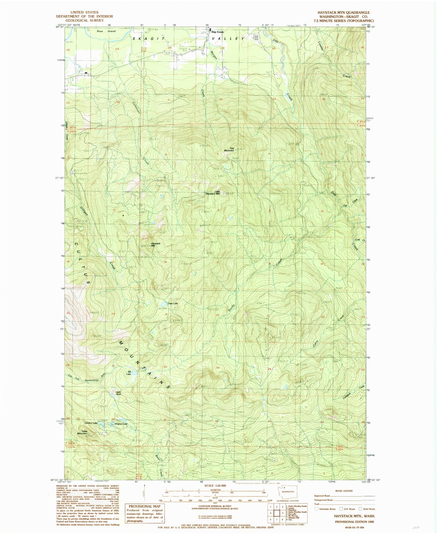
Classic USGS Haystack Mountain Washington 7.5'x7.5' Topo Map
Regular price
$16.95
Regular price
Sale price
$16.95
Unit price
per
Couldn't load pickup availability
Historical USGS topographic quad map of Haystack Mountain in the state of Washington. Map scale may vary for some years, but is generally around 1:24,000. Print size is approximately 24" x 27"
This quadrangle is in the following counties: Skagit.
The map contains contour lines, roads, rivers, towns, and lakes. Printed on high-quality waterproof paper with UV fade-resistant inks, and shipped rolled.
Contains the following named places: Coal Creek, Cultus Mountains, Day Creek, Day Creek Sand and Gravel Quarry, Dixie Lake, Fall Creek, Gordon Lake, Haystack Mountain, Little Haystack Mountain, R B Lake, Rocky Canyon, Rocky Creek, Sorenson Creek, Split Rock, Table Mountain, Talc Mountain, Wagner Lake