MyTopo
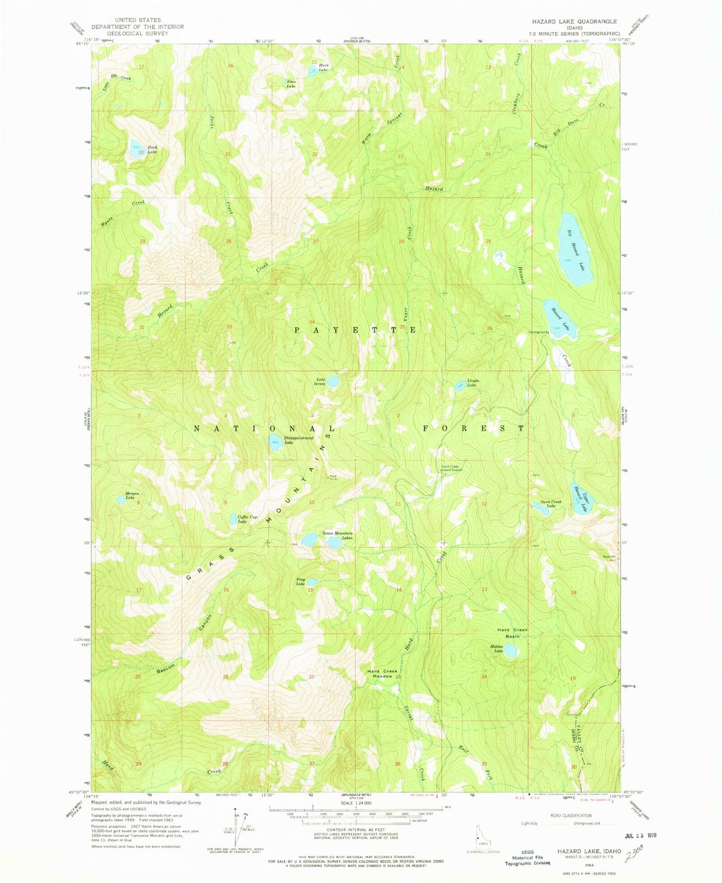
Classic USGS Hazard Lake Idaho 7.5'x7.5' Topo Map
Couldn't load pickup availability
Historical USGS topographic quad map of Hazard Lake in the state of Idaho. Typical map scale is 1:24,000, but may vary for certain years, if available. Print size: 24" x 27"
This quadrangle is in the following counties: Idaho, Valley.
The map contains contour lines, roads, rivers, towns, and lakes. Printed on high-quality waterproof paper with UV fade-resistant inks, and shipped rolled.
Contains the following named places: Big Dave Creek, Big Hazard Lake, Black Lake, Buck Lake, Clayburn Creek, Coffee Cup Lake, Corral Creek, Disappointment Lake, East Fork Corral Creek, Eden Lake, Frog Lake, Grass Mountain Lakes, Grass Mountains, Hard Creek Basin, Hard Creek Guard Station, Hard Creek Lake, Hard Creek Meadow, Hazard Lake, Hidden Lake, Jacks Creek, Lloyds Lake, Morgan Lake, Lake Serene, Upper Hazard Lake, Vance Creek, Warm Springs Creek, Hazard Campground, Lloyds Lake Overlook