MyTopo
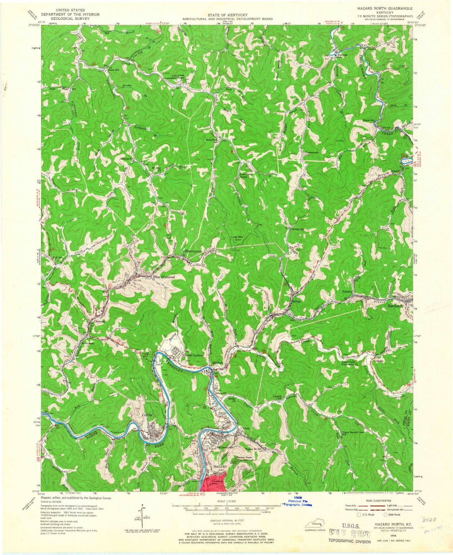
Classic USGS Hazard North Kentucky 7.5'x7.5' Topo Map
Couldn't load pickup availability
Historical USGS topographic quad map of Hazard North in the state of Kentucky. Map scale may vary for some years, but is generally around 1:24,000. Print size is approximately 24" x 27"
This quadrangle is in the following counties: Knott, Perry.
The map contains contour lines, roads, rivers, towns, and lakes. Printed on high-quality waterproof paper with UV fade-resistant inks, and shipped rolled.
Contains the following named places: A B Combs Elementary School, Airport Gardens, Airport Gardens Post Office, Allais, Allais Post Office, Andy Camp Branch, Ary, Ary Cemetery, Ary Post Office, Bear Branch, Bethel Church, Big Branch, Big Creek, Blue Diamond, Blue Diamond Post Office, Bonnyman, Bonnyman Post Office, Bonnyman Railroad Station, Broadway School, Browns Fork, Brushy Branch, Bulan, Bulan Number One Railroad Station, Bulan Post Office, Cane Branch, City of Hazard, Clemons, Clemons Post Office, Coalstone Branch, Coates Branch, Combs, Combs Bend, Combs Branch, Combs Census Designated Place, Combs Post Office, Combs Railroad Station, Cornett School, Crawford Branch, Crawford Mountain, Darb Fork, Darfork, Darfork Post Office, Dedman Post Office, Diamond Railroad Station, Dice, Dice Division, Dice Post Office, Domino Post Office, Dowlais Railroad Station, Downing Railroad Station, Duane Railroad Station, Dwarf, Dwarf Baptist Church, Dwarf Post Office, Elm Shoal Branch, Engle Fork, Engle School, Eversole School, Faith Gospel Witness Mission, Fifteenmile Creek, First Creek School, Godsy Creek, Gorman Railroad Station, Grigsby, Grigsby Branch, Grigsby Post Office, Grigsby School, Ground Hog Branch, Happy Valley, Hardburly Post Office, Harris Branch, Harveyton, Harveyton Post Office, Hayslen Railroad Station, Hazard Appalachian Regional Healthcare Medical Center, Hazard Christian Academy, Hazard Division, Hazard Fire Department Station 2, Hazard Post Office, Heiner Post Office, Heiner Railroad Station, Heiner School, Hilton, Hilton Presbyterian Church, Hilton Railroad Station, Hiltonian Post Office, Hiner, Hiram Fork, Hogpen Branch, Holiday Post Office, Holiness Hollow, Hominy Mill Branch, Hull School, Hunter Memorial Church, Jack Lot Hollow, Jake Branch, Jakes Branch Volunteer Fire Department, Jones, Jones School, Kentucky State Police Post 13, Ladder Branch, Laurel Fork, Laurel Lick Branch, Left Fork Upper Second Creek, Lennut Post Office, Lick Branch, Linx Creek, Little Wolf Pen Branch, Lost Creek Chapel, Lost Creek Community Chapel, Lost Creek School, Lost Creek Volunteer Fire Department, Lost Mountain, Lost Mountain Lookout Tower, Lotts Creek, Lotts Creek Community Church, Low Gap Branch, Meadow Branch, Mill Branch, Mona's Post Office, Napier High School, Neace Gorman Park, New Mount Zion Church, Pads Fork, Perry County Ambulance Authority, Perry County Park, Peters Cave Branch, Peters Peak, Pigeonroost Branch, Pigeonroost School, Poplar Hollow, Right Fork Upper Second Creek, Riverside Cemetery, Road Branch, Road Fork, Robinson School, Rock Branch, Rock Fork, Rock Fork School, Rockhouse Branch, Rube Fork, Second Creek Missionary, Seng Fork, Seng Fork Church, Setty Fuel Branch, Shop Branch, Sixteen, Sixteen School, Sixteenmile Creek, Smith Cemetery, Still House Branch, Still House Hollow, Strong Branch, Sucks Fork, Sunfire Mine, Tauber Railroad Station, Trace Branch, Trace Fork, Tribbey, Tribbey Post Office, Tribbey Railroad Station, Troublesome Creek Volunteer Fire Department, Tub Post Office, Tunnel Mill Point, Twin Hollow, Typo Chapel, Upper Pidgeonroost, Upper Second Creek, Upper Second Creek Church, Upper Second Creek School, Walker Branch, Walker Branch School, Walkertown, Walkertown School, Walter Hull Presbyterian Church, Whitsett, Whitsett Railroad Station, Willow Fern Church, Wolf Pen Branch, Wolfpen Branch, Wooton School, WQXY-AM (Hazard), ZIP Codes: 41701, 41712, 41729


